Kareli, Georgia
| Kareli ქარელი | |
|---|---|
| Town | |
 Kareli 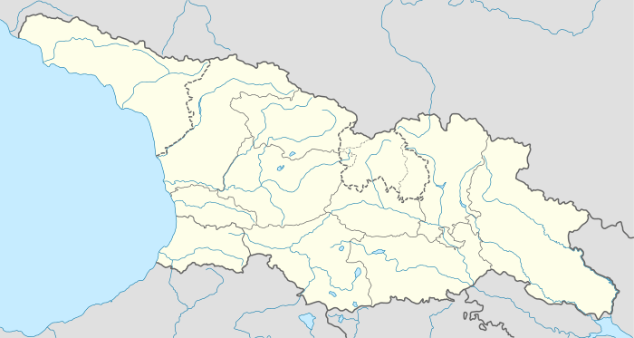 Kareli Location of Kareli in Georgia | |
| Coordinates: 42°01′28″N 43°54′4″E / 42.02444°N 43.90111°ECoordinates: 42°01′28″N 43°54′4″E / 42.02444°N 43.90111°E | |
| Country |
|
| Mkhare | Shida Kartli |
| Elevation | 620 m (2,030 ft) |
| Population (2014)[1] | |
| • Total | 6,654 |
| Time zone | Georgian Time (UTC+4) |
Kareli (Georgian: ქარელი) is a town in Shida Kartli, Georgia, located on the right bank of the Mtkvari, 94 km west of the country's capital of Tbilisi.
Overview
Kareli is first mentioned as a village in the 1715 documents. It was a property of the Tsitsishvili noble family. It acquired the status of a town under the Soviet government in 1981. Since 1939, it has been an administrative center of the homonymous district. As of the 2014 census, Kareli had a population of 6,654.[1]
Kareli has a humid subtropical climate with moderately cold winters and long warm summers. The town’s environs are a home to several architectural monuments of medieval Georgia such as the churches of Zghuderi, Samtsevrisi, Ruisi, and Kintsvisi, and the fortress of Ortubani (Dzama).
References
- 1 2 "Population Census 2014". www.geostat.ge. National Statistics Office of Georgia. November 2014. Retrieved 2 June 2016.
| Autonomous Republic of Abkhazia |   | |
|---|---|---|
| Autonomous Republic of Adjara | ||
| Guria |
| |
| Imereti | ||
| Kakheti | ||
| Mtskheta-Mtianeti | ||
| Samegrelo-Zemo Svaneti | ||
| Samtskhe-Javakheti |
| |
| Racha-Lechkhumi and Kvemo Svaneti |
| |
| Kvemo Kartli | ||
| Shida Kartli | ||
| Cities with local government | ||
| Capital city | ||