Karauli district
| Karauli district करौली | |
|---|---|
| District of Rajasthan | |
 Location of Karauli district in Rajasthan | |
| Country | India |
| State | Rajasthan |
| Administrative division | Bharatpur Division |
| Headquarters | Karauli |
| Government | |
| • District collector | Mr. Manoj Sharma, I.A.S. |
| Area | |
| • Total | 5,043 km2 (1,947 sq mi) |
| Population (2011) | |
| • Total | 1,458,248[1] |
| Demographics | |
| • Literacy | 66.22 |
| • Sex ratio | 861 |
| Website | Official website |
Karauli District is a district of Rajasthan state in western India. The town of Karauli is the district headquarters. Karauli is famous for popular red-stone.
The population of the district is 1,458,248 (2011 census), indicating a population density is 264 persons per km2.
Geography and location
The district of Karauli encompasses an area of 5043 km2. It is bordered by Dholpur District to the east; by Bharatpur District to the north-east; by Dausa District to the north; and by Sawai Madhopur District to the west.
The Chambal River forms the south-eastern boundary of the district, 5 km from Mandrayal across which lies the state of Madhya Pradesh. While almost the entire district is covered by hills and ravines, there are no lofty peaks, the highest having an elevation of less than 1400 feet above sea level.
Good grade stone and some iron ore comprise the mineral resources of the area.
Topography
Karauli is famous for its geographical specialities and is full of natural beauty and covered by Vindhyanchal and Aravali mountains. The district has all sorts of plain, high and low and hilly parts. The plains are very fertile and clay is very lightweight and sandy. There are many local rivers in the district. Annual rainfall is 668.86 mm, about 35 days in a year. Maximum temperature is 49 °C in May and 2 °C in January.
History
Karauli is one of the holiest city of India as there are more than 300 temples. According to the ancient history, region of Karauli was under Matsya Kingdom before the 11th century. It is to be highly noted that Raja Bijai Pal, a Jadon Rajput, founded the modern princely state Karauli in 995. The local legends and Hindu scholars believe that he was the 88th in descent of Lord Krishna.
On the other hand, historians and scholars cite that it was Maharaja Arjun Dev Yadav who founded the princely state of Karauli in 1348. It is to be remembered that till the 19th century, Karauli was an independent principality. In 1818, this region came under the direct rule of the Rajputana Agency.
Availability of minerals
Sand stone, Missionary Stone, Silica sand, Soapstone, White clay are the major Minerals found in this district. About 200 small units are using sand stone for cutting & polishing of stones to be used in building making.
How to reach Karauli
Karauli Location- Karauli city is located in the Karauli district in the east of Rajasthan state in western India. Karauli is situated at 114 kilometres west from Agra and 158 kilometres from the city of Jaipur. It has an average elevation of 275 metres (902 ft).
Getting here
By road
The district of Karauli is well connected by the network of road to other major and minor cities and towns of Rajasthan and rest of India. This district is nearly 170 km away from Jaipur, the capital city of Rajasthan. There are number of private and government buses plying between Karauli and rest of Rajasthan cities. The tourist can hire a taxi to move around and visit the major and minor destinations of this district.
By train
The major railway stations are Hindaun City (HAN), Shri Mahaveer Ji (SMVJ) and Gangapur City, that connect to Karauli is railway station, and other minor rail heads are Phatehsinghpura railway station, Suroth, Khandeep, Narayanpur Tatbada, and Sikroda Meena. These railway stations are located on Delhi-Kota main route and on the broad gauge of Northern Western Railway line. This particular railway line has good connectivity to various parts of the country.
Karauli is a proposed rail line via Gangapur City-Karauli-Dholpur. This line is under Allahabad Zone. Sanctioned since 2006, work on this line is in progress and will complete soon.
By air
Jaipur Sanganer Airport is the nearest airport from where you can reach the district of Karauli. It is nearly 170 km from the airport. You can or hire a taxi to reach this district headquarters. The other airport that is a bit far from Karauli is Kheria Airport. There are regular flights connectivity between other major and minor airports of Rajasthan such as Udaipur, Karauli and Aurangabad. These airports have daily flights to major cities of India like New Delhi, Mumbai, Kolkata and Chennai.
Tourist places
Kaila Devi Temple: Kaila Devi Temple is a Hindu temple situated 23 km from Karauli and 37 km from Gangapur City in the Rajasthan state in India. The temple is located on the banks of the Kalisil river, a tributary of the Banas River in the hills of Trikut, 2 km to the north-west of Kaila village. The temple is dedicated to the tutelary deity, goddess Kaila Devi, of the erstwhile princely Jadaun Rajput rulers of the Karauli state. It is a marble structure with a large courtyard of a checkered floor. In one place are a number of red flags planted by devotees.
Madan Mohan Ji Temple: Madan Mohan is a form of the Hindu god, Krishna. Krishna is celebrated as Madan Mohan, who mesmerises everyone. His consort, Radha is glorified as Madan Mohan's Mohini, the mesmeriser of the mesmeriser for spiritual aspirants. Radha is known as the mediator without whom access to Krishna is not possible. Originally from Shri Vrindavan, Madan Mohan ji went to Amer in Jaipur with Raja Sawai Jai Singh II - the founder of Jaipur and from there was brought to Karauli in Rajasthan by Maharaj Gopal Singh after he conquered the battle of Daulatabad.
Mehandipur Balaji Temple: Mehandipur Balaji Mandir is a mandir in the Indian state of Rajasthan dedicated to the Hindu God Hanuman. The name Balaji is applied to Sri Hanuman in several parts of India because the childhood (Bala in Hindi or Sanskrit) form of the Lord is especially celebrated there. It is important to note that the temple is not dedicated to Balaji another name for Krishna. Unlike similar religious sites it is located in a town rather than the countryside. Its reputation for ritualistic healing and exorcism of evil spirits attracts many pilgrims from Rajasthan and elsewhere.
Shri Mahavir Ji Temple: Shri Mahaveer Ji Temple is in Hindaun City, Karauli district in Rajasthan, India. Earlier known as Chandanpur, this small village became famous as a Jain religious site after an ancient idol of Mahaveer was excavated from its soil several hundred years ago. It was then renamed as Shri Mahaveer Ji This idol was excavated over 200 years ago from the same spot, after which the temple was constructed. Thousands of worshipers flock from across India to catch a glimpse of this famous statue.
Nakkash Ki Devi - Gomti Dham: Nakkash Ki Devi - Gomti Dham Temple is in Hindaun City, Karauli district in Rajasthan, India. Nakkash Ki Devi is a Hindu Devi Temple of Durga Mata and Gomti Dham is a Temple and Vatika(ashram) of Gomti Dass Ji Maharaj.
Bhanwar Vilas Palace: Maharaja Ganesh Pal Deo Bahadur, the great monarch of Karauli, got the ancient fortress built in the year 1938. It was preordained to function as the palatial house of the old regal family. Classical buildings with royal panache and antique historical fittings in the spacious interiors are some of the main basic qualities of the Bhanwar Vilas Palace. Recently partially transformed into a rich heritage hotel, it still privately accommodates the wealthy imperial clan of Karauli.
Kaila Devi Sanctuary: The Kaila Devi Wildlife Sanctuary begins right after the temple and runs along both sides of the road all the way to Karanpur, and further on to join the Ranthambhore National Park. Chinkaras, nilgai, jackals and leopards are to be found here, as are birds such as sandpipers and kingfishers.
City Palace: Arjun Pal built the palace, along with the town, in the 14th century. However, little or nothing of the original can now be seen. What you do see is the structure erected by Raja Gopal Singh in the 18th century. He chose to adopt the Delhi style of architecture – the abundance of red sandstone in Karauli, similar to that used in Delhi, made the rendering easy. The more embellished additions came in the 19th century. White and off-white stones have been used very becomingly, painted upon with bright blues, reds, browns and oranges. From the terrace atop the palace, you can see the town laid out by the River Bhadrawati below, and the ravines and hills beyond.
Chhatri of Raja Gopal Singh: The chhatri of Raja Gopal Singh, outside the Nadi Gate leading out of the palace to the river below, is stunningly adorned with frescoes. Dayanand Saraswati, the 19th century reformer and founder of the Arya Samaj, is said to have given a sermon here.
Timan Garh Fort: 40 km from the district headquarters in the heart of the hills on the edge of the historic Sea reservoir built in 1244 AD, the fort was built by Timnpal Ydvanshi ruler. Museum of architecture with architectural sculptures is called a precious treasure of the fort.
Dev Giri Fort: Located 70 km from the district headquarters near Krnpur Untgiri, Durg devgiri is historical. In the present case in that they are cap - are cap Durg is strategically important. Located on the banks of Chambal high hills Durgo old statues and remains of palaces. Chambal River flows nearby crocodile is found in large quantities.
Mandrayal: 40 km from the district headquarters is Mndrayl Durg. The year 1327 was dominated by Arjun Dev about the ruler of Karauli. The Trinity Baradari temple, located in the middle of the court, and is worth a visit Bala Durg. Rhugat in Chambal River flows nearby waterfall, crocodile century is worth seeing.
Gadhmora: Located 90 kilometers from the district headquarters nestled in the lap of the Aravalli mountain chain Gdmora mythological, historical and idyllic town. The castle on the hill in Gdmora Rajamordwaj, Temple, Konark style wall and Buddhists stupas 13th - 14th century architecture is superior specimen Kedar Nath Baba's cave, 13 km long, as well as to present the historical fair every year Makarsankranti. Lord Devnarayan temple, Narayani Mata temple, throughout the year of continuous running water reservoir, Shivmath 1100 years old, The only son Hanuman temple Makardhwaj and perform natural beauty attract tourists to their side.
Gufa Temple: Gufa temple is believed to be the original temple of Kaila Devi. The native and foreign tourists are requested not to venture into this region as this forest area is dotted with wild animals. This temple falls under the jungle of the Ranthambore. The devotees walk nearly 8–10 km from the town in order to reach this temple and have darshan.
Forts in Karauli
Timangarh Fort: Timangarh Fort is located in proximity of Karauli, in the Masalpur sub-tehsil. According to historians, the fort was built in 1100 AD but was destroyed soon after by an attack. In 1244 AD, Yaduvanshi Raja Timanpal, the scion of Vijay Pal, reconstructed the fort.
It is believed that there are ancient ashtadhatu as well as stone idols and sculptures hidden under the temples of the fort complex. Visitors can also see the religious, geometrical and flower patterned carvings on the rooftops and pillars of the temples. These pillars are also adorned with carvings of several gods and goddesses.
Ancient records discovered at the site corroborate the belief that the fort was occupied by Mohammad Gouri's forces from 1196 to 1244 AD. There is a Sagar Lake at the side of the fort, which is believed to have a Paras stone at its bottom.
Ramathra Fort: Ramathra Fort is situated in Sapotra in the Karauli District of Rajasthan. The fort is located between Keoladeo Ghana Bird Sanctuary in Bharatpur and Ranthambore Tiger Reserve in Sawai Madhopur. At a distance of 15 km from the fort is located Keladevi Wildlife Sanctuary. Within its premises, the attraction contains the fort, the lake and countryside.
Maharaja of Karauli granted the fort as jagir (fiefdom) in 1645 AD to Thakur Bhoj Pal, his son. The fort is currently managed by Thakur Brijendra Raj Pal and his family. Within the fort lie Ganesh Mandir and Shiva Mandir that houses a marble idol of Lord Shiva displaying the craftsmanship of the early 18th century.
From the fort, tourists can enjoy the views of the farmland, rugged scrub of the Daang Plateau, Kalisil Lake and its irrigation canal. The lake is visited by numerous water birds from the nearby Bharatpur Bird Sanctuary. Owing to its location in part of a green farming belt in the Kalisil River Valley, the area around the fort abounds with greenery.
Amargarh Fort: Amargarh Fort is located on a hill top in the village of Amargarh in Rajasthan. This 250-year-old fort was built under the supervision of Raja Amar Mal, after whom it was named. The fort is surrounded with greenery and a field of local crops. Moreover, tourists visiting the fort can also view the forests and mountains all around it.
Forest
The forest covers an area of 172,459 hectares in 2010–11, which is about 30% of total geographical area of the district's 504,301 hectares. As per the records of 2011–12. total 895.2 mm rainfall was recorded against 565 mm average rainfall.
Administrative setup
Karauli City is the district headquarters of Karauli district, which is divided into 7 tehsils, 6 subdivisions, 223 panchayats, 881 villages, 5 panchayat samiti and 2 Nagar Parishad, 1 Nagarpalika.
Subdivisions in Karauli District
- Hindaun Subdivision
- Karauli
- Todabhim
- Nadoti
- Sapotra
- mandrail
Panchayat Samiti in Karauli
- Hindaun Panchayat Samiti
- Karauli
- Todabhim
- Nadoti
- Sapotra
- mandrayal
Nagar- Parishad & Palika
Weather
The climatic condition of Karauli district is throughout the year sunny temperature ranging between high 35 °C and low 23 °C. The humidity of this region ranges from 31 to 35% with a dew point of 11° to 15°. The winds speed is NW 11–15 km/h. The chance of precipitation may be 30% to 40%. During the rainy season the village gets scattered showers. This region is termed to be dry climate area of subtropical region. There is also distinct winter and long summer season. The recorded highest temperature is 49 °C during May–June and lowest temperature is 20 °C during January. The average rainfall recorded in this district is 880 mm. The monsoon season falls in July to September.
Best time to visit
It is to be highly noted that the native and foreign tourist can visit this district between March and April, when the annual fair is conducted in Kaila Devi Temple. During the rest of the year also is the best time to visit this particular district. It is to be remembered that between June to September, this region faces rainy season. If you are comfortable with rainy season then these months are also pleasant months to visit this particular district.
Settlements
Temples
There are four major temples in Karauli district, hence they are called Char Dham of Karauli:
- Kaila Devi temple, Kaila devi, Karauli
- Krishna temple, Karauli (Madan Mohan)
- Mehandipur Balaji Temple, Todabhim
Hindaun Block
- Shri Mahavirji Temple, Hindaun City
- Narsinghji Temple, Hindaun City
- Nakkash Ki Devi - Gomti Dham, Hindaun City
- Kyarda Hanumanji Temple, Hindaun City
Economy
In 2006 the Ministry of Panchayati Raj named Karauli one of the country's 250 most backward districts (out of a total of 640).[2] It is one of the twelve districts in Rajasthan currently receiving funds from the Backward Regions Grant Fund Programme (BRGF).[2]
Demographics
According to the 2011 census Karauli district has a population of 1,458,459,[3] roughly equal to the nation of Swaziland[4] or the US state of Hawaii.[5] This gives it a ranking of 340th in India (out of a total of 640).[3] The district has a population density of 264 inhabitants per square kilometre (680/sq mi).[3] Its population growth rate over the decade 2001-2011 was 20.57%.[3] Karauli has a sex ratio of 858 females for every 1000 males,[3] and a literacy rate of 67.34%.[3] Meena and Gurjer caste dominates in Karauli.[6]
References
- ↑ "Name Census 2011, Rajasthan data" (PDF). censusindia.gov.in. 2012. Retrieved 28 Feb 2012.
- 1 2 Ministry of Panchayati Raj (September 8, 2009). "A Note on the Backward Regions Grant Fund Programme" (PDF). National Institute of Rural Development. Retrieved September 27, 2011.
- 1 2 3 4 5 6 "District Census 2011". Census2011.co.in. 2011. Retrieved 2011-09-30.
- ↑ US Directorate of Intelligence. "Country Comparison:Population". Retrieved 2011-10-01.
Swaziland 1,370,424
- ↑ "2010 Resident Population Data". U. S. Census Bureau. Retrieved 2011-09-30.
Hawaii 1,360,301
- ↑ http://www.newsbullet.in/india/34-more/48432-rajasthan-goes-to-polls-today-
External links
 |
Dausa district | Bharatpur district | | |
| Sawai Madhopur district | |
Dhaulpur district | ||
| ||||
| | ||||
| Sheopur district, Madhya Pradesh | Morena district, Madhya Pradesh |
| Outline | 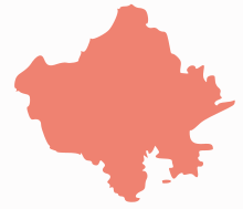 | ||||||||||||||||||||||||||
|---|---|---|---|---|---|---|---|---|---|---|---|---|---|---|---|---|---|---|---|---|---|---|---|---|---|---|---|
| Governance | |||||||||||||||||||||||||||
| Divisions and Districts |
| ||||||||||||||||||||||||||
| Major cities | |||||||||||||||||||||||||||
| Related templates |
| ||||||||||||||||||||||||||
Coordinates: 26°30′00″N 77°01′12″E / 26.50000°N 77.02000°E