Karamay
| Karamay 克拉玛依市 • قاراماي شەھىرى | |
|---|---|
| Prefecture-level city | |
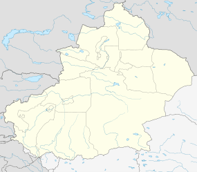
.png) Location of Karamay City jurisdiction in Xinjiang | |
 Karamay Location of the city centre in Xinjiang | |
| Coordinates: 45°36′N 84°53′E / 45.600°N 84.883°ECoordinates: 45°36′N 84°53′E / 45.600°N 84.883°E | |
| Country | People's Republic of China |
| Region | Xinjiang |
| Municipal seat | Karamay District |
| Subdivisions | |
| Area | |
| • Total | 9,252 km2 (3,572 sq mi) |
| Elevation | 354 m (1,161 ft) |
| Population (2002) | |
| • Total | 290,000 |
| • Density | 31/km2 (81/sq mi) |
| • Major Nationalities | Han - 75% |
| Time zone | China Standard (UTC+8) |
| Postal code | 834000 |
| Area code(s) | 0990 |
| GDP (2008) | ¥66.1 billion |
| GDP per capita (2008) |
¥242,391 (USD 34,901) |
| License Plate Prefix | 新J |
| Website |
www |
| Karamay | |||||||||||
| Chinese name | |||||||||||
|---|---|---|---|---|---|---|---|---|---|---|---|
| Simplified Chinese | 克拉玛依 | ||||||||||
| Traditional Chinese | 克拉瑪依 | ||||||||||
| Hanyu Pinyin | Kèlāmǎyī | ||||||||||
| |||||||||||
| Uyghur name | |||||||||||
| Uyghur |
قاراماي | ||||||||||
| |||||||||||
Karamay or Kelamayi is a prefecture-level city in the north of the Xinjiang Uygur Autonomous Region, People's Republic of China. The name of the city comes from the Uyghur language, and means "black oil", referring to the oil fields near the city.
Karamay was the site of one of the worst disasters in modern Chinese history, the 12-08 incident, when 324 people, 288 of them school children, lost their lives in a cinema fire on 8 December 1994.[1]
History
Theatre fire in 1994
On December 8, 1994, a fire broke out in Friendship Theatre (友谊馆), Karamay, which caused the death of 325 people including 288 school children, according to official figures. Many teachers were killed while trying to protect and evacuate their students from the building, which lacked adequate safety features. A show was being organized at that moment for a number of local government officials, who managed to escape ahead of the others on spotting the fire, and were afterwards charged with neglecting their duty and received prison sentences of up to 5 years.
Subdivisions
Karamay City has jurisdiction over 4 districts (区 qu). They are not contiguous as Dushanzi District is located south of the Lanxin Railway and forms an exclave, separated from the rest of Karamay City by Kuytun City. Together with Kuytun City, Karamay City forms an enclave surrounded on all sides by Tacheng Prefecture.
| Map | |||||||
|---|---|---|---|---|---|---|---|
| District | Hanzi | Hanyu Pinyin | Uyghur (UEY) | Uyghur Latin (ULY) | Population (2010 Census) |
Area (km²) |
Density (/km²) |
| Karamay | 克拉玛依区 | Kèlāmǎyī Qū | قاراماي رايونى | Qaramay Rayoni | 261,445 | 3,833 | 68.20 |
| Dushanzi | 独山子区 | Dúshānzǐ Qū | مايتاغ رايونى | Maytagh Rayoni | 69,361 | 400 | 173.40 |
| Baijiantan | 白碱滩区 | Báijiǎntān Qū | جەرەنبۇلاق رايونى | Jerenbulaq Rayoni | 50,422 | 1,272 | 39.63 |
| Urho | 乌尔禾区 | Wū'ěrhé Qū | ئورقۇ رايونى | Orqu Rayoni | 9,780 | 2,229 | 4.38 |

Geography
Karamay is located in the northwest of the Dzungarian basin, with an average elevation of 400 metres (1,300 ft). Its administrative area ranges in latitude from 44° 07' to 46° 08' N and in longitude from 80° 44' to 86° 01' E, and has a maximal 240 km (150 mi) north-south extent and reaches 110 km (68 mi) in east-west width. It borders Hoboksar Mongol Autonomous County to the northeast, Shawan County to the southeast, Toli County and Wusu to the west, and Kuytun to the south.
The naturally available water supply in the Karamay area is rather limited: it mostly consists of two fairly small rivers (the Baiyang River and the Da'erbute River (达尔不特河) flowing into the Dzungarian Basin from the mountains of its northwestern rim. In addition, the city receives water from the Irtysh River, over the Irtysh–Karamay Canal, which was officially opened in 2008.[2]
A number of natural (Ailik Lake) and artificial (Fengcheng, Huangyangquan) reservoirs are located in Karamay's northeastern Urho District; they all are replenished, directly or indirectly, by water from the Irtysh–Karamay Canal.
Climate
Karamay has a cold, continental desert climate (Köppen BWk), with great seasonal extremes in temperature, varying by 53 °C (95 °F); winters are long (lasting from November to March) and bitterly cold, spring and autumn are brief, and summers long and very hot. The monthly 24-hour average temperature is −15.4 °C (4.3 °F) in January and soars to 27.9 °C (82.2 °F) in July, and the annual mean is 8.61 °C (47.5 °F), warmer than most places at the corresponding latitude, due to the long summers. Annual precipitation is 106 millimetres (4.17 in), and the summer months record the most rainfall, despite relative humidity levels averaging around 30%. With monthly percent possible sunshine ranging from 37% in December to 71% in September, sunshine is generous, only occurring less than 50% of the time in November and December, and the annual average total is 2,694 hours.
| Climate data for Karamay (1971–2000) | |||||||||||||
|---|---|---|---|---|---|---|---|---|---|---|---|---|---|
| Month | Jan | Feb | Mar | Apr | May | Jun | Jul | Aug | Sep | Oct | Nov | Dec | Year |
| Average high °C (°F) | −11.2 (11.8) |
−7.2 (19) |
4.9 (40.8) |
18.9 (66) |
26.3 (79.3) |
31.8 (89.2) |
33.9 (93) |
32.1 (89.8) |
25.3 (77.5) |
14.8 (58.6) |
2.6 (36.7) |
−7.6 (18.3) |
13.7 (56.7) |
| Average low °C (°F) | −18.9 (−2) |
−15.6 (3.9) |
−4.2 (24.4) |
7.9 (46.2) |
14.9 (58.8) |
20.5 (68.9) |
22.6 (72.7) |
20.8 (69.4) |
14.6 (58.3) |
5.7 (42.3) |
−4.4 (24.1) |
−13.9 (7) |
4.2 (39.5) |
| Average precipitation mm (inches) | 4.2 (0.165) |
2.1 (0.083) |
3.6 (0.142) |
6.6 (0.26) |
16.3 (0.642) |
13.1 (0.516) |
20.2 (0.795) |
15.1 (0.594) |
7.4 (0.291) |
5.6 (0.22) |
6.1 (0.24) |
5.3 (0.209) |
105.6 (4.157) |
| Average precipitation days (≥ 0.1 mm) | 7.7 | 4.5 | 3.9 | 4.4 | 6.1 | 6.9 | 8.1 | 6.9 | 5.0 | 3.7 | 4.4 | 8.9 | 70.5 |
| Average relative humidity (%) | 78 | 75 | 57 | 33 | 30 | 29 | 31 | 30 | 32 | 44 | 63 | 77 | 48.3 |
| Mean monthly sunshine hours | 140.0 | 159.7 | 220.5 | 258.8 | 291.9 | 295.8 | 302.5 | 298.1 | 266.2 | 221.5 | 139.3 | 99.8 | 2,694.1 |
| Percent possible sunshine | 50 | 55 | 60 | 64 | 64 | 63 | 64 | 68 | 71 | 65 | 49 | 37 | 61 |
| Source: China Meteorological Administration | |||||||||||||
Demographics
80% of Karamay's population are Han with minorities such as Uighur, Kazakhs, Mongols and Hui making up the rest.
Economy
In 1955, one of the largest oil fields in China was discovered there. Since then, the city has grown into an oil-producing and refining center.
In 2008 the GDP reached ¥66.1 billion, and GDP per capita reached ¥242,391 (US$34,901). The GDP per capita ranks first among 659 cities in Mainland China.
Transport
- Kuytun–Beitun Railway. There are passenger stations in Karamay itself and in Wuwu New Town (五五新镇街道), south of central Karamay.
- Karamay Airport
- China National Highway 217
See also
References
External links
- Government website of Karamay (in Simplified Chinese)
- Map of the City of Karamay