Caransebeș
| Caransebeș | ||
|---|---|---|
| Municipality | ||
|
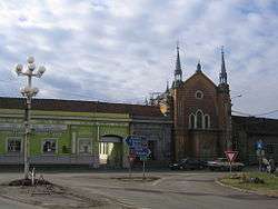
Caransebeș synagogue | ||
| ||
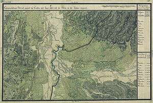
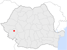 Location of Caransebeș | ||
| Coordinates: 45°25′17″N 22°13′19″E / 45.42139°N 22.22194°ECoordinates: 45°25′17″N 22°13′19″E / 45.42139°N 22.22194°E | ||
| Country |
| |
| County | Caraș-Severin County | |
| Status | Municipality | |
| Government | ||
| • Mayor | Marcel Vela (National Liberal Party) | |
| Area | ||
| • Total | 70.08 km2 (27.06 sq mi) | |
| Population (2002) | ||
| • Total | 28,301 | |
| • Density | 384/km2 (990/sq mi) | |
| Time zone | EET (UTC+2) | |
| • Summer (DST) | EEST (UTC+3) | |
| Climate | Cfb | |
| Website | primaria-caransebes.ro | |
Caransebeș (Romanian pronunciation: [karanˈsebeʃ]; German: Karansebesch; Hungarian: Karánsebes, Hungarian pronunciation: [ˈkɒraːnʃɛbɛʃ]; Turkish: Karansebeş) is a city in Caraș-Severin County, part of the Banat region in southwestern Romania. It is located at the confluence of the River Timiș with the River Sebeș, the latter coming from the Țarcu Mountains. To the west, it is in direct contact with the Banat Hills. It is an important railroad node, being located approximately 40 km away from Reșița, 21 km from Oțelu Roșu, 70 km from Hațeg and about 25 km from the Muntele Mic ski resort, in the Țarcu Mountains.
One village, Jupa (Hungarian: Zsuppa), is administered by the city.
Climate
The climate in Caransebeș is rather mild. Sub-Mediterranean climatic influences are present to some extent. Temperatures do not drop too low in winter (with an average of 0,-15 °C), but summers can be warm (30-38 °C average). Rainfall can be quite abundant throughout the year.
History
The first traces of habitation here might date as far as Dacian times. Dacian ruins have been discovered recently near Obreja, a village 7 km away. As the Romans invaded Dacia, they built a castrum named Tibiscum, which was dug up by archaeologists near the nearby village of Jupa, a castrum which later grew to be a full city. Tibiscum is considered one of the gates of Christianity in Dacia, having an important role also in the Romanization of the local people.
During the Middle Ages, the local people continuously inhabited the area. The region passed under the control of the Hungarian Kingdom, then later under the rule of the Transylvanian Principality, and under the rule of the Ottoman Empire. In 1787 a self-inflicted defeat, the Battle of Caransebeș, is supposed (the historical accuracy is in doubt) to have taken place here. Later, the Habsburgs took the control of the region, after prologued wars against the Ottomans.
After railroads began to appear, the role of Caransebeș grew continuously. In the late 19th century, the Romanian people of the settlement elected to the Parliament of Hungary the Hungarian Lajos Mocsáry, who was a progressive democratic politician fighting for the cultural and administrative rights of all nationalities (including the Romanians) living in the Hungarian Kingdom of that time. After the 1918 union of Transylvania with Romania, Caransebeș became part of Greater Romania. After the rise of the communist regime in 1947, an airport and an airbase were built close to the city. However, the airport did not remain operational for long after the 1989 Revolution.
Demographics
| Historical population | ||
|---|---|---|
| Year | Pop. | ±% |
| 1912 | 7,999 | — |
| 1930 | 8,704 | +8.8% |
| 1948 | 10,106 | +16.1% |
| 1956 | 15,195 | +50.4% |
| 1966 | 18,194 | +19.7% |
| 1977 | 27,190 | +49.4% |
| 1992 | 31,985 | +17.6% |
| 2002 | 31,199 | −2.5% |
| 2011 | 21,932 | −29.7% |
| Source: Census data | ||
As of 2011 Caransebeș had a population of 21,932, mainly Romanians (93.48%), with Ukrainian (1.56%), German (1.17%) and Hungarian (0.78%) minorities present, but in decline.
Notable people
- Nicolae Corneanu, Orthodox metropolitan bishop
- Ion Dragalina, Romanian World War I General
- Corneliu Dragalina, Romanian World War II General
- Gustav Jaumann, Austrian physicist (1863–1924)
- Wilhelm Klein, archaeologist
External links
| Wikimedia Commons has media related to Caransebeș. |
- (Romanian) Official Website of the Caransebeș City Hall
- (Romanian) Unofficial website about Caransebeș
- (Romanian) Banaterra - Informations about the Caransebeș Region