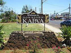
Kapaa, Hawaii
| Kapaa, Hawaii | |
|---|---|
| Census-designated place | |
 | |
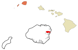 Location in Kauai County and the state of Hawaii | |
| Coordinates: 22°5′18″N 159°20′16″W / 22.08833°N 159.33778°WCoordinates: 22°5′18″N 159°20′16″W / 22.08833°N 159.33778°W | |
| Country | United States |
| State | Hawaii |
| County | Kauai |
| Area | |
| • Total | 10.0 sq mi (25.9 km2) |
| • Land | 9.8 sq mi (25.3 km2) |
| • Water | 0.2 sq mi (0.6 km2) |
| Elevation | 20 ft (6 m) |
| Population (2010) | |
| • Total | 10,699 |
| • Density | 971.2/sq mi (375.0/km2) |
| Time zone | Hawaii-Aleutian (UTC-10) |
| ZIP code | 96746 |
| Area code(s) | 808 |
| FIPS code | 15-28850 |
| GNIS feature ID | 0360457 |
Kapaʻa (Kauaʻi dialect: Tapaʻa) is an unincorporated census-designated place (CDP) in Kauaʻi County, Hawaiʻi, United States. The population was 10,699 at the 2010 census.
History
Kapaʻa is a Hawaiian adjective meaning "solid".[1] The town is located in the ancient district of Puna, in the ahupuaʻa of Kapaʻa. The famous "Sleeping Giant" or Nounou Mountain overlooks the town.
Geography

Kapaʻa is located at 22°5′18″N 159°20′16″W / 22.08833°N 159.33778°W (22.088281, -159.337706).[2] According to the United States Census Bureau, the CDP has a total area of 10.0 square miles (26 km2). 9.8 square miles (25 km2) of it is land and 0.2 square miles (0.52 km2) of it (2.40%) is water.
Demographics
As of the census[3] of 2000, there were 9,471 people, 3,129 households, and 2,281 families residing in the CDP. The population density was 971.2 inhabitants per square mile (375.1/km²). There were 3,632 housing units at an average density of 372.4 per square mile (143.8/km²). The racial makeup of the CDP was 27.8% Euro-American, 0.3% Black, 0.5% Native American, 31.7% Asian, 10.0% Pacific Islander, 1.0% from other races, and 28.7% from two or more races. Hispanic or Latino of any race were 9.5% of the population.
There were 3,129 households out of which 40.6% had children under the age of 18 living with them, 51.1% were married couples living together, 15.0% had a female householder with no husband present, and 27.1% were non-families. 20.4% of all households were made up of individuals and 6.2% had someone living alone who was 65 years of age or older. The average household size was 2.99 and the average family size was 3.44.
In the CDP the population was spread out with 29.8% under the age of 18, 7.8% from 18 to 24, 29.3% from 25 to 44, 22.8% from 45 to 64, and 10.4% who were 65 years of age or older. The median age was 35 years. For every 100 females there were 98.2 males. For every 100 females age 18 and over, there were 94.9 males.
The median income for a household in the CDP was $39,448, and the median income for a family was $45,878. Males had a median income of $30,129 versus $25,680 for females. The per capita income for the CDP was $16,878. About 14.1% of families and 15.7% of the population were below the poverty line, including 18.6% of those under age 18 and 12.6% of those age 65 or over.
Education
The town is served by Kapaa High School and a feeder elementary school and middle school. There is one private school St. Catherine Catholic School (K-8; online high school program), founded in 1947.[4]
References
- ↑ Pukui, Mary Kawena. Place Names of Hawaii. University of Hawaii Press. ISBN 0-8248-0524-0.
- ↑ "US Gazetteer files: 2010, 2000, and 1990". United States Census Bureau. 2011-02-12. Retrieved 2011-04-23.
- ↑ "American FactFinder". United States Census Bureau. Retrieved 2008-01-31.
- ↑ "St. Catherine Catholic School website". St. Catherine of Alexandria Parish.
External links
Islands, municipalities, and communities of Kauai County, Hawaii, United States | ||
|---|---|---|
| CDPs |  | |
| Unincorporated communities | ||