Kanker, Chhattisgarh
| Kanker | |
|---|---|
 Kanker Location in Chhattisgarh, India | |
| Coordinates: 20°16′N 81°29′E / 20.27°N 81.49°ECoordinates: 20°16′N 81°29′E / 20.27°N 81.49°E | |
| Cou |
|
| State | Chhattisgarh |
| District | Kanker |
| Elevation | 388 m (1,273 ft) |
| Population (2011) | |
| • Total | 31,385 |
| Languages | |
| • Official | Hindi, Chhattisgarhi |
| Time zone | IST (UTC+5:30) |
| PIN | 494 334 |
| Telephone code | 91 7868 |
| Vehicle registration | CG 19 |
Kanker is a city and a municipality in Kanker District in the Indian state of Chhattisgarh.
Geography
Kanker is located at 20°16′N 81°29′E / 20.27°N 81.49°E.[1] It has an average elevation of 388 metres (1272 feet).
Demographics
As of 2011 India census,[2] Kanker has a population of 31,385. Males constitute 51.6% of the population and females 49.4%.[3] Kanker has an average literacy rate of 77%, higher than the national average of 59.5%: male literacy is 83%, and female literacy is 71%. In Kanker, 12% of the population is under 23 years of age, meaning they are younger than the population aged 23 and above.
Transport
Kanker is situated on National Highway No. 30 (Raipur-Jagdalpur-Vizianagram) at a distance of 140 km from the State Capital Raipur and 160 km from the Divisional Headquarters Jagdalpur. It is connected with other parts of the state by road network. Coaches operated by a myriad of private bus operators run at frequent intervals for major towns and cities of the state.[4] In addition, shared cab facility is also available to the neighbouring local routes. Unfortunately, Kanker has no railway or air connectivity yet. Nearest Airport and major Railway Station is at Raipur.
Gallery of places around Kanker
 View of Kanker from DIET
 Doodh river in Kanker[5]
 Villages around Kanker
 Stream in Kanker
 Mosque in Kanker
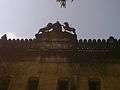 Tehsildar office
 Tehsildar office 2
References
- ↑ Falling Rain Genomics, Inc - Kanker
- ↑ "Census of India 2001: Data from the 2001 Census, including cities, villages and towns (Provisional)". Census Commission of India. Archived from the original on 2004-06-16. Retrieved 2008-11-01.
- ↑ http://censusindia.gov.in/PopulationFinder/View_Village_Population.aspx?pcaid=6288&category=U.A.
- ↑ http://kanker.gov.in/aboutKanker.html
- ↑ "About Kanker". Official website for Kanker, India. 2013-07-27.
Mainly five rivers flow through the district namely- doodh river, Mahanadi, Hatkul river, sindur river and Turu river.