Kander (Germany)
| Kander | |
| River | |
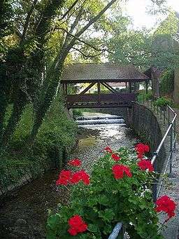 The river as it flows through Kandern | |
| Country | Germany |
|---|---|
| State | Baden-Württemberg |
| Tributaries | |
| - right | Lippisbach, Feuerbach, Wollbach |
| Source | |
| - location | Hochblauen, Germany |
| - elevation | 1,000 m (3,281 ft) |
| - coordinates | 47°46′42″N 07°42′05″E / 47.77833°N 7.70139°E |
| Mouth | |
| - location | Rhine River, Germany |
| - elevation | 250 m (820 ft) |
| - coordinates | 47°36′30″N 07°37′00″E / 47.60833°N 7.61667°ECoordinates: 47°36′30″N 07°37′00″E / 47.60833°N 7.61667°E |
| Length | 22 km (14 mi) |
The Kander is a small river flowing from the southern Black Forest westward into the Rhine River
Geography
The Kander rises at the head of the Kandertal on the Blauen in the Black Forest. Within the first 10 km of its course to Kandern, the Kander loses 650m of elevation. The stream has a total length of 22 km and a drop of 750m to its mouth on the Rhine near the town of Märkt
History
The name Kander comes from the Celtic word kandera, meaning clear flowing.
Transport uses
Due to the stream's small size it has no transportation function.
External links
This article is issued from Wikipedia - version of the 4/15/2015. The text is available under the Creative Commons Attribution/Share Alike but additional terms may apply for the media files.