Kamenar Point
Kamenar Point (Bulgarian: нос Каменар, ‘Nos Kamenar’ \'nos ka-me-'nar\) is the narrow rocky point on Davis Coast in Graham Land, Antarctica projecting 650 m northwards into Jordanoff Bay and forming the east side of the entrance to Hvoyna Cove. The point is named after the settlements of Kamenar in Northeastern and Southeastern Bulgaria.
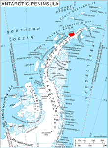
Location
Kamenar Point is located at 63°50′48″S 59°54′14″W / 63.84667°S 59.90389°WCoordinates: 63°50′48″S 59°54′14″W / 63.84667°S 59.90389°W, which is 1.7 km east of Wennersgaard Point, 4.2 km south-southwest of Tarakchiev Point, and 1.95 km north of Sratsimir Hill. German-British mapping in 1996.
Maps
- Trinity Peninsula. Scale 1:250000 topographic map No. 5697. Institut für Angewandte Geodäsie and British Antarctic Survey, 1996.
- Antarctic Digital Database (ADD). Scale 1:250000 topographic map of Antarctica. Scientific Committee on Antarctic Research (SCAR), 1993–2016.
References
- Bulgarian Antarctic Gazetteer. Antarctic Place-names Commission. (details in Bulgarian, basic data in English)
- Kamenar Point. SCAR Composite Antarctic Gazetteer
This article includes information from the Antarctic Place-names Commission of Bulgaria which is used with permission.