Kalsoy
| Kalsoy | |
|---|---|
| Island | |
|
Kalsoy | |
 Location within the Faroe Islands | |
| Coordinates: 62°17′N 6°44′W / 62.283°N 6.733°WCoordinates: 62°17′N 6°44′W / 62.283°N 6.733°W | |
| State | Kingdom of Denmark |
| Constituent country | Faroe Islands |
| Municipality seat | Klaksvík |
| Area | |
| • Total | 30.9 km2 (11.9 sq mi) |
| Area rank | 9 |
| Highest elevation | 787 m (2,582 ft) |
| Population (2002) | |
| • Total | 147 |
| • Rank | 9 |
| • Density | 4.8/km2 (12/sq mi) |
| Time zone | GMT (UTC+0) |
| • Summer (DST) | EST (UTC+1) |
| Calling code | 298 |
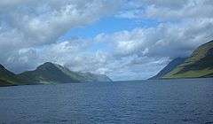
Kalsoy (Danish: Kalsø) is an island in the north-east of the Faroe Islands between Eysturoy and Kunoy.
Geography
The western coast has dramatically steep cliffs for the full length of the island, whereas idyllic valleys on the eastern slopes protect the four tiny settlements, Húsar, Mikladalur, Syðradalur and Trøllanes, whose combined populations total less than 150. They are connected by a partly surfaced road which passes through four dark tunnels. The island's thin shape and road-tunnels give it the nickname "the flute". There is a lighthouse at Kallur, the northern tip of Kalsoy.
Important Bird Area
The northern and western coastline of the island has been identified as an Important Bird Area by BirdLife International because of its significance as a breeding site for seabirds, especially Atlantic puffins (40,000 pairs), European storm petrels (5000 pairs) and black guillemots (200 pairs).[1]


Mountains
The island has 13 peaks, the two highest of which are Nestindar (787 m) and Botnstindur (743 m).
Travel
There are ferry landings at Syðradalur, and one of the mail boats (named Sam) makes regular trips from Klaksvík to both settlements. One can walk north all the way to the lighthouse at Kallur, but the four unlit tunnels on the way make it advisable to carry a torch. However, there is not enough traffic to pose problems with exhaust gases. The northernmost tunnel through to Trøllanes is narrow, cold, damp and over 2 km long; it is rarely used by vehicles since the population of Trøllanes is only 20. The alternative overland route from Mikladalur to Trøllanes is a dangerous and precipitous path which is best avoided.
There is also a bus service between Húsar and Trøllanes.
Legends
Kalsoy has many legends, the best known of which is the legend of the Selkie or Seal-Woman of Mikladalur.
A young farmer from the town of Mikladalur on Kalsoy island goes to the beach to watch the selkies dance. He hides the skin of a beautiful selkie maid, so she cannot go back to sea, and forces her to marry him. He keeps her skin in a chest, and keeps the key with him both day and night. One day when out fishing, he discovers that he has forgotten to bring his key. When he returns home, the selkie wife has escaped back to sea, leaving their children behind. Later, when the farmer is out on a hunt, he kills both her selkie husband and two selkie sons, and she promises to take revenge upon the men of Mikladalur. Some shall be drowned, some shall fall from cliffs and slopes, and this shall continue, until so many men have been lost that they will be able to link arms around the whole island of Kalsoy, there are still occasional deaths occurring in this way on the island.
This revenge has always been taken seriously, not only in Kalsoy but in the Faroe Islands generally. The descendants of the "Seal-woman" are still known in the country by certain characteristics, especially their short fingers.[2]
References
- ↑ BirdLife International. (2012). Important Bird Areas factsheet: Kalsoy. Downloaded from http://www.birdlife.org on 2012-02-23.
- ↑ "The seal-woman of Mikladalur". Sjoferdir Skúvadal (www.puffin.fo). Retrieved 6 November 2013.
- Swaney, Deanna (June 1997) [February 1991]. Iceland, Greenland & the Faroe Islands (3rd ed.). Lonely Planet Publications. ISBN 0-86442-453-1.
- "Norðoyggjar - The Northern Islands". Faroe Islands Tourist Guide 2005. 2005. Archived from the original on 2006-05-08. Retrieved 2006-07-16.
- some material on this page was translated from the Kalsoy article on German Wikipedia
| Look up Kalsoy in Wiktionary, the free dictionary. |
| Wikimedia Commons has media related to Kalsoy. |
External links
- Personal website with 6 aerial photos of Kalsoy

