Kalmius
| Kalmius, Кальміус | |
|---|---|
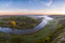 Kalmius river | |
| Country | Ukraine |
| Basin | |
| Main source | Donetsk Oblast, Ukraine |
| River mouth | Azov Sea (Mariupol) |
| Basin size | 5,070 km2 (1,960 sq mi) |
| Physical characteristics | |
| Length | 209 km (130 mi) |
The Kalmius (Ukrainian: Кальміус) is one of two rivers flowing through the Ukrainian city of Mariupol. The other river called the Kalchik flows into the Kalmius. The Kalmius flows into the Sea of Azov near the Azovstal steel manufacturing complex in Mariupol.
Kalmius was the name of a 16th-century Cossack encampment where the city of Mariupol was later founded.[1]
The Kalmius Trail was a Tatar raiding trail, one of the branches of the Muravsky Trail.
After an offensive by the separatist forces of the Donetsk People's Republic in August 2014 during the War in Donbass, in southern Donetsk Oblast the river became the boundary between Donetsk People's Republic-controlled territory on the east bank of the river, and Ukrainian government-controlled territory on the west bank.[2] A Donetsk People's Republic unit was named "Kalmius" Battalion.
References
- ↑ http://www.britannica.com/EBchecked/topic/365548/Mariupol
- ↑ http://mobile.nytimes.com/2015/06/05/world/europe/hardening-of-positions-undercuts-ukraine-poroshenko-peace-accord.html
| Wikimedia Commons has media related to Kalmius. |
Coordinates: 47°05′10″N 37°34′32″E / 47.0862°N 37.5755°E