Kakata
| Kakata | |
|---|---|
 | |
 Kakata Location in Liberia | |
| Coordinates: 6°31′48″N 10°21′6″W / 6.53000°N 10.35167°WCoordinates: 6°31′48″N 10°21′6″W / 6.53000°N 10.35167°W | |
| Country |
|
| County | Margibi County |
| Climate | Am |
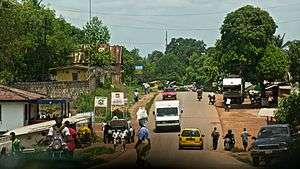
Kakata, Kak-ah-tah, is the capital city of Liberia's Margibi County and is located in Kakata District just over the Du River bridge which is its border with Todee District. It is a transit town at the heart of the historical natural rubber cultivation belt in Liberia. The city is colloquially known as "Kak City".
It is estimated that the city is surrounded by more than one hundred thousand acres[1] of rubber plantations, most of which are now past latex production. Though the Salala Rubber Company and Firestone Liberia are not far from Kakata, the nearby rubber plantations are mostly privately owned. Morris American Rubber Company (MARCO) and Bright Farm are the two largest, and Liberian-owned plantations, by area around Kakata. Small and medium-holder rubber plantations also dot most of the landscape.
Kakata has many primary and secondary schools. One of the most notable is Booker Washington Institute (BWI), Liberia's premiere vocational high school and technical institution. It also hosts KRTTI, Kakata Rural Teacher Training Institute, which trains Liberian elementary and lower-grade secondary teachers. It has Eight Senior High Schools: St. Christopher Catholic High School, St. Augustine, Methodist, Pentecostal Conquerors Academy, Kakata Community College, Francis Michell, Lango Lippaye, and BWI. Lango Lippaye is the only Government Senior High School in Margibi county. There are three government junior high schools: the KRTTI Demonstration school, E. J. Yancy, and Lango Lippaye. Students from all over Liberia come to Kakata for studies at these institutions.
C. H. Rennie Hospital in Kakata is the headquarters for the Margibi County health team. The Firestone Duside Hospital in Harbel is the nearest referral health care facility.
Kakata has a large daily market in the center of town. Kakata is a meeting point between urban and rural Liberia: Many of Kakata’s inhabitants either travel to Monrovia to bring goods to Kakata to sell, or travel to the rural areas, to bring produce back to Kakata to sell. The primary groups are Kpelle and Bassa, but all the different groups from across Liberia are represented in Kakata.
As of the 2008 census, Kakata has a population of 33,945. Of this, 16,501 were male and 17,444 female; it is the fifth most populous urban area in Liberia.[2]
Radio coverage
Radio is one of the main source of news and community engagement. The prominent stations broadcasting in Kakata are:
- Radio Kakata is 101.7 FM
- Atlantic Radio 92.6
- Choice FM is 98.2 FM
- The BBC World Service is 103.0 FM
Geography
The city is connected by the paved highway from Monrovia, Liberia via Paynesville, Liberia, and to Firestone Natural Rubber Company's Harbel, Liberia in the south by a dirt dusty road 26th Gate road, and by the paved 15th Gate plantation road in Careysburg, Liberia. It is also connected to Bong Town, Liberia to the north by a partially paved road, by the dusty Borlala road, to Gibi mountain and Gibi District in the east. Finally the paved Monrovia highway continues northeast to Salala, Liberia and Gbarnga.
See also
References
- ↑ "2008-2012 Margibi County Development Agenda" (PDF). County Development Committee, in collaboration with the Ministries of Planning and Economic Affairs and Internal Affairs. Ministry of Planning and Economic Affairs. 2008. Retrieved 2012-06-12.
- ↑ "2008 National Population and Housing Census: Preliminary Results" (PDF). Liberia Institute of Statistics and Geo-Information Services. Government of the Republic of Liberia. June 2008. Retrieved 2011-11-08.
| | |||||||||
|---|---|---|---|---|---|---|---|---|---|
| Rank | Name | County | Pop. | ||||||
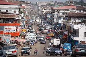 Monrovia |
1 | Monrovia | Montserrado | 939,524 | Kakata | ||||
| 2 | Gbarnga | Bong | 45,835 | ||||||
| 3 | Kakata | Margibi | 33,945 | ||||||
| 4 | Bensonville | Montserrado | 33,188 | ||||||
| 5 | Harper | Maryland | 32,661 | ||||||
| 6 | Voinjama | Lofa | 26,594 | ||||||
| 7 | Buchanan | Grand Bassa | 25,731 | ||||||
| 8 | Zwedru | Grand Gedeh | 25,678 | ||||||
| 9 | New Yekepa | Nimba | 24,695 | ||||||
| 10 | Greenville | Sinoe | 16,434 | ||||||