Kabirdham district
| Kabirdham district कबीरधाम जिला | |
|---|---|
| District of Chhattisgarh | |
 Location of Kabirdham district in Chhattisgarh | |
| Country | India |
| State | Chhattisgarh |
| Administrative division | Durg |
| Headquarters | Kawardha |
| Tehsils | 4 |
| Government | |
| • Assembly seats | 2 |
| Area | |
| • Total | 4,235 km2 (1,635 sq mi) |
| Population (2011) | |
| • Total | 822,239 |
| • Density | 190/km2 (500/sq mi) |
| Demographics | |
| • Literacy | 61.95% |
| • Sex ratio | 991 |
| Major highways | NH 30 |
| Website | Official website |
Kabirdham district is one of the 27 administrative districts of Chhattisgarh state in central India. The district was earlier known as Kawardha district. The district is located between 21.32' to 22.28' north latitude and 80.48' to 81.48' east longitude. The district covers an area of 4,447.5 km2 (1,717.2 sq mi). The city of Kawardha is its administrative headquarters. This district is known for the Bhoramdeo temple (which is also known by the sobriquet, "the Khajuraho of Chhattisgarh") located at a distance of 18 km from the district headquarters, Kawardha.
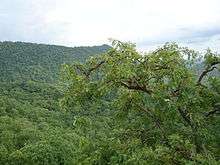
The boundaries of the district are Dindori District to the north, Mungeli District and Bemetara District to the east, Rajnandgaon District to the south, Balaghat District and Mandla District to the west. The northern and western parts are surrounded by the Maikal mountain ranges of Satpura. The current district collector is Dhananjay Dewangan (IAS)
History
On July 2, 1998 the government of Madhya Pradesh state decided to constitute a new district, Kawardha by combining the erstwhile tehsil of Kawardha of Rajnandgaon district and the erstwhile tehsil of Pandariya of Bilaspur district.[1] The town of Kawardha was decided as the headquarters for this new district. The new district came into existence on July 6, 1998.[1] The district is now known as Kabirdham district.
The name of the district was changed from Kawardha to Kabeerdham on 17 January 2003 by then chief minister of state Ajit Jogi on the occasion of sixth century birth celebration of Dhani Dharm Das, the founder of Kabir panth in Chhattisgarh. Kabirdham name is given due to Kawardha was Guru Gaddi Pith of kabir panth from 1806 to 1903. Eighth Guru of Kaber panth Haq Nam Saheb established Guru Gaddi here in 1806. Ninth Guru Pak Nam Saheb, Tenth Guru Prakat Nam Saheb and Eleventh Guru Dhiraj Nam Saheb resided here Twelfth Guru Ugr Nam Saheb changed Guru Gaddi place from Kawardha to Damakheda in 1903, where Guru Gaddi is situated.
The present day tehsil of Kawardha was a princely state, formed in the year 1751 by Mahabali Singh. In 1895 it became Kawardha tehsil of Mandla district. In 1903, it was included in Bilaspur district. In 1912, it was shifted to Raipur district and in 1948 it became a part of Durg district. On January 26, 1973 a new district, Rajnandgaon came into existence and it became a part of it.[1]
The other tehsil Pandariya was known as Pandariya zamindari till 1952. In 1952, it became a community block of Bilaspur district and in 1986 its status was raised to a tehsil.[1] Headquarters of Kabirdham is Kawardha.Kawardha city is established by first Jamindar of Kawardha riyasat Mahabali Singh on1751.

Demographics
According to the 2011 census Kabirdham district has a population of 822,239,[2] roughly equal to the nation of Comoros[3] or the US state of South Dakota.[4] This gives it a ranking of 479th in India (out of a total of 640).[2] The district has a population density of 195 inhabitants per square kilometre (510/sq mi) .[2] Its population growth rate over the decade 2001-2011 was 40.66%.[2] Kabirdham has a sex ratio of 997 females for every 1000 males,[2] and a literacy rate of 61.95%.[2]
Languages
Languages spoken include Agariya, an Austroasiatic tongue with approximately 72 000 speakers, spoken in the Maikal Hills.[5]


Divisions
The district is divided into four tehsils, Kabirdham,Bodla,Sahaspur Lohara and Pandariya. Each tehsil is a single block of same name.[6] The two Vidhan Sabha constituencies in this district are Kawardha and Pandariya.
References
- 1 2 3 4 History of Kabirdham district from official website, accessed 06-Sep-2008
- 1 2 3 4 5 6 "District Census 2011". Census2011.co.in. 2011. Retrieved 2011-09-30.
- ↑ US Directorate of Intelligence. "Country Comparison:Population". Retrieved 2011-10-01.
Comoros 794,683 July 2011 est.
- ↑ "2010 Resident Population Data". U. S. Census Bureau. Archived from the original on 2011-08-23. Retrieved 2011-09-30.
South Dakota 814,180
- ↑ M. Paul Lewis, ed. (2009). "Agariya: A language of India". Ethnologue: Languages of the World (16th ed.). Dallas, Texas: SIL International. Retrieved 2011-09-28.
- ↑ Divisions of Kabirdham district lohara from official website, accessed 06-Sep-2008
External links
- Official website
- Information about Kabirdham
- Kabirdham District Map
 |
Dindori district, Madhya Pradesh |  | ||
| Mandla district, Madhya Pradesh | |
Bilaspur district | ||
| ||||
| | ||||
| Balaghat district, Madhya Pradesh | Rajnandgaon district | Durg district |
Coordinates: 22°01′N 81°15′E / 22.017°N 81.250°E
