Kaabong
| Kaabong | |
|---|---|
|
Kaabong | |
 Kaabong Map of Uganda showing the location of Kaabong. | |
| Coordinates: 03°31′12″N 34°07′12″E / 3.52000°N 34.12000°ECoordinates: 03°31′12″N 34°07′12″E / 3.52000°N 34.12000°E | |
| Country |
|
| Region | Northern Uganda |
| Sub-region | Karamoja sub-region |
| District | Kaabong District |
| Elevation | 1,520 m (4,990 ft) |
| Population (2011 Estimate) | |
| • Total | 23,900 |
| Time zone | EAT (UTC+3) |
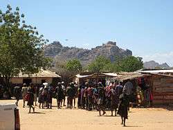
Kaabong is a town in the Northern Region of Uganda. It is the chief municipal, administrative and commercial center of Kaabong District, and the district headquarters are located there.
Location
Kaabong is approximately 155 kilometres (96 mi), by road, northwest of Moroto, the largest town in the sub-region.[1] This is approximately 495 kilometres (308 mi), by road, northeast of Kampala, the capital and largest city of Uganda.[2] The coordinates of the town are 3°31'12.0"N, 34°07'12.0"E (Latitude:3.5200; Longitude:34.1200).[3]
Population
The national census in 2002 estimated the population of Kaabong at 13,100. In 2010, the Uganda Bureau of Statistics (UBOS) estimated the population at 22,300. In 2011, UBOS estimated the mid-year population at 23,900.[4]
Points of interest
The following points of interest lie within the town limits or close to the edges of town:
- Offices of Kaabong Town Council
- Kaabong Central Market
- Kaabong Parish Catholic Church, a place of worship affiliated with the Roman Catholic Diocese of Kotido. Simon Lokodo was the parish priest here before he was elected to parliament to represent Dodoth County in this district.
- Kaabong General Hospital, a 100-bed hospital under he supervision of the Uganda Ministry of Health.
- Stanbic Bank maintains a branch in town.
See also
References
- ↑ "Road Distance Between Moroto and Kaabong With Map". Globefeed.com. Retrieved 2 June 2014.
- ↑ "Map Showing Kampala And Kaabong With Distance Marker". Globefeed.com. Retrieved 2 June 2014.
- ↑ Google (5 July 2015). "Location of Kaabong at Google Maps" (Map). Google Maps. Google. Retrieved 5 July 2015.
- ↑ UBOS. "Estimated Population of Kaabong In 2002, 2010 And 2011" (PDF). Uganda Bureau of Statistics (UBOS). Retrieved 2 June 2014.
External links
Capital: Kaabong | |
| Counties and sub-counties | |
| Parishes |
|
| Towns and villages | |
| Banking | |
| Transport |
|
| Health | |
| Notable landmarks | |
| Notable people | |