K-23 (Kansas highway)
| ||||
|---|---|---|---|---|
 | ||||
| Route information | ||||
| Maintained by KDOT | ||||
| Length: | 199 mi (320 km) | |||
| Major junctions | ||||
| South end: |
| |||
|
| ||||
| North end: |
| |||
| Location | ||||
| Counties: | Meade, Gray, Finney, Lane, Gove, Sheridan | |||
| Highway system | ||||
| ||||

K-23 is a state highway in Kansas. It starts as a continuation of Oklahoma Route 23 and it runs north to US 83 and K-383.
Route description
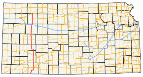
K-23 begins its northerly journey at the Kansas-Oklahoma state line northwest of Forgan, Oklahoma, picking up northbound traffic from Oklahoma Highway 23. It traverses flat land with a few hills, passing near Meade Lake, then intersects U.S. Routes 54 and 160 in downtown Meade. After leaving Meade, it starts to traverse rolling hills until K-98, where the road levels out. K-23 intersects U.S. Route 56 on its way to Cimarron, where it junctions U.S. Routes 50 and 400. North of Cimarron, the route alternates between flat and hilly land through farmland. North of Cimarron, the route overlaps K-156 for five miles. After leaving K-156, the highway turns back north, levels out and heads toward Dighton, the only city in Lane County. There it intersects K-96. North of Dighton the route intersects K-4, and the two routes briefly run concurrent. After leaving K-4, it travels north to Gove City, and continues to Grainfield, where it intersects I-70 and U.S. Route 40, where the three routes overlap for two miles before K-23 turns north again. North of Grainfield, rolling hills alternate with the flatter land. In Hoxie, U.S. Route 24 is intersected. North of Hoxie, the road intersects K-123, turns west, then intersects K-223. K-23 continues west until its northern terminus at U.S. Route 83 and K-383.
Junction List
| County | Location | mi | km | Destinations | Notes |
|---|---|---|---|---|---|
| Meade | | 0.0 | 0.0 | Southern terminus; continuation into Oklahoma | |
| Meade | 26 | 42 | |||
| Gray | | 50 | 80 | ||
| Cimarron | 62 | 100 | |||
| Finney | | 80 | 130 | Southern end of concurrency with K-156 | |
| | 86 | 138 | Northern end of concurrency with K-156 | ||
| Lane | Dighton | 115 | 185 | ||
| Shields | 124 | 200 | Southern end of concurrency with K-4 | ||
| | 126 | 203 | Northern end of concurrency with K-4 | ||
| Gove | Grainfield | 160 | 260 | Southern end of concurrency with I-70/US-40; I-70 exit 93 | |
| | 162 | 261 | Northern end of concurrency with I-70/US-40; I-70 exit 95 | ||
| | 164 | 264 | |||
| Sheridan | Hoxie | 180 | 290 | ||
| | 193 | 311 | |||
| | 194 | 312 | |||
| | 199 | 320 | Northern terminus of K-23; southern terminus of K-383; road continues as US-83 north | ||
1.000 mi = 1.609 km; 1.000 km = 0.621 mi
| |||||
K-23 Alternate
K-23 Alternate starts at the K-23 south interchange with I-70. Mainline K-23 uses I-70 east for a few miles. K-23 Alt. follows Old Highway 40 for 3⁄4 mile (1.2 km), then turns north on Main Street. The route passes through downtown Grainfield. When Main St. ends, the highway turns east and heads back toward mainline K-23.