Köttmannsdorf
| Köttmannsdorf | ||
|---|---|---|
 | ||
| ||
 Köttmannsdorf Location within Austria | ||
| Coordinates: 46°34′N 14°14′E / 46.567°N 14.233°ECoordinates: 46°34′N 14°14′E / 46.567°N 14.233°E | ||
| Country | Austria | |
| State | Carinthia | |
| District | Klagenfurt-Land | |
| Government | ||
| • Mayor | Ing. Josef (Seppi) Lindl | |
| Area | ||
| • Total | 28.16 km2 (10.87 sq mi) | |
| Elevation | 558 m (1,831 ft) | |
| Population (1 January 2016)[1] | ||
| • Total | 2,909 | |
| • Density | 100/km2 (270/sq mi) | |
| Time zone | CET (UTC+1) | |
| • Summer (DST) | CEST (UTC+2) | |
| Postal code | 9071 | |
| Area code | 04220 | |
| Website | www.koettmannsdorf.at | |

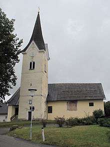
Sankt Gandolf, church
Köttmannsdorf (Slovene: Kotmara vas) is a town in the district of Klagenfurt-Land in the Austrian state of Carinthia.
Geography
Köttmannsdorf lies southwest of Klagenfurt in the heights of the Sattnitz Mountains. The highest point in the municipality at 921 m is the Sabalahöhe in the west, and the lowest point the Ferlach Reservoir at 441 m. The Rekabach flows from west to east through the municipality.
Population
According to the 2001 census 6.4% of the population are Carinthian Slovenes.
| Village (German) | Village (Slovenian) | Number of people 1991 | Percent of Slovenes 1991 | Percent of Slovenes 1951 |
|---|---|---|---|---|
| Neusaß | Vesava | 48 | 45.8% | 100% |
| Plöschenberg | Plešivec | 34 | 47.1% | 81.2% |
| St.Gandolf | Šentkandolf | 77 | 6.5% | 85.4% |
| Trabesing | Trabesinje | 188 | 14.4% | 65.9% |
| Tschachoritsch | Čahorče | 251 | 16.7% | 91.7% |
| Gaisach | Čežava | 49 | 10.2% | 20.0% |
| Hollenburg | Humberk | 8 | 12.5% | 15.4% |
| St.Margarethen | Šmarjeta | 60 | 21.7% | 100% |
| Wurdach | Vrdi | 118 | 12.7% | 63.0% |
| Preliebl | Preblje | 64 | 9.4% | 46.5% |
| Göriach | Gorje | 76 | 6.6% | 28.6% |
| Tschrestal | Črezdol | 52 | 9.6% | 62.2% |
| Köttmannsdorf | Kotmara vas | 709 | 6.3% | 50.1% |
References
| Wikimedia Commons has media related to Köttmannsdorf. |
This article is issued from Wikipedia - version of the 5/11/2016. The text is available under the Creative Commons Attribution/Share Alike but additional terms may apply for the media files.