Juab Valley
| Juab Valley | |
| Valley | |
 eastern Juab Valley at Nephi | |
| Country | United States |
|---|---|
| State | Utah |
| Regions | ((southeast)-Great Basin region) Utah Valley region (south region)-Wasatch Front |
| County | Juab |
| Borders on | East Tintic Mountains-W & NW Goshen Valley-NNW West Mountain (Utah)-N Utah Valley-NNE Wasatch Range-NE & E (north valley) San Pitch Mountains-E-(south valley) Valley Mountains-S Sevier River & Little Valley-SW Yuba State Park-SW West Hills (Juab County)-W-(south valley) |
| Communities | Starr, Mona, Nephi, Sharp, Levan, Juab, Mills |
| Lakes (Reservoirs) |
Sevier Bridge Reservoir, Mona Reservoir, Chicken Creek Reservoir |
| Creeks | Current & Chicken Creeks |
| Coordinates | 39°35′29″N 111°57′44″W / 39.5913°N 111.9623°WCoordinates: 39°35′29″N 111°57′44″W / 39.5913°N 111.9623°W |
| Length | 40 mi (64 km), N-S, (SSW in extreme south) |
| Width | 6 mi (10 km), (average of 4-6 mi, mostly) |
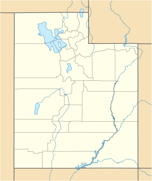 Juab Valley
in Utah | |
The Juab Valley is a 40-mi (64 km) long[1] valley located in far east Juab County, Utah. The border of the county is on the valley's north; the south county borders the valley's southeast.
The Juab Valley is in a region of dissected mountain ranges and valleys in the southern Wasatch Front region, with the Wasatch Range northeast, and the San Pitch Mountains bordering east and southeast. The valley's NNE borders the south of Utah Valley and another section of Utah Valley's southwest, the Goshen Valley.
Description
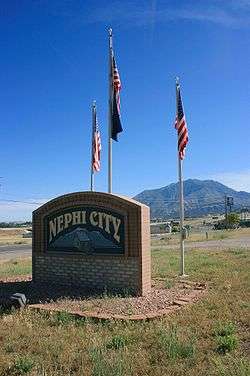
Juab Valley is linear, mostly N-S trending, with the major city-center of Nephi adjacent north of the valley center. The extreme north of the valley is adjacent to Santaquin which is located between the three valleys of: southwest Utah Valley, east Goshen Valley, and north Juab Valley.
The valley's extreme southwest borders a hilly region on the Sevier River's northeast riverbank-shoreline and Yuba State Park-(Sevier Bridge Reservoir), a stretch of the Sevier that flows north, then northwest to west. No major flow exits the valley into the Sevier River, but instead Chris Creek drains the area from the southwest San Pitch Mountains.
The Juab Valley north-south center is south of Nephi, in the region of Sharp, Utah. Sage Valley Pass is located nearby west in the hills, (West Hills (Juab County), that border the east of a small mountain valley, Sage Valley.
Creeks and reservoirs
The south of the valley has a water divide north of Levan. Chicken Creek flows southwest then southerly into Chicken Creek Reservoir; no outflow, the drainage is endorheic. The north of Juab Valley has Current Creek and West Creek flowing north into the Mona Reservoir; Current Creek then flows northwest through the hills at Goshen Valley's southeast, to Goshen Reservoir, then Goshen Bay of Utah Lake.
References
| Wikimedia Commons has media related to Juab Valley. |
- ↑ Utah, DeLorme Atlas & Gazetteer, p. 34-35, 24-25.
External links
- Sage Valley Pass (coordinates) at hometownlocator (west of valley center)]
- Cedar Point at hometownlocator (approx. valley center-(east), coordinates)