Joliette Regional County Municipality
| Joliette | |
|---|---|
| Regional county municipality | |
 | |
| Coordinates: 46°01′N 73°27′W / 46.017°N 73.450°WCoordinates: 46°01′N 73°27′W / 46.017°N 73.450°W[1] | |
| Country |
|
| Province |
|
| Region | Lanaudière |
| Effective | January 1, 1982 |
| County seat | Joliette |
| Government[2] | |
| • Type | Prefecture |
| • Prefect | André Hénault |
| Area[2][3] | |
| • Total | 424.20 km2 (163.78 sq mi) |
| • Land | 418.43 km2 (161.56 sq mi) |
| Population (2011)[3] | |
| • Total | 63,551 |
| • Density | 151.9/km2 (393/sq mi) |
| • Pop 2006-2011 |
|
| • Dwellings | 29,446 |
| Time zone | EST (UTC−5) |
| • Summer (DST) | EDT (UTC−4) |
| Area code(s) | 450 and 579 |
| Website |
www |
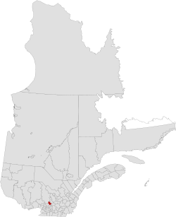
Joliette is a regional county municipality in the Lanaudière region of Quebec, Canada. Its seat is Joliette.
The municipality has a land area of 418.43 km² and a Canada 2011 Census population of 63,551 inhabitants.
Subdivisions
There are 10 subdivisions within the RCM:[2]
|
|
|
Transportation
Access Routes
Highways and numbered routes that run through the municipality, including external routes that start or finish at the county border:[4]
|
|
See also
References
 |
Matawinie RCM | | ||
| Montcalm RCM | |
D'Autray RCM | ||
| ||||
| | ||||
| L'Assomption RCM |
| Regional county municipalities and equivalent territories | |
|---|---|
| Municipalities | |
This article is issued from Wikipedia - version of the 7/22/2015. The text is available under the Creative Commons Attribution/Share Alike but additional terms may apply for the media files.