Joe, North Carolina
| Joe | |
|---|---|
| Unincorporated community | |
 Joe Location within the state of North Carolina | |
| Coordinates: 35°47′48″N 82°54′32″W / 35.79667°N 82.90889°WCoordinates: 35°47′48″N 82°54′32″W / 35.79667°N 82.90889°W | |
| Country | United States |
| State | North Carolina |
| County | Madison County |
| Elevation | 2,644 ft (806 m) |
| Time zone | Eastern (EST) (UTC-5) |
| • Summer (DST) | EDT (UTC-4) |
| ZIP code | 28743 |
| Area code(s) | 828 |
| GNIS feature ID | 1024894[1] |
Joe, North Carolina, is an unincorporated community south-southwest of Hot Springs, in Madison County, North Carolina. The community is part of the Asheville Metropolitan Statistical Area.[2]
"Joe" is not found easily on online maps. The old post office building however is still visible.
References
- ↑ U.S. Geological Survey Geographic Names Information System: Joe Post Office
- ↑ Madison County, North Carolina (PDF) (Map). Cartography by NCDOT. Raleigh: North Carolina Department of Transportation. September 2015. Retrieved April 7, 2016.
Municipalities and communities of Madison County, North Carolina, United States | ||
|---|---|---|
| Towns | 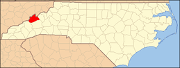 | |
| Unincorporated communities | ||
This article is issued from Wikipedia - version of the 5/28/2016. The text is available under the Creative Commons Attribution/Share Alike but additional terms may apply for the media files.