Jericho, New York
| Jericho, New York | |
|---|---|
| Hamlet and census-designated place | |
 Location in Nassau County and the state of New York. | |
 Location within the state of New York | |
| Coordinates: 40°47′12″N 73°32′12″W / 40.78667°N 73.53667°WCoordinates: 40°47′12″N 73°32′12″W / 40.78667°N 73.53667°W | |
| Country | United States |
| State | New York |
| County | Nassau |
| Area | |
| • Total | 4.1 sq mi (10.5 km2) |
| • Land | 4.1 sq mi (10.5 km2) |
| • Water | 0.0 sq mi (0.0 km2) |
| Elevation | 197 ft (60 m) |
| Population (2010) | |
| • Total | 13,567 |
| Time zone | Eastern (EST) (UTC-5) |
| • Summer (DST) | EDT (UTC-4) |
| ZIP codes | 11753, 11853, (small part of 11590) |
| Area code(s) | 516 |
| FIPS code | 36-38539 |
| GNIS feature ID | 0954000 |
Jericho /dʒɛrɪkoʊ/ is a hamlet and census-designated place (CDP) in Nassau County, New York on the North Shore of Long Island. As of the United States 2010 Census, the CDP population was 13,567. The area is served by the Jericho Union Free School District and the Syosset Central School District, the boundaries of which differ somewhat from those of the hamlet. The boundaries of the Jericho Post Office vary from both the hamlet and the school district boundaries, notably the inclusion of a portion of Jericho in the Westbury zip code, and the inclusion of a portion of Syosset in the Jericho zip code. Also, Jericho is located approximately 29 miles (47 km) east of Midtown Manhattan. Direct service is available by driving west on the Long Island Expressway or one can take the Long Island Rail Road from nearby Syosset train station.
History
Located mainly in the Town of Oyster Bay with a small part in the Town of Hempstead, Jericho was part of the Robert Williams Plantation in 1648. The English families who settled in Jericho were, or soon became, Quakers, members of the Society of Friends. Many fled from persecution in England and in the New England Colonies. They sought a peaceful existence as farmers. The name of the area was changed in 1692 from Lusum to Jericho after the town in the Middle East near the Jordan River mentioned in the Bible as part of the Promised Land.
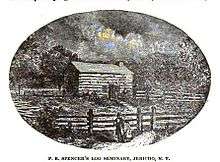
Elias Hicks married Jemima Seaman in 1771 and moved to her family’s farm in Jericho, where he soon became a noted preacher of Quaker doctrine. All the Quakers suffered during the British occupation of Long Island in the Revolutionary War. The practice was to quarter troops in homes of residents, who had to provide room and board for them. The Quakers continued to protest the entire concept of war itself. After the war, peace returned to Jericho, and the neat farms and businesses began to prosper. A Friends Meeting house was built in 1788 in Jericho that is still used in the 21st century. A Quaker school was built in 1793, the Charity Society of Jericho and Westbury in 1794, and slavery was abolished in 1817, with Hicks' help.
A Post Office was established in 1802, a cider mill in the mid-19th century, the first public elementary school in 1905, known as the Robert Seaman Elementary School. Improvements to infrastructure were made with the founding of the Jericho Water District in 1923. As the population increased, a new elementary school was built in 1920s (Cantiague Elementary School), and a Volunteer Fire Department established in 1938. The population kept increasing until the last elementary school in Jericho was built the George A. Jackson Elementary School. When the Village of Muttontown was incorporated, the cider mill was within the village limits. Because most Gold Coast villages wanted to remain business free areas, many do not have their own post offices or ZIP Codes. Therefore, Jericho Post Office which serves this area of Muttontown is displayed as the official USPS mailing address and leads to the misconception that the cider mill is in Jericho.
After World War II, in the 1950s Phebe Underhill Seaman sold a large piece of her land to real estate developers. This property was developed for new suburban housing. The water tower was erected in 1952. In 1958 the NY Department of Transportation demolished "Old Jericho" to widen Broadway, Routes 106/107, and to put in a cloverleaf access to Jericho Turnpike. New grade schools and a high school were added to the community along with a shopping center, a new Post Office, new Fire Department and a Public Library.
Also in Jericho is the New York Community Bank Theatre, originally established in 1956 as the Westbury Music Fair. The main entrance to SUNY Old Westbury is located in Jericho.
Geography

Jericho is located at 40°47′12″N 73°32′12″W / 40.786544°N 73.536757°W.[1]
According to the United States Census Bureau, the CDP has a total area of 4.1 square miles (11 km2), all land.
There is also another Jericho in New York, this one is located in the extreme Northeast corner of the state, in the Town of Altona, county of Clinton. It lies primarily along the Rand Hill Road.
Demographics
As of the census[2] of 2000, there were 13,045 people, 4,545 households, and 3,813 families residing in the CDP. The population density was 3,214.1 per square mile (1,240.6/km2). There were 4,600 housing units at an average density of 1,133.4/sq mi (437.5/km2). The racial makeup of the CDP was 86.36% White, 1.42% African American, 0.03% Native American, 10.69% Asian, 0.01% Pacific Islander, 0.51% from other races, and 0.98% from two or more races. Hispanic or Latino of any race were 2.44% of the population.
There were 4,545 households out of which 38.6% had children under the age of 18 living with them, 74.8% were married couples living together, 7.1% had a female householder with no husband present, and 16.1% were non-families. 13.7% of all households were made up of individuals and 6.1% had someone living alone who was 65 years of age or older. The average household size was 2.81 and the average family size was 3.08.
In the CDP the population was spread out with 25.3% under the age of 18, 4.6% from 18 to 24, 25.4% from 25 to 44, 28.4% from 45 to 64, and 16.4% who were 65 years of age or older. The median age was 42 years. For every 100 females there were 94.3 males. For every 100 females age 18 and over, there were 90.2 males.
The median income for a household in the CDP was $101,477, and the median income for a family was $109,635. Males had a median income of $79,204 versus $48,431 for females. The per capita income for the CDP was $45,312. About 2.7% of families and 4.7% of the population were below the poverty line, including 4.8% of those under age 18 and 5.2% of those age 65 or over.
Underground Railroad
The building now known as the Maine Maid Inn was built in 1789[3] as the home for the prominent Quaker and abolitionist Valentine Hicks, his wife Abigail, and their children. Hicks' father Elias Hicks "had been the spark that helped convince Quakers and other like-minded people after the Revolutionary War that all men were created equal—including people of color who were enslaved".[4] Valentine Hicks was also an Underground Railroad station master; in his home - a key way station - a removable panel behind an upstairs linen closet (that is still there today) concealed a staircase to the attic where Hicks hid runaways until the coast was clear.[4][5] The Town of Oyster Bay designated the site as an historic town landmark in 2012.[3] In 2015 there was a lot of outrage over the preservation of this historic site. Partial demolition of the Maine Maid Inn took place without the approval of the Oyster Bay landmark commission, which outraged many preservationists.
Economy
Aer Lingus operates its United States office in Jericho CDP and in the Town of Oyster Bay.[6][7][8]
Nathan's Famous is headquartered in Wing A of the second floor of One Jericho Plaza, in Jericho.[9]
Notable people
- Jamie-Lynn Sigler, who played Meadow Soprano on the HBO series The Sopranos.[10]
- Adrienne Shelly, actress
- Jon Carin, musician (Pink Floyd)
- David Carol, photographer
- Matt Litwin, musician, founder of band Bulletproof Messenger
- Stephanie Klein, writer
- Natalie Portman, actress
- Madison Beer, singer
- Miroslav Šatan, professional hockey player
- Allan Steele, actor and writer
References
- ↑ "US Gazetteer files: 2010, 2000, and 1990". United States Census Bureau. 2011-02-12. Retrieved 2011-04-23.
- ↑ "American FactFinder". United States Census Bureau. Retrieved 2008-01-31.
- 1 2 Bleyer, Bill (May 15, 2012). "Jericho's Maine Maid Inn gets landmark status". Newsday.
- 1 2 Rumsey, Spencer (February 4, 2014). "Slavery and Salvation: Long Island's Underground Railroad". Long Island Press.
- ↑ Velsor, Kathleen G. (February 12, 2013). The Underground Railroad on Long Island: Friends in Freedom (Paperback ed.). The History Press. ISBN 978-1609497705.
- ↑ "Contact Us." Aer Lingus. Retrieved 2009-05-25.
- ↑ "Jericho CDP, New York." U.S. Census Bureau. Retrieved 2009-05-25.
- ↑ "Oyster Bay town, New York." U.S. Census Bureau. Retrieved 2009-05-25.
- ↑ "Contact Us." Nathan's Famous. Retrieved 2011-12-17. "Nathan's Famous Executive Offices One Jericho Plaza Second Floor - Wing A Jericho, New York 11753"
- ↑ Fischler, Marcelle S. "LONG ISLAND JOURNAL; Three Who Write the Island's Rhythms." The New York Times. November 24, 2002. Accessed 2007-10-02. "Ms. Sigler, who grew up in Jericho and started acting and singing at age 7, is a soprano. She honed her skills at Jericho High School and the Cultural Arts Playhouse in Old Bethpage."