Jemez Mountains
| Jemez Mountains | |
|---|---|
 Jemez Mountains | |
| Highest point | |
| Peak | Chicoma Mountain |
| Elevation | 3,524 m (11,562 ft) [1] NAVD 88 |
| Coordinates | 36°00′26″N 106°23′04″W / 36.00722°N 106.38444°WCoordinates: 36°00′26″N 106°23′04″W / 36.00722°N 106.38444°W |
| Geography | |
| State/Province | New Mexico |
| Topo map | USGS Polvadera Peak (1977) |
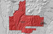
The Jemez Mountains (pronounced Heh-mez, Tsąmpiye'ip'įn in Towa) are a volcanic group of mountains in Rio Arriba, Sandoval, and Los Alamos counties, New Mexico, United States. The highest point in the range is Chicoma Mountain (also spelled as Tschicoma or Tchicoma) at an elevation of 11,561 feet (3524 meters). The town of Los Alamos and Los Alamos National Laboratory adjoin the eastern side of the range while the town of Jemez Springs is to the west. Pajarito Mountain Ski Area is the only ski area in the Jemez. New Mexico State Highway 4 is the primary road that provides vehicular access to locations in the Jemez Mountains.
Geology

The Jemez Mountains lie to the north of the Albuquerque Basin in the Rio Grande rift.[2] They are a classic example of intracontinental volcanism and consist of a broadly circular ridge surrounding the famous Valles Caldera. The most recent known eruption was an obsidian flow dated to 50,000 to 60,000 years before the present; however, most of the volume of the range is composed of rhyolite. The two most recent caldera-forming eruptions, dated to about 1.61 million and 1.22 million years ago, produced massive ignimbrite deposits known as the Otowi and Tshirege members, respectively, of the Bandelier Tuff.[3] Much of the material in these deposits now forms the Pajarito Plateau, a scenic region of canyons and mesas on which Los Alamos is situated. Redondo Peak, the second highest summit in the range at 11,254 ft (3431 m), is a resurgent dome in the middle of the Valles Caldera, which also contains several smaller volcanos. The caldera is segregated by these structures and its rim into multiple lush grass valleys (valles in Spanish, hence the name).
Public use
Much of the range is federal land, including Santa Fe National Forest, Bandelier National Monument, and the Valles Caldera National Preserve. State lands include Fenton Lake State Park [4] at 35°52′58″N 106°43′46″W / 35.88278°N 106.72944°W in Sandoval County. Hiking trails crisscross the range and lead to many of the summits, although some regions are closed to hikers either because of environmental restrictions or because they are on the territory of Santa Clara Pueblo or private land holders. (Access to pueblo lands is available by permit.) The summits are generally easy to climb (in good weather) and require no technical-climbing skills, but rock climbing is popular on some of the basalt cliffs near Los Alamos, Caja del Rio and elsewhere in the range. The mountains also are home to Pajarito Mountain, a small downhill ski area and offer some opportunities for cross country skiing, although not every winter produces enough snow to support this recreational activity. The region is prone to forest fires because of the tendency for spring weather to be dry and windy, creating conditions under which fires caused by human activities or lightning can spread rapidly. The Las Conchas Fire in 2011 was the most recent large wildfire. Parts of Los Alamos National Laboratory were also damaged, although none of the laboratory's special nuclear materials were threatened or released.
Communities
Census-designated places within the Jemez Mountains include Jemez Springs and Jemez Pueblo.
Wildlife
The Jemez Mountains are home to a federally endangered species, the Jemez Mountains salamander.
References
- ↑ "Langley". NGS data sheet. U.S. National Geodetic Survey. Retrieved 2008-12-22.
- ↑ Pinet, Bertrand; Bois, Christian; Bois, C. (1990). The Potential of Deep Seismic Profiling for Hydrocarbon Exploration: Proceedings of the 5th IFP Exploration and Production Research Conference, Held in Arles, June 19-23, 1989. Editions TECHNIP. p. 178. ISBN 978-2-7108-0590-8. Retrieved 2012-09-30.
- ↑ Dethier, David P.; Kampf, Stephanie K. (2007). Geology of the Jemez Region II. Ne Mexico Geological Society. p. 499 p. Retrieved 6 November 2015.
- ↑ Official website: Fenton Lake State Park
External links
| Wikimedia Commons has media related to Jemez Mountains. |
| Wikivoyage has a travel guide for Jemez Mountains. |
- "Valles Caldera". Global Volcanism Program. Smithsonian Institution.
- Santa Fe National Forest (Forest Service site)
- First Photo from Space identifies Jemez Mountains as "Valle Grande Mts"