Jefferson County, Ohio
| Jefferson County, Ohio | ||
|---|---|---|
|
| ||
| ||
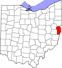 Location in the U.S. state of Ohio | ||
 Ohio's location in the U.S. | ||
| Founded | July 29, 1797[1] | |
| Named for | Thomas Jefferson | |
| Seat | Steubenville | |
| Largest city | Steubenville | |
| Area | ||
| • Total | 411 sq mi (1,064 km2) | |
| • Land | 408 sq mi (1,057 km2) | |
| • Water | 2.6 sq mi (7 km2), 0.6% | |
| Population | ||
| • (2010) | 69,709 | |
| • Density | 171/sq mi (66/km²) | |
| Time zone | Eastern: UTC-5/-4 | |
| Website |
www | |


Jefferson County is a county located in the U.S. state of Ohio. As of the 2010 census, the population was 69,709.[2] Its county seat is Steubenville.[3] The county is named for Thomas Jefferson, who was at the time Vice President.[4]
Jefferson County is part of the Weirton-Steubenville, WV-OH Micropolitan Statistical Area, which is also included in the Pittsburgh-New Castle-Weirton, PA-WV-OH Combined Statistical Area.[5]
History
Jefferson County was organized on July 29, 1797 by proclamation of Governor Arthur St. Clair, six years before Ohio was granted statehood.
In 1786, the United States built Fort Steuben to protect the government surveyors mapping the land west of the Ohio River. When the surveyors completed their task a few years later, the fort was abandoned. In the meantime, settlers had built homes around the fort; they named their settlement La Belle. When the County was created in 1797, La Belle was selected as the County seat. The town was subsequently renamed Steubenville, in honor of the abandoned fort.
During the first half of the nineteenth century, Steubenville was primarily a port town, and the rest of the county consisted of small villages and farms. However, in 1856, Frazier, Kilgore and Company erected a rolling mill (the forerunner of steel mills) and the Steubenville Coal and Mining Company sank a coal shaft, resulting in Jefferson County becoming one of the leading centers of the new Industrial Revolution.
Jefferson County's population has declined to 70% of its 1960 figure as its manufacturing base collapsed over the last few decades.
Geography
According to the U.S. Census Bureau, the county has a total area of 411 square miles (1,060 km2), of which 408 square miles (1,060 km2) is land and 2.6 square miles (6.7 km2) (0.6%) is water.[6]
Adjacent counties
- Columbiana County (north)
- Hancock County, West Virginia (northeast)
- Brooke County, West Virginia (east)
- Ohio County, West Virginia (southeast)
- Belmont County (south)
- Harrison County (southwest)
- Carroll County (northwest)
Demographics
| Historical population | |||
|---|---|---|---|
| Census | Pop. | %± | |
| 1800 | 8,766 | — | |
| 1810 | 17,260 | 96.9% | |
| 1820 | 18,531 | 7.4% | |
| 1830 | 22,489 | 21.4% | |
| 1840 | 25,030 | 11.3% | |
| 1850 | 29,133 | 16.4% | |
| 1860 | 26,115 | −10.4% | |
| 1870 | 29,188 | 11.8% | |
| 1880 | 33,018 | 13.1% | |
| 1890 | 39,415 | 19.4% | |
| 1900 | 44,357 | 12.5% | |
| 1910 | 65,423 | 47.5% | |
| 1920 | 77,580 | 18.6% | |
| 1930 | 88,307 | 13.8% | |
| 1940 | 98,129 | 11.1% | |
| 1950 | 96,495 | −1.7% | |
| 1960 | 99,201 | 2.8% | |
| 1970 | 96,193 | −3.0% | |
| 1980 | 91,564 | −4.8% | |
| 1990 | 80,298 | −12.3% | |
| 2000 | 73,894 | −8.0% | |
| 2010 | 69,709 | −5.7% | |
| Est. 2015 | 67,347 | [7] | −3.4% |
| U.S. Decennial Census[8] 1790-1960[9] 1900-1990[10] 1990-2000[11] 2010-2013[2] | |||
2000 census
As of the census[12] of 2000, there were 73,894 people, 30,417 households, and 20,592 families residing in the county. The population density was 180 people per square mile (70/km²). There were 33,291 housing units at an average density of 81 per square mile (31/km²). The racial makeup of the county was 92.49% White, 5.68% Black or African American, 0.20% Native American, 0.33% Asian, 0.02% Pacific Islander, 0.25% from other races, and 1.03% from two or more races. 0.62% of the population were Hispanic or Latino of any race. 96.5% spoke English, 1.1% Spanish and 1.0% Italian as their first language.
There were 30,417 households out of which 26.70% had children under the age of 18 living with them, 52.30% were married couples living together, 11.60% had a female householder with no husband present, and 32.30% were non-families. 28.50% of all households were made up of individuals and 14.40% had someone living alone who was 65 years of age or older. The average household size was 2.36 and the average family size was 2.88.
In the county, the population was spread out with 21.40% under the age of 18, 8.50% from 18 to 24, 25.60% from 25 to 44, 25.90% from 45 to 64, and 18.60% who were 65 years of age or older. The median age was 42 years. For every 100 females there were 91.20 males. For every 100 females age 18 and over, there were 87.50 males.
The median income for a household in the county was $30,853, and the median income for a family was $38,807. Males had a median income of $35,785 versus $20,375 for females. The per capita income for the county was $16,476. About 11.40% of families and 15.10% of the population were below the poverty line, including 22.30% of those under age 18 and 8.90% of those age 65 or over.
2010 census
As of the 2010 United States Census, there were 69,709 people, 29,109 households, and 18,713 families residing in the county.[13] The population density was 170.7 inhabitants per square mile (65.9/km2). There were 32,826 housing units at an average density of 80.4 per square mile (31.0/km2).[14] The racial makeup of the county was 91.9% white, 5.6% black or African American, 0.4% Asian, 0.1% American Indian, 0.2% from other races, and 1.7% from two or more races. Those of Hispanic or Latino origin made up 1.1% of the population.[13] In terms of ancestry, 20.0% were German, 17.1% were Irish, 12.9% were Italian, 9.1% were English, 8.3% were Polish, and 4.6% were American.[15]
Of the 29,109 households, 26.4% had children under the age of 18 living with them, 47.0% were married couples living together, 12.4% had a female householder with no husband present, 35.7% were non-families, and 30.5% of all households were made up of individuals. The average household size was 2.32 and the average family size was 2.86. The median age was 43.9 years.[13]
The median income for a household in the county was $37,527 and the median income for a family was $47,901. Males had a median income of $43,601 versus $27,965 for females. The per capita income for the county was $20,470. About 12.4% of families and 17.7% of the population were below the poverty line, including 29.5% of those under age 18 and 7.7% of those age 65 or over.[16]
Politics
| Year | Republican | Democratic |
|---|---|---|
| 2016 | 65.1% 21,117 | 29.8% 9,675 |
| 2012 | 51.3% 17,034 | 46.4% 15,385 |
| 2008 | 48.7% 17,559 | 48.9% 17,635 |
| 2004 | 47.3% 17,185 | 52.3% 19,024 |
| 2000 | 43.4% 15,038 | 50.5% 17,488 |
| 1996 | 29.5% 10,212 | 56.0% 19,402 |
| 1992 | 27.7% 10,764 | 54.1% 20,978 |
| 1988 | 38.7% 14,141 | 60.5% 22,095 |
| 1984 | 42.5% 17,105 | 56.7% 22,832 |
| 1980 | 41.0% 15,777 | 53.0% 20,382 |
| 1976 | 39.2% 14,839 | 59.0% 22,318 |
| 1972 | 56.3% 21,531 | 42.3% 16,198 |
| 1968 | 33.5% 12,949 | 56.8% 21,917 |
| 1964 | 26.3% 11,784 | 73.7% 33,039 |
| 1960 | 44.0% 21,186 | 56.0% 26,955 |
Jefferson county was a strong Democratic county in the 20th century. However, since the turn of the century it has become much more competitive and even moved towards the Republicans during the Democratic years of 2008 and 2012. In 2012 Mitt Romney became the first Republican in four decades to win the county, the last being President Nixon.
Government
Commissioners: Thomas Graham, Ph.D, Dave Maple, and Adam Scurti
Prosecutor: Jane Hanlin
Sheriff: Fred Abdalla
Auditor: Patrick J. Marshall
Treasurer: Raymond M. Agresta
Engineer: James Branagan
Judges of the Court of Common Pleas: Hon. Joseph J. Bruzzese Jr, Hon. David E. Henderson
Probate Court: Hon. Samuel W. Kerr
Clerk of Courts: John A. Corrigan
Health Commissioner: Frank J. Petrola, M.D.
Director, Board of Elections: Diane M. Gribble
Director, Job and Family Services: Nicholas Balakos
Director, Progress Alliance: Ed Looman
Transportation
Commercial air service is available at nearby Pittsburgh International Airport to the east via U.S. Route 22. The county is served by two general aviation fields, the Jefferson County Airpark and the Eddie Dew Memorial Airpark.
Ohio Route 7 is the main north-south highway through the county.
Communities

Cities
- Steubenville (county seat)
- Toronto
Villages
Townships
Census-designated place
Unincorporated communities
- Alikanna
- Annapolis
- Bradley
- Calumet
- Circle Green
- Connorville
- Costonia
- Deyarmonville
- Dunglen
- East Springfield
- Emerson
- Fairplay
- Fernwood
- Georges Run
- Gould
- Greentown
- Hammondsville
- Herrick
- Hopewell
- Knoxville
- Monroeville
- New Somerset
- Osage
- Piney Fork
- Port Homer
- Pravo
- Ramsey
- Reeds Mill
- Rush Run
- Unionport
- Warrenton
- Wolf Run
- Weems
- York
Historical community
Carpenter's Fort, or Carpenter's Station as it was sometimes called, was established in the summer of 1781 when John Carpenter built a fortified house above the mouth of Short Creek on the Ohio side of the Ohio River in Coshocton County, but now in Jefferson County, Ohio, near Marietta, Ohio.[17][18]
See also
References
- ↑ "Ohio County Profiles: Jefferson County" (PDF). Ohio Department of Development. Archived from the original (PDF) on 2007-06-21. Retrieved 2007-04-28.
- 1 2 "State & County QuickFacts". United States Census Bureau. Retrieved February 8, 2015.
- ↑ "Find a County". National Association of Counties. Archived from the original on 2011-05-31. Retrieved 2011-06-07.
- ↑ "Jefferson County data". Ohio State University Extension Data Center. Retrieved 2007-04-28.
- ↑ http://www.whitehouse.gov/sites/default/files/omb/bulletins/2013/b13-01.pdf
- ↑ "2010 Census Gazetteer Files". United States Census Bureau. August 22, 2012. Retrieved February 8, 2015.
- ↑ "County Totals Dataset: Population, Population Change and Estimated Components of Population Change: April 1, 2010 to July 1, 2015". Retrieved July 2, 2016.
- ↑ "U.S. Decennial Census". United States Census Bureau. Archived from the original on May 11, 2015. Retrieved February 8, 2015.
- ↑ "Historical Census Browser". University of Virginia Library. Retrieved February 8, 2015.
- ↑ Forstall, Richard L., ed. (March 27, 1995). "Population of Counties by Decennial Census: 1900 to 1990". United States Census Bureau. Retrieved February 8, 2015.
- ↑ "Census 2000 PHC-T-4. Ranking Tables for Counties: 1990 and 2000" (PDF). United States Census Bureau. April 2, 2001. Retrieved February 8, 2015.
- ↑ "American FactFinder". United States Census Bureau. Archived from the original on 2013-09-11. Retrieved 2008-01-31.
- 1 2 3 "DP-1 Profile of General Population and Housing Characteristics: 2010 Demographic Profile Data". United States Census Bureau. Retrieved 2015-12-27.
- ↑ "Population, Housing Units, Area, and Density: 2010 - County". United States Census Bureau. Retrieved 2015-12-27.
- ↑ "DP02 SELECTED SOCIAL CHARACTERISTICS IN THE UNITED STATES – 2006-2010 American Community Survey 5-Year Estimates". United States Census Bureau. Retrieved 2015-12-27.
- ↑ "DP03 SELECTED ECONOMIC CHARACTERISTICS – 2006-2010 American Community Survey 5-Year Estimates". United States Census Bureau. Retrieved 2015-12-27.
- ↑ J. A. Caldwell: History of Belmont and Jefferson Counties, Ohio, Historical Publishing Co., Wheeling, W.Va., 1880, p. 605, reprinted 1983.
- ↑ Julie Minot Overton, with Kay Ballantyne Hudson and Sunda Anderson Peters eds.: Ohio Towns and Townships to 1900: A Location Guide, The Ohio Genealogical Society, Mansfield, O. (Penobscot Press), 2000, p. 59.
External links
 |
Carroll County | Columbiana County | Hancock County, West Virginia | |
| |
Brooke County, West Virginia | |||
| ||||
| | ||||
| Harrison County | Belmont County | Ohio County, West Virginia |
Municipalities and communities of Jefferson County, Ohio, United States | ||
|---|---|---|
| Cities | | |
| Villages | ||
| Townships | ||
| CDPs |
| |
| Unincorporated communities |
| |
| Ghost town | ||
| Footnotes | ‡This populated place also has portions in an adjacent county or counties | |
| Counties |  Map of the Pittsburgh Tri-State with green counties in the metropolitan area and yellow counties in the combined area. | |
|---|---|---|
| Major cities | ||
| Cities and towns 15k-50k (in 2010) | ||
| Airports | ||
| Topics | ||
| ||
Coordinates: 40°23′N 80°46′W / 40.38°N 80.76°W