Jangaon, Telangana
| Jangaon జనగాం جنگاوں | |
|---|---|
| Town | |
 Jangaon Location in Telangana, India | |
| Coordinates: 17°43′N 79°11′E / 17.72°N 79.18°ECoordinates: 17°43′N 79°11′E / 17.72°N 79.18°E | |
| Country | India |
| State | Telangana |
| District | Jangaon district |
| Government | |
| • Type | Democratic |
| • Body | Municipality |
| • MLA | Muthireddy Yadagiri Reddy |
| • Member of Parliament | Burra Narsaiah |
| Area[1] | |
| • Total | 16.04 km2 (6.19 sq mi) |
| Elevation | 382 m (1,253 ft) |
| Population (2011)[2] | |
| • Total | 52,394 |
| • Rank | 1st in District |
| • Density | 3,300/km2 (8,500/sq mi) |
| Languages | |
| • Official | Telugu |
| Time zone | IST (UTC+5:30) |
| PIN | 506 167 |
| Telephone code | 91–8716 |
| Vehicle registration | TS-27 |
Jangaon is a city and the district headquarters of Jangaon district in the Indian state of Telangana. It is also the mandal headquarters of Jangaon Mandal in Jangaon Revenue Division. It is about 85 kilometres from Hyderabad, on the National Highway 163 and State Highway 9 (Suryapet-Siddipet). Jangaon is spread over an area of 16.04 km² and divided into 29 municipal wards as second grade municipality.
Geography
Jangaon is located at 17°43′N 79°11′E / 17.72°N 79.18°E.[3] It has an average elevation of 382 metres (1,253 ft).It is Geographically located in the eastern Deccan plateau.
Etymology
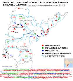
The name Jangaon evolved from "jain gaon" which means village of Jains, a religion of India. Kolanpak (kulpak) in the Nalgonda district which is about 20 km from Jangaon is a famous pilgrimage center for Jain people and it has much historical background.
History
When the Jain religion dominated in India, most of the tourists from different places of India visited Kulpak. At that time most of the Jains settled in Jangaon, which was called Jaingaon at that time. Things changed from time to time and people started calling it "Jangaon".
History suggests that there has been human habitation in Jangaon area since the mid-Neolithic period. It was also the second capital region of the Kalyani Chalukyas in 11th century. This region came under Kakatiya dynasty from 1195 CE to 1323 before transferring to Khilji dynasty of Delhi Sultanate under Ala-ud-din Khilji rule. After the demise of the Nayaks rule for 50 years, region was part of the Bahmani Sultanate and then the Sultanate of Golconda Qutb Shahi dynasty in 1512.The Mughal emperor Aurangzeb conquered Golconda in 1687, and it remained part of the Mughal empire until Asaf Jah I declared sovereignty in 1724 and established Asaf Jahi Dynasty.Hyderabad State was annexed to India in 1948, and became an Indian state called as Hyderabad state. In 1948 Jangaon taluka was part of Nalgonda district in Gulshanabad Division of Hyderabad State. Hydearabad State census 1951 Report show Jangaon taluka was most populated taluka of Nalgonda district with total population of 2,91,165 with area of 1403.9 SqKm consist of more than 200 inhabited towns and villages. Aler, Cherial, and Kolanpak was under Jangaon taluka before they were transferred to other districts.
In 1953,there was shuffling of areas shifting of some villages from one taluka to the other. Subsequently, when Warangal district was divided to facilitate administrative control and on October 1, 1953 the Khammam district was formed. Khammam, Yellandu, Madhira, Burugunpahad and Palavancha talukas have been made part of it. Warangal, Mulugu, Mahabubabad, Pakala(Narsampet) remained in Warangal district. But Parkaala from Karimnagar district and Jangaon taluka from Nalgonda district have become part of Warangal district living back Nalgonda, Miryalguda, Deverkonda, Bhongir, Ramannapet, Suryapet, and Huzurnagar to Nalgonda district. After these changes in 1953, few villages of Jangaon taluka went to Medak district and some remained in Nalgonda district.
During resigm of Marri Chenna Reddy in 1979 Jangaon taluka was split in to Cherial, Kodakandla and Jangaon talukas. In 1985 when N. T. Rama Rao introduces mandal system Jangaon taluka further divided in to Jangaon, Raghunathpalle, Lingalaghanpur and Devaruppula Mandals
In 2016 on 11th Oct, Jangaon is made as the district headquarters along with 21 newly formed district in Telangana. Warangal district was divided in to Five districts are Warangal Urban district, Warangal Rural district, Jangaon district, Jayashankar district and Mahabubabad district. The Jangaon district was formed with mostly old Jangaon Revenue division except Maddur, Cherial and Newly formed Komuravelli Mandals Which were transferred to Newly formed Siddipet district, Ghanpur and Zaffergadh from Warangal Revenue division and Gundala of Nalgonda district were merged with Jangaon district
Demographics
| Jangaon Town population | |||
|---|---|---|---|
| Census | Pop. | %± | |
| 1901 | 1,696 | — | |
| 1911 | 3,537 | 108.5% | |
| 1921 | 4,158 | 17.6% | |
| 1931 | 8,078 | 94.3% | |
| 1941 | 7,036 | -12.9% | |
| 1951 | 11,259 | 60.0% | |
| 1961 | 11,927 | 5.9% | |
| 1971 | 16,866 | 41.4% | |
| 1981 | 25,112 | 48.9% | |
| 1991 | 34,305 | 36.6% | |
| 2001 | 43,996 | 28.2% | |
| 2011 | 52,394 | 19.1% | |
| Sources:[5] | |||
As of the 2011 India census,[2] Jangaon had a population of 52,394. Males constitute 51% of the population and females 49%. Jangaon City has an average literacy rate of 82.3%, higher than the national average of 74.5% and state average of 67.02%: male literacy is 89.8%, and female literacy is 74.5%. In Jangaon, 10% of the population is under 6 years of age.
Jangaon Municipality has total administration over 12,276 houses to which it supplies basic amenities like water and sewerage. It is also authorized to build roads within Municipality limits and impose taxes on properties coming under its jurisdiction.
Out of total population, 28,099 were engaged in work or business activity. Of this 33,066 were males while 25,033 were females. In census survey, worker is defined as person who does business, job, service, and cultivator and labour activity. Of total 15196 working population, 89.20% were engaged in Main Work while 10.80% of total workers were engaged in Marginal Work.
Climate
Jangaon experiences a tropical kind of climate. It's a drought prone area according to Geological survey. Experiences very hot summers, moderate winters and rains less than the average precipitation.
The climate in Jangaon is referred to as a local steppe climate. During the year, there is little rainfall in Jangaon. The climate here is classified as BSh by the Köppen-Geiger system. The average annual temperature is 27.3 °C in Jangaon. In a year, the average rainfall is 788 mm. The least amount of rainfall occurs in January. The average in this month is 1 mm. Most precipitation falls in July, with an average of 183 mm.
The temperatures are highest on average in May, at around 33.9 °C. In December, the average temperature is 22.0 °C. It is the lowest average temperature of the whole year. The variation in the precipitation between the driest and wettest months is 182 mm. The average temperatures vary during the year by 11.9 °C.
| Climate data for Jangaon Town | |||||||||||||
|---|---|---|---|---|---|---|---|---|---|---|---|---|---|
| Month | Jan | Feb | Mar | Apr | May | Jun | Jul | Aug | Sep | Oct | Nov | Dec | Year |
| Average high °C (°F) | 29.7 (85.5) |
32.4 (90.3) |
36.0 (96.8) |
38.4 (101.1) |
40.4 (104.7) |
35.9 (96.6) |
31.1 (88) |
30.8 (87.4) |
31.0 (87.8) |
31.4 (88.5) |
29.6 (85.3) |
28.8 (83.8) |
32.96 (91.32) |
| Average low °C (°F) | 16.3 (61.3) |
18.6 (65.5) |
21.7 (71.1) |
25.0 (77) |
27.5 (81.5) |
25.8 (78.4) |
23.7 (74.7) |
23.6 (74.5) |
23.2 (73.8) |
21.4 (70.5) |
17.6 (63.7) |
15.2 (59.4) |
21.63 (70.95) |
| Average precipitation mm (inches) | 1 (0.04) |
2 (0.08) |
5 (0.2) |
21 (0.83) |
17 (0.67) |
119 (4.69) |
183 (7.2) |
167 (6.57) |
168 (6.61) |
78 (3.07) |
21 (0.83) |
8 (0.31) |
790 (31.1) |
| Source: | |||||||||||||
Governance
Civic Administration
Jangaon Municipality was constituted in 1953 and is classified as a second grade municipality with 29 municipal wards. The jurisdiction of the civic body is spread over an area of 16.04 km2 (6.19 sq mi).[1]
Law and order
Deputy Commissioner of Police Jangaon are responsible for maintaining law and order in Town and Jangaon district areas. Jangaon have Senior Civil Judge’s Court, and Prl. Junior Civil Judge’s Court for maintaining law and order.
Healthcare
The 100-bed Government Area Hospital Jangaon is the largest hospital in the Town. It also serves the needs of patients from the surrounding ares of Jangaon including parts Yadadri district. Apart from this there are many private specialist hospitals are situated in Town.And very soon 100-bed maternity hospital is also their, it is under construction,at chempak hills.
Economy
Nawabpet cattle market is the second biggest market in Telangana state. The people here directly or indirectly depend on agriculture. Farming, farming related business, education, retail and wholesale business, handloom, weaving etc. are the major occupations. It is expected that the completion of J Chokka Rao Godavari Devadula Lift Irrigation Phase – II, will boost the farming activity and also will provide fluoride-free drinking water to the area.
Places of interest
Jeedikal is a holy place where devotees worship Shri Rama, Laxmana, Sita and Hanuman. Devotees believe Shri Ram passed through Jeedikal in search of Golden Deer (Mareecha). Jeedikal Jatara is a biennial event. People from all over Telangana region visit this temple to attend the holy event. Kolanupaka was the second capital of the Kalyani Chalukyas during the 11th Century AD. During this period the village was the center of the Jains as well as the Saivites. According to literary evidence, it is the birthplace of 'Renukacharya', the great 'Veera Saiva' saint, believed to be born from the 'Svayambaghu Linga' at this village and absorbed into it after preaching Veera Saivam. Besides the Jain temple, other temples at Kulpak are the Shree Veeranarayan temple, and the Shree Someshwara temple.
Pembarthi, located 6 km from Jangaon, is world-famous for brass artifacts. The craftsmen at Pembarthi follow the method of embossing on brass and copper sheets. Komaravelli is a holy place where devotees worship Komaravelli Mallanna Swamy. Yadagirigutta is a popular Hindu temple of Narasimha Swamy situated on a hillock, located about 35 km from Jangaon.[6] Banapuram has an old Hanuman temple,[7] temple of Lord Venkateshwara and Ayyappa Temple.[8] At the time of Bathukamma festival women play bathukamma here. Sri Someswara Laxminarasimha Swamy Temple Palakurthi.
Tharigoppula has oldest temples like Nalla Pochamma Temple, Tharigoppula and Shri Chenna Keshavaswamy Temple, Tharigoppula located about 28 km from Jangaon. Nalla Pochamma Temple, Tharigoppula and Shri Chenna Keshavaswamy Temple, Tharigoppula was constructed by Arjula Dynasty Reddy Kings, Arjula Jagga Reddy & Arjula Joga Reddy, muula purush for the Arjula Dynasty. Arjula Dynasty was Samantha Rajulu in Kakatiya Dynasty.[9][10][11][12]
Sri Someshwara Laxminarasimha Swamy Temple, Palakurthy is 34 km from Jangoan on a hillock in the outskirts of Palakurthi Mandal headquarters. It is also the birthplace of famous poet "Palakurthi Somanadha Kavi" of 12 the century.
Education
Jangaon is a major education hub in the district. Apart from local students, many students from the surrounding villages pursue their Education. There are many Engineering Colleges, Pharmacy colleges, Degree & PG Colleges, Junior Colleges and international Schools in the town.
Transport
Roadway
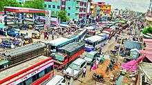
Jangaon is connected to major cities and towns by means of road and railways. National and state highways that pass through the Town are, National Highway 163, connecting Hyderabad and Bhopalpatnam, and state highway 16 (Suryapet-Siddipet) passes through the town. It is about 85 km from the state capital, Hyderabad, and 60 km from Warangal city and 58km away from Siddipet and 85km away from Suryapet and 210km away from Vijayawada ,AP. The state's bus service provider TSRTC has a bus depot in Jangaon. It is well connected to all cities in Telangana and Major cities in Andhra Pradesh.
Railway
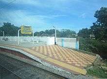
Jangaon Railway Station is major station which provides rail connectivity to the Jangaon to rest of India. Jangaon Station is under the jurisdiction of the Secunderabad railway division of South Central Railway zone. It lie on the important route of New Delhi- Hyderabad main line of Indian Railways.It is connected by a train from Hyderabad by Falaknuma – Jangaon MEMU train and Secunderabad – Warangal trains.
Airway
The nearest International Airport is Rajiv Gandhi International Airport in Hyderabad. It is 97 km from Jangaon Town. Other Airport near to Jangaon is Warangal Airport built by the Nizams at Mamnoor in 1930.
See also
- Jangaon district
- Jangaon (Assembly constituency)
- Warangal district
- List of towns in India by population
References
- 1 2 "Urban Local Body Information" (PDF). Directorate of Town and Country Planning. Government of Telangana. Retrieved 28 June 2016.
- 1 2 "Census 2011". The Registrar General & Census Commissioner, India. Retrieved 25 July 2014.
- ↑ Falling Rain Genomics, Inc – Jangaon
- ↑ "Jangaon Town Population Census 2011 – Andhra Pradesh".
- ↑ Gopi, K.N (1978). Process of urban fringe development: A model. Concept Publishing Company. p. 25. Retrieved 6 August 2013.
- ↑ The Hindu : Life Hyderabad : Perfect setting
- ↑ Jangaon Information | Govt. Offices, Hospitals, Schools, Colleges, Real Estate, Shopping, Hotels And More Information | Banapuram Hanuman Temple
- ↑ Jangaon Information | Govt. Offices, Hospitals, Schools, Colleges, Real Estate, Shopping, Hotels And More Information | Ayyappa Temple Jangaon Images
- ↑ AAP Releases first list for T and AP | Siasat
- ↑ Jangaon (Telangana) Assembly Constituency Elections Results, Candidate Lists, Localities, Current MLA
- ↑ Temple Assets
- ↑ Thari Goppula