Jamtara district
| Jamtara district जामताड़ा जिला | |
|---|---|
| District of Jharkhand | |
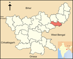 Location of Jamtara district in Jharkhand | |
| Country | India |
| State | Jharkhand |
| Administrative division | Santhal Pargana division |
| Headquarters | Jamtara |
| Government | |
| • Lok Sabha constituencies | 1. Dumka (shared with Dumka district) |
| • Assembly seats | 3 |
| Area | |
| • Total | 1,801.98 km2 (695.75 sq mi) |
| Population (2011) | |
| • Total | 790,207 |
| • Density | 440/km2 (1,100/sq mi) |
| Demographics | |
| • Literacy | 63.73 per cent |
| • Sex ratio | 959 |
| Website | Official website |
Jamtara district (Hindi: जामताड़ा जिला) is one of the twenty-four districts of Jharkhand state in eastern India. Jamtara town is the administrative headquarters of this district. The district is situated between 23°10′ and 24°05′ north latitudes and 86°30′ and 87°15′ east longitudes.
History
The district was carved out on 26 April 2001 by separating four blocks-Kundhit, Nala, Jamtara and Narayanpur—of the erstwhile Dumka district. Earlier, it was a sub-division. In its long history it was a part of Birbhum under the Hetampur Raj and the Bardhaman Maharaja-Dhiraj.There are a few surviving former raj families in the district. Raja of Jamtara left everlasting impression on the culture and lives of the people of Jamtara and the adjoining area. The Zamindar family of Jamjuri had influence over a major portion of Kundahit and Fatehpur blocks. There are several historical sites waiting for study and exploration. The region was disturbed during the Santal Insurrection of 1854-55 under Siddhu and Kanhu. It is said that the insurgents moved village to village and gained sympathy. Legends are that one village headman, Gopal Mandal of Madhopur,now in Fatehpur Block, faced them with great honour, when all other villagers of the vicinity fled. He offered three muns of rice to the leaders and a night feast in the village ground. Scholar and intellectual Dr. Sharat Kumar Mandal is his grandson's grandson. Siddhu was captured at Ghatiyari, Narayanpur, now in this district. After the insurgence, a separate Santal Pargana district was created. Prior to the formation of Bihar, it was a part of Bengal. The people of this area speak Maithili and Hindi, but Santali is the language of tribals. Bengali is also widely spoken.
Amit Besra, a well-known author and philanthropist, has brought Jamtara to the world map. He is the author of the bestselling novel It's Dying Time - A Chilling Indian Thriller published in the year 2010 and Be The Change published in the year 2013.He is also the owner of the websites www.thesanthalexpress.in and www.viewmoviesreview.in.
Economy
In 2006 the Indian government named Jamtara one of the country's 250 most backward districts (out of a total of 640).[1] It is one of the 21 districts in Jharkhand currently receiving funds from the Backward Regions Grant Fund Programme (BRGF).[1]
Administration
Blocks/Mandals
Jamtara district consists of 06 Blocks. The following are the list of the Blocks inJamtara district:
Divisions
There are three Vidhan Sabha constituencies in the district: Nala, Jamtara and Sarath (shared with Deoghar district). All three constituencies are part of Dumka Lok Sabha constituency.
Demographics
According to the 2011 census Jamtara district has a population of 790,207,[2] roughly equal to the nation of Comoros[3] or the US state of South Dakota.[4] This gives it a ranking of 486th in India (out of a total of 640).[2] The district has a population density of 439 inhabitants per square kilometre (1,140/sq mi) .[2] Its population growth rate over the decade 2001-2011 was 21%.[2] Jamtara has a sex ratio of 959 females for every 1000 males,[2] and a literacy rate of 63.73%.[2]
See also
References
- 1 2 Ministry of Panchayati Raj (September 8, 2009). "A Note on the Backward Regions Grant Fund Programme" (PDF). National Institute of Rural Development. Retrieved September 27, 2011.
- 1 2 3 4 5 6 "District Census 2011". Census2011.co.in. 2011. Retrieved 2011-09-30.
- ↑ US Directorate of Intelligence. "Country Comparison:Population". Retrieved 2011-10-01.
Comoros 794,683 July 2011 est.
- ↑ "2010 Resident Population Data". U. S. Census Bureau. Retrieved 2011-09-30.
South Dakota 814,180
External links
- Jamtara district website
- List of places in Jamtara
 |
Giridih district | Deoghar district | Dumka district | |
| Dhanbad district | |
Birbhum district, West Bengal | ||
| ||||
| | ||||
| Bardhaman district, West Bengal |
Coordinates: 23°57′36″N 86°48′00″E / 23.96000°N 86.80000°E