Jalainur District
| Jalainur 扎赉诺尔区 • ᠵᠠᠯᠠᠢᠨᠠᠭᠤᠷᠲᠤᠭᠤᠷᠢᠠᠠ | |
|---|---|
| District | |
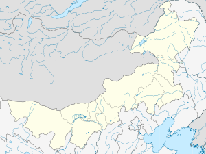 Jalainur Location in Inner Mongolia | |
| Coordinates: 49°25′N 117°37′E / 49.417°N 117.617°ECoordinates: 49°25′N 117°37′E / 49.417°N 117.617°E | |
| Country | China |
| Region | Inner Mongolia |
| Prefecture-level city | Hulunbuir |
| Area | |
| • Total | 272 km2 (105 sq mi) |
| Population (2010) | |
| • Total | 97,000 |
| • Density | 360/km2 (920/sq mi) |
| Time zone | China Standard (UTC+8) |
| Website |
www |
Jalainur District or Zhalainuo'er District (Mongolian: ᠵᠠᠯᠠᠢᠳᠨᠠᠭᠤᠷ ᠲᠣᠭᠣᠷᠢᠭ Жалаинаур тоори Jalainaɣur toɣoriɣ; simplified Chinese: 扎赉诺尔区; traditional Chinese: 扎賚諾爾區; pinyin: Zhālàinuò'ěr Qū) is an urban district under Manzhouli's administration in northeastern Inner Mongolia, China.[1]
Transportation
Jalainur's railway station is the midway stop between Manzhouli, the port city that stands close to the Russian border and Hailar District the seat of Hulunbuir. It is on the famous Manchuria branch of the Trans-Siberian express route and China National Highway 301.
Tourist attractions
A scale model of Moscow's Cathedral of the Intercession of the Most Holy Theotokos on the Moat (popularly known as Saint Basil's Cathedral) has been built in Jalainur. The building houses a science museum.[2]
References
- ↑ "扎赉诺尔区人民政府". Retrieved 2 June 2013.
- ↑ Hessler, Peter (2016-02-09), "Invisible Bridges: Life Along the Chinese-Russian Border", The New Yorker