Jaj
| Jaj جاج Jaje | |
|---|---|
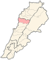
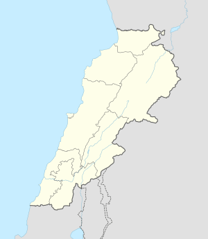 Jaj Location in Lebanon | |
| Coordinates: 34°9′53″N 35°48′19″E / 34.16472°N 35.80528°ECoordinates: 34°9′53″N 35°48′19″E / 34.16472°N 35.80528°E | |
| Country | Lebanon |
| Governorate | Mount Lebanon |
| District | Jbeil |
| Area | |
| • Total | 1,174 ha (2,901 acres) |
| Elevation | 1,220 m (4,000 ft) |
Jaj (Arabic: جاج, also spelled Jaje) is a mountainous village in the Jbeil District of Mount Lebanon Governorate, Lebanon. It is 68 kilometers north of Beirut. Jaj has an average elevation of 1,220 meters above sea level and a total land area of 1,174 hectares.[1] Its inhabitants are predominantly Maronite Catholics.[2] Jaj is known for its cedar trees high in the mountains. The village is home to many families many of whom come up primarily on weekends.
History
In Maronite literature, Jaj was the headquarters of the Sunni Muslim sheikhs of the Jbeil region during the early Ottoma era, and that the Shia Muslim Hamade sheikhs Ali Dib, Ahmad Abu Za'zua and Sirhan succeeded them in 1600 by killing them on behalf of the Sayfa clan of Tripoli.[3]
According to Lebanese historian Issa Alexander Maalouf, the Geagea family of Bsharri, to which politician Samir Geagea belongs, originated from the village of Jaj. The family was originally called Ma'eit and became known as "Geagea", which means "to control the donkeys" in Arabic because a forefather of the family used to care for the donkeys of the local Maronite patriarch Youhanna al-Jaji (1404–1455) of Jaj.[4]
References
- ↑ "Jaj". Localiban. Localiban. 2008-01-17. Retrieved 2016-02-09.
- ↑ "Elections municipales et ikhtiariah au Mont-Liban" (pdf). Localiban. Localiban. 2010. p. 19. Retrieved 2016-02-12.
- ↑ Winter, Stefan (2010). The Shiites of Lebanon under Ottoman Rule, 1516–1788. Cambridge University Press. p. 70 and 73.
- ↑ "Lebanon Families: Geagea families: the majority are Maronites from Bcharri and the minority are Shia'a and Sunni". Information International. Retrieved 2016-02-09.
Capital: Jbeil | ||
| Towns and villages |
|  |
| Landmarks |
| |