Chagang Province
| Chagang Province 자강도 | |
|---|---|
| Province | |
| Korean transcription(s) | |
| • Hangul | 자강도 |
| • Hanja | 慈江道 |
| • McCune‑Reischauer | Chagang-do |
 | |
| Country | North Korea |
| Region | Kwansŏ |
| Capital | Kanggye |
| Subdivisions | 3 cities; 15 counties |
| Area | |
| • Total | 16,613 km2 (6,414 sq mi) |
| Population (2008) | |
| • Total | 1,299,830 |
| • Density | 78/km2 (200/sq mi) |
| Dialect | Pyongan |
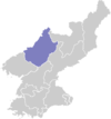
Chagang Province (Chagangdo) is a province in North Korea; it is bordered by China to the north, Ryanggang and South Hamgyong to the east, South Pyongan to the south, and North Pyongan to the west. Chagang was formed in 1949, after being demarcated from North Pyongan. The provincial capital is Kanggye.
Geography
Chagang Province is located in the northwestern part of Korea. It is a mountainous province; with the mountainous area amounting to 98 per cent of its total area. The mean height above sea level is 750 meters and the slope of most regions is 15 to 40 degrees.
The province has a distinct continental climate under the influence of the Asian continent. It has very cold and long winters, and brief springs and falls. The climate is characterized by great differences in daily and yearly temperature. In summer, downpours of rain and hail are frequent. Thus thunder and lightning occur frequently.
The province has great mineral wealth, and is North Korea's main source of lead, zinc, gold, copper, molybdenum, tungsten, antimony, graphite, apatite, alunite, limestone, calcium carbonate, anthracite and iron ores. There are also crystals and valuable gems there.
Main cities and economic activities
The province abounds in underground, forest and water resources. Before the Korean War, Chagang province was an isolated land with only two primitive mines, one timber mill and a distillery.
Nowadays, it has power, machine, chemical, light, mining and timber industries. Its total industrial output is 1000 times as much as just before the war.
The majority of North Korea's underground military industrial facilities are located in Chagang Province,[1] including portions of their weapons of mass destruction program.[2]
Kanggye is the capital city of Chagang Province. One of the main economic timber processing factories of the province, and the country, is located in Kanggye.
Huichon is the most developed city in the province, though. Its development dates back to the Korean War, when it became one of the cities of industrial relocation, as it was isolated and far from the main battlefields.
Nowadays, Huichon has several industries, such as a huge machine tool factory, silk mill and a hard glassware factory. In Huichon there is the main North Korean University of Telecommunications.
Chagang was one of the less developed and isolated provinces in North Korea after liberation in 1945. The terrain made farming difficult and only slash-and-burn farmers tilled mountain plots to eke out a living.
Nowadays, farming activities are mainly linked with livestock activities. One example is Hungju Farm.
-

Huichon Hard Glassware Factory
-
.jpg)
Huichon Machine Tool Factory
-

Hungju Chicken Farm
Small and medium-size power stations
The province has been converted into a power base for the country, with the construction of Kanggye Youth Power Station, Unbong Power Station, Jangjagang Power Station and other large hydroelectric power stations.
The province has built since the 90s many small and medium-sized power stations, as a duty of the local authorities. Log-dam, water-course, raft and sluice were among the efficient methods practised in their construction.
Small hydraulic turbines, with a capacity of 2 kW to 70 kW, were developed by local technicians to dramatically increase the generating capacity.
Administrative divisions
Chagang is divided into 3 cities (si) and 15 counties (gun).
Cities
- Kanggye-si (강계시; 江界市; made into "si" from "gun" December 1949)
- Huichon-si (희천시; 熙川市; made into "si" October 1967)
- Manpo-si (만포시; 滿浦市; made into "si" October 1967)
Counties
- Changgang County (장강군; 長江郡)
- Chasong County (자성군; 慈城郡)
- Chonchon County (전천군; 前川郡)
- Chosan County (초산군; 楚山郡)
- Chunggang County (중강군; 中江郡)
- Hwapyong County (화평군; 和坪郡)
- Kopung County (고풍군; 古豐郡)
- Rangnim County (랑림군; 狼林郡)
- Ryongnim County (룡림군; 龍林郡)
- Sijung County (시중군; 時中郡)
- Songgan County (성간군; 城干郡)
- Songwon County (송원군; 松原郡)
- Tongsin County (동신군; 東新郡)
- Usi County (우시군; 雩時郡)
- Wiwon County (위원군; 渭原郡)
See also
References
- ↑ "Defense". Federation of American Scientists. Retrieved October 11, 2013.
- ↑ "North Korea Expanding WMD Production Capabilities". Nuclear Threat Initiative. October 27, 2011. Retrieved October 11, 2013.
- 행정 구역 현황 (Haengjeong Guyeok Hyeonhwang) (in Korean only)
- Administrative divisions of North Korea (in simplified Chinese; used as reference for Hanja)
- Panorama Korea, Foreign Language Publishing House, Pyongyang, 1999.
External links
| Wikivoyage has a travel guide for Baekdu Mountains. |
 |
|
Ryanggang | | |
| |
||||
| ||||
| | ||||
| North Pyongan | South Pyongan | South Hamgyong |
| Regions | |
|---|---|
| Provinces | |
| Direct-administered city | |
| Special cities | |
| Special administrative regions | |
Coordinates: 40°58′14″N 126°35′33″E / 40.9706°N 126.5925°E