Jach'a Q'awa
| Jach'a Q'awa | |
|---|---|
 Jach'a Q'awa Location in Bolivia | |
| Highest point | |
| Elevation | 4,718 m (15,479 ft) [1] |
| Coordinates | 19°17′13″S 66°01′24″W / 19.28694°S 66.02333°WCoordinates: 19°17′13″S 66°01′24″W / 19.28694°S 66.02333°W |
| Geography | |
| Location | Bolivia, Potosí Department, Tomás Frías Province |
| Parent range | Andes |
Jach'a Q'awa (Aymara jach'a big, q'awa little river, ditch, crevice, fissure, gap in the earth, [2][3] "big brook" or "big ravine", Hispanicized spelling Jachcha Khaua) is a 4,718-metre-high (15,479 ft) mountain in the Cordillera de los Frailes in the Andes of Bolivia. It is situated in the Potosí Department, Tomás Frías Province, Tinguipaya Municipality, north of the Pillku Mayu (red river"). It lies southeast of the village of Janq'u Laqaya (Jankho Lacaya) and the mountain named Janq'u Laqaya (Jhanco Lacaya) and northwest of Pari Chata.[4]
The river Jach'a Q'awa originates on the west side of the mountain. It flows to the south.
References
- ↑ BIGM map 1:50,000 6336-II Carhuayo
- ↑ Radio San Gabriel, "Instituto Radiofonico de Promoción Aymara" (IRPA) 1993, Republicado por Instituto de las Lenguas y Literaturas Andinas-Amazónicas (ILLLA-A) 2011, Transcripción del Vocabulario de la Lengua Aymara, P. Ludovico Bertonio 1612 (Spanish-Aymara-Aymara-Spanish dictionary)
- ↑ "Diccionario Bilingüe, Castellano - Aymara, Para: Tercera Edición". Félix Layme Pairumani. Retrieved September 4, 2014.
- ↑ "Tinquipaya". INE, Bolivia. Retrieved September 4, 2014.
Capital: Potosí | ||
| Provinces | 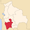 | |
| Municipalities (and seats) |
| |
This article is issued from Wikipedia - version of the 5/5/2016. The text is available under the Creative Commons Attribution/Share Alike but additional terms may apply for the media files.