Ivanhoe, North Carolina
| Ivanhoe, North Carolina | |
|---|---|
| CDP | |
 Ivanhoe, North Carolina Location within the state of North Carolina | |
| Coordinates: 34°35′43″N 78°14′4″W / 34.59528°N 78.23444°WCoordinates: 34°35′43″N 78°14′4″W / 34.59528°N 78.23444°W | |
| Country | United States |
| State | North Carolina |
| County | Sampson |
| Area | |
| • Total | 5.0 sq mi (13.0 km2) |
| • Land | 5.0 sq mi (13.0 km2) |
| • Water | 0.0 sq mi (0.0 km2) |
| Elevation | 30 ft (10 m) |
| Population (2000) | |
| • Total | 311 |
| • Density | 61.9/sq mi (23.9/km2) |
| Time zone | Eastern (EST) (UTC-5) |
| • Summer (DST) | EDT (UTC-4) |
| ZIP code | 28447 |
| Area code(s) | 910 |
| FIPS code | 37-33940[1] |
| GNIS feature ID | 1020903[2] |
Ivanhoe is a census-designated place (CDP) in Sampson County, North Carolina, United States. The population was 311 at the 2000 census.
History
The Beatty-Corbett House, Black River Presbyterian and Ivanhoe Baptist Churches, and Delta Farm were listed on the National Register of Historic Places in 1986.[3]
Geography
Ivanhoe is located at 34°35′43″N 78°14′4″W / 34.59528°N 78.23444°W (34.595158, -78.234380).[4]
According to the United States Census Bureau, the CDP has a total area of 5.0 square miles (13 km2).5.0 square miles (13.0 km²) of it is land and 0.20% is water.
Demographics
As of the census[1] of 2000, there were 311 people, 113 households, and 83 families residing in the CDP. The population density was 61.9 people per square mile (23.9/km²). There were 123 housing units at an average density of 24.5/sq mi (9.4/km²). The racial makeup of the CDP was 21.54% White, 70.74% African American, 0.32% Native American, 0.64% Asian, 6.11% from other races, and 0.64% from two or more races. Hispanic or Latino of any race were 8.68% of the population.
There were 113 households out of which 35.4% had children under the age of 18 living with them, 49.6% were married couples living together, 19.5% had a female householder with no husband present, and 26.5% were non-families. 22.1% of all households were made up of individuals and 12.4% had someone living alone who was 65 years of age or older. The average household size was 2.61 and the average family size was 3.10.
In the CDP the population was spread out with 26.7% under the age of 18, 6.8% from 18 to 24, 30.2% from 25 to 44, 22.5% from 45 to 64, and 13.8% who were 65 years of age or older. The median age was 39 years. For every 100 females there were 98.1 males. For every 100 females age 18 and over, there were 101.8 males.
The median income for a household in the CDP was $22,500, and the median income for a family was $32,917. Males had a median income of $20,000 versus $18,458 for females. The per capita income for the CDP was $11,305. About 6.8% of families and 6.2% of the population were below the poverty line, including none of those under age 18 and 16.3% of those age 65 or over.
References
- 1 2 "American FactFinder". United States Census Bureau. Retrieved 2008-01-31.
- ↑ "US Board on Geographic Names". United States Geological Survey. 2007-10-25. Retrieved 2008-01-31.
- ↑ National Park Service (2010-07-09). "National Register Information System". National Register of Historic Places. National Park Service.
- ↑ "US Gazetteer files: 2010, 2000, and 1990". United States Census Bureau. 2011-02-12. Retrieved 2011-04-23.
Municipalities and communities of Sampson County, North Carolina, United States | ||
|---|---|---|
| City | 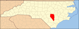 | |
| Towns | ||
| CDPs | ||
| Unincorporated communities | ||
| Footnotes | ‡This populated place also has portions in an adjacent county or counties | |