Ivanci
| Ivanci Zalaivánd | |
|---|---|
 Ivanci Location in Slovenia | |
| Coordinates: 46°39′27.98″N 16°15′29.49″E / 46.6577722°N 16.2581917°ECoordinates: 46°39′27.98″N 16°15′29.49″E / 46.6577722°N 16.2581917°E | |
| Country |
|
| Traditional region | Prekmurje |
| Statistical region | Mura |
| Municipality | Moravske Toplice |
| Area | |
| • Total | 4.38 km2 (1.69 sq mi) |
| Elevation | 178.7 m (586.3 ft) |
| Population (2002) | |
| • Total | 254 |
| [1] | |
Ivanci (pronounced [iˈʋaːntsi]; Hungarian: Zalaivánd) is a small village southeast of Bogojina in the Municipality of Moravske Toplice in the Prekmurje region of Slovenia.[2] The area is a flat region used primarily for farming, celebrated by the people of Ivanci during the annual Vegetable Farmers' Day in August.
References
External links
| Settlements | 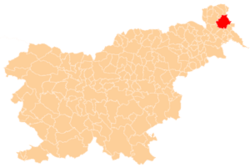 | |
|---|---|---|
| Landmarks |
| |
| Notable people |
| |
This article is issued from Wikipedia - version of the 5/3/2016. The text is available under the Creative Commons Attribution/Share Alike but additional terms may apply for the media files.