Ivanšćica
| Ivanšćica | |
|---|---|
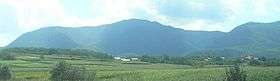 Ivanšćica as seen from the north | |
| Highest point | |
| Elevation | 1,059 m (3,474 ft) [1] |
| Coordinates | 46°10′32″N 16°06′21″E / 46.175551°N 16.105957°ECoordinates: 46°10′32″N 16°06′21″E / 46.175551°N 16.105957°E |
| Geography | |
 Ivanšćica Location of Ivanšćica in Croatia | |
| Location | Croatia |
Ivanšćica (Croatian pronunciation: [iʋǎnʃt͡ɕit͡sa]), also sometimes spelled Ivanščica and Ivančica, is a mountain in northern Croatia. The highest peak is the eponymous Ivanšćica at 1,059 metres (3,474 ft).[1]
The rivers of Bednja, Lonja, Krapina and Veliki potok rise and flow in the area.
On March 16, 1983, at 13:52:52, Ivanšćica was the epicenter of a very strong (MCS VII) earthquake.[2]
References
- 1 2 Ostroški, Ljiljana, ed. (December 2015). Statistički ljetopis Republike Hrvatske 2015 [Statistical Yearbook of the Republic of Croatia 2015] (PDF). Statistical Yearbook of the Republic of Croatia (in Croatian and English). 47. Zagreb: Croatian Bureau of Statistics. p. 48. ISSN 1333-3305. Retrieved 27 December 2015.
- ↑ Ostroški, Ljiljana, ed. (December 2015). Statistički ljetopis Republike Hrvatske 2015 [Statistical Yearbook of the Republic of Croatia 2015] (PDF). Statistical Yearbook of the Republic of Croatia (in Croatian and English). 47. Zagreb: Croatian Bureau of Statistics. p. 52. ISSN 1333-3305. Retrieved 27 December 2015.
This article is issued from Wikipedia - version of the 1/4/2016. The text is available under the Creative Commons Attribution/Share Alike but additional terms may apply for the media files.