Itea, Phocis
| Itea Ιτέα | |
|---|---|
.jpg) | |
 Itea | |
|
Location within the regional unit 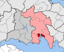 | |
| Coordinates: 38°26′N 22°25.5′E / 38.433°N 22.4250°ECoordinates: 38°26′N 22°25.5′E / 38.433°N 22.4250°E | |
| Country | Greece |
| Administrative region | Central Greece |
| Regional unit | Phocis |
| Municipality | Delphi |
| • Municipal unit | 26.351 km2 (10.174 sq mi) |
| Highest elevation | 10 m (30 ft) |
| Lowest elevation | 2 m (7 ft) |
| Population (2011)[1] | |
| • Municipal unit | 5,888 |
| • Municipal unit density | 220/km2 (580/sq mi) |
| Community[1] | |
| • Population | 4,362 (2011) |
| • Area (km2) | 6.305 |
| Time zone | EET (UTC+2) |
| • Summer (DST) | EEST (UTC+3) |
| Postal code | 332 00 |
| Area code(s) | +30-2265-xxx-xxx |
| Vehicle registration | ΑΜx-xxxx |
Itea (Greek: Ιτέα meaning willow), is a town and a former municipality in the southeastern part of Phocis, Greece. Since 2011 local government reforms made the city a part of the municipality Delphi, of which it is a municipal unit.[2]
Administrative division
The municipal unit Itea consists of the communities Itea, Kirra and Tritaia.
Geography
Itea is situated on the north coast of the Gulf of Corinth, 2 km (1 mi) west of Kirra, 8 km (5 mi) southwest of Delphi, 11 km (7 mi) south of Amfissa and 52 km (32 mi) east of Naupactus. The Greek National Road 48 connects Itea with Naupactus, Delphi and Livadeia, the Greek National Road 27 with Amfissa and Lamia. The community of Itea covers an area of 6.305 km2 (2.434 sq mi) while the minicipal unit covers an area of 26.351 km2 (10.174 sq mi).[3]
Historical population
| Year | Town population | Municipality population |
|---|---|---|
| 1981 | 4,438 | - |
| 1991 | 4,303 | 5592 |
| 2001 | 4,666 | 6,072 |
| 2011 | 4,362 | 5,888 |


See also
References
- 1 2 "Απογραφή Πληθυσμού - Κατοικιών 2011. ΜΟΝΙΜΟΣ Πληθυσμός" (in Greek). Hellenic Statistical Authority.
- ↑ Kallikratis law Greece Ministry of Interior (Greek)
- ↑ "Population & housing census 2001 (incl. area and average elevation)" (PDF) (in Greek). National Statistical Service of Greece.
External links
 |
Amfissa | Amfissa | Delphi | |
| |
Desfina | |||
| ||||
| | ||||
| Galaxidi | Gulf of Corinth |