Itasy Region
| Itasy Region | |
|---|---|
| Region | |
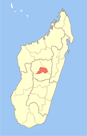 Location in Madagascar | |
| Country |
|
| Capital | Miarinarivo |
| Area | |
| • Total | 6,993 km2 (2,700 sq mi) |
| Population (2013) | |
| • Total | 732,834 |
| • Density | 100/km2 (270/sq mi) |
| • Ethnicities | Merina |
| Time zone | EAT (UTC3) |
Itasy is a region in central Madagascar. It borders Analamanga region in northeast, Vakinankaratra in south and Bongolava in northwest. The capital of the region is Miarinarivo, and the population was estimated to be 732,834 in 2013.[1] It is the smallest of all the 22 regions in area with 6,993 km2 (2,700 sq mi), and is the most densely populated region after Analamanga.[2]
Administrative divisions
Itasy region is divided into three districts, which are sub-divided into 51 communes.
- Arivonimamo District
- Miarinarivo District
- Soavinandriana District
Lake Itasy
The region of Itasy is named after Lake Itasy, the third largest lake in Madagascar. The lake is 120 km from the capital city of Antananarivo.
Tourism
According to the ONTM (Office National de Tourism de Madagascar), more 60% of domestic tourists from the capital city use this as their short-stay holiday destination each year. However, this still amounts to less than 200 tourists per day, or up to 1200 tourists per day on national holidays. Ampefy, by lake Itasy, is the main tourist town.
Tourist sights
The region is famous for several features:
- Lake Itasy, which is a source of livelihood for 3000 fisherman, with over 100 small canoes out daily;
- The monument of the Virgin Mary, on the edge of the lake, marking the very centre of the country;
- The isle of the Lake Itasy King, with a stone circle;
- The two Lily Waterfalls, of which the first is 16 m high by 35 m wide and the second over 22 m high, but not as wide;
- The Analavory Chute, which is over 20 m high;
- Over 20 small lakes;
- Boating and trekking experiences;
- The Analavory geysers, which are coldwater geysers that occasionally reach a height of nearly 3 m and have formed high travertine mounds;
- An ancient double-moated hillfort which can be seen near the town of Soavinandriana;
- Substantial numbers of huge extinct volcanic craters, some with crater lakes; and
- Lemurs Park, which is seen at PK 22 (22 km) en route to Lake Itasy from the capital city.
See also
References
- ↑ Institut National de la Statistique, Antananarivo.
- ↑ Ralison, Eliane; Goossens, Frans. "Madagascar: Profil des marchés pour les évaluations d'urgence de la sécurité alimentaire" (PDF) (in French). Programme Alimentaire Mondial, Service de l’Evaluation des besoins d’urgence (ODAN). Retrieved 2008-03-01.
| Arivonimamo | | |
|---|---|---|
| Miarinarivo | ||
| Soavinandriana | ||
Coordinates: 19°00′00″S 46°46′00″E / 19°S 46.7667°E