Isle Ristol
| Gaelic name | Eilean Ruisteil |
|---|---|
| Meaning of name | 'island with the horse valley' from Gaelic and Norse. |
 Isle Ristol from the air | |
| Location | |
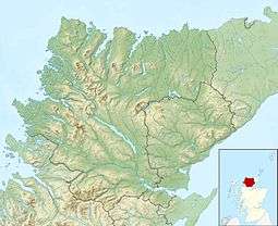 Isle Ristol Isle Ristol shown within Scotland | |
| OS grid reference | NB971112 |
| Physical geography | |
| Island group | Summer Isles |
| Area | 225 hectares (0.87 sq mi)[1] |
| Area rank | 103 [2] |
| Highest elevation | 71 metres (233 ft) |
| Administration | |
| Sovereign state | United Kingdom |
| Country | Scotland |
| Council area | Highland |
| Demographics | |
| Population | 0[3] |
| References | [4][5][6] |
Isle Ristol, the innermost of the Summer Isles in Scotland, is a Scottish Wildlife Trust Reserve.
Lying roughly 12 miles (19 km) north of Ullapool in Wester Ross, it is a tidal island, in Loch an Alltain Duibh, that is separated by a narrow channel from Old Dorney Bay. Access is by boat from Old Dornie.
Over fifty higher species have been identified amongst the flora on the Isle Ristol machair, amongst which are moonwort and adder's tongue.[7]
Isle Ristol was a site of a British Fishery Society station in the late 18th century.[4]
.JPG)
View south, over Altandhu, of Isle Ristol, in Loch an Alltain Duibh, with Eilean Mullagrach to the right
References
- ↑ "Isle Ristol". Gazetteer for Scotland. Retrieved 16 July 2007.
- ↑ Area and population ranks: there are c. 300 islands over 20 ha in extent and 93 permanently inhabited islands were listed in the 2011 census.
- ↑ National Records of Scotland (15 August 2013) (pdf) Statistical Bulletin: 2011 Census: First Results on Population and Household Estimates for Scotland - Release 1C (Part Two). "Appendix 2: Population and households on Scotland’s inhabited islands". Retrieved 17 August 2013.
- 1 2 Haswell-Smith, Hamish. (2004) The Scottish Islands. Edinburgh. Canongate.
- ↑ Mac an Tàilleir, Iain (2003) Ainmean-àite/Placenames. (pdf) Pàrlamaid na h-Alba. Retrieved 26 August 2012.
- ↑ Ordnance Survey: Landranger map sheet 15 Loch Assynt (Lochinver & Kylesku) (Map). Ordnance Survey. 2012. ISBN 9780319231265.
- ↑ "SWT Reserve: Isle Ristol". Archived from the original on 2007-07-14. Retrieved 2007-07-16.
Coordinates: 58°2′39″N 5°26′14″W / 58.04417°N 5.43722°W
This article is issued from Wikipedia - version of the 3/11/2016. The text is available under the Creative Commons Attribution/Share Alike but additional terms may apply for the media files.