Ishasha, Uganda
| Ishasha border point | |
|---|---|
 Ishasha border point Location of Ishasha Border Station | |
| Coordinates: 0°43′32″S 29°37′52″E / 0.72556°S 29.63111°ECoordinates: 0°43′32″S 29°37′52″E / 0.72556°S 29.63111°E | |
| Country | Uganda |
| Region | Western |
| District | Kanungu |
| Elevation | 990 m (3,250 ft) |
| Time zone | East Africa Time (UTC+3) |
| Sources: Google Maps[1] QENP[2] | |
Ishasha border point is a border crossing station and customs post in the Kanungu District in the Western Region of Uganda. It is inset 350 metres (1,150 ft) from the Ishasha River, which is the Uganda-Democratic Republic of the Congo (DRC) border locally, and is 1.3 kilometres (0.81 mi) from the town of Ishasha across the river in the DRC.[1]
The border point is a designated end of the Rukungiri–Kihihi–Ishasha–Kanungu Road, which partially forms the boundary of the Ishasha Sector of Queen Elizabeth National Park.[3] It is also on the boundary of Virunga National Park in the DRC.
The station is the location of a UNHCR transit centre for refugees fleeing violence in eastern DRC.[4] From there, refugees are sent on to safer refugee settlements such as Nakivale[5] and Kyangwali.[6]
See also
References
External links
Capital: Kanungu | ||
| Counties and sub-counties | Kinkinzi County | 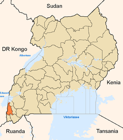 |
| Towns and villages | ||
| Economy | ||
| Notable landmarks | ||
| Transport |
| |
| Health | ||
| Notable people | ||