Isanti, Minnesota
| Isanti, Minnesota | |
|---|---|
| City | |
| Motto: A Community for Generations | |
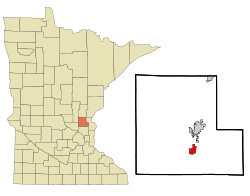 Location of the city of Isanti within Isanti County, Minnesota | |
| Coordinates: 45°29′26″N 93°15′0″W / 45.49056°N 93.25000°W | |
| Country | United States |
| State | Minnesota |
| County | Isanti |
| Government | |
| • Mayor | George A. Wimmer |
| • Council Member | Dan Collison |
| • Council Member | Steve Lundeen |
| • Council Member | Paul Bergley |
| • Council Member | Adam Johnson |
| Area[1] | |
| • Total | 4.85 sq mi (12.56 km2) |
| • Land | 4.81 sq mi (12.46 km2) |
| • Water | 0.04 sq mi (0.10 km2) |
| Elevation | 935 ft (285 m) |
| Population (2010)[2] | |
| • Total | 5,251 |
| • Estimate (2012[3]) | 5,395 |
| • Density | 1,091.7/sq mi (421.5/km2) |
| Time zone | Central (UTC-6) |
| • Summer (DST) | Central (UTC-5) |
| Zip code | 55040 |
| Area code(s) | 763 |
| FIPS code | 27-31328[4] |
| GNIS feature ID | 0645470[5] |
| Website | www.cityofisanti.us |
Isanti (/ˈaɪsæntiː/ eye-SAN-tee) is a city in Isanti County, Minnesota, United States. The population was 5,251 at the 2010 census.[6] Then name Isanti is composed of two Dakota words: isan - 'knife' + ati - 'camp', and refers to the Santee Dakota people.
Minnesota State Highway 65 and Isanti County Road 5 are two of the main routes in Isanti.
Geography
According to the United States Census Bureau, the city has a total area of 4.85 square miles (12.56 km2), of which 4.81 square miles (12.46 km2) is land and 0.04 square miles (0.10 km2) is water.[1]
Major highways
Demographics
| Historical population | |||
|---|---|---|---|
| Census | Pop. | %± | |
| 1910 | 316 | — | |
| 1920 | 411 | 30.1% | |
| 1930 | 371 | −9.7% | |
| 1940 | 354 | −4.6% | |
| 1950 | 422 | 19.2% | |
| 1960 | 521 | 23.5% | |
| 1970 | 679 | 30.3% | |
| 1980 | 858 | 26.4% | |
| 1990 | 1,228 | 43.1% | |
| 2000 | 2,324 | 89.3% | |
| 2010 | 5,251 | 125.9% | |
| Est. 2015 | 5,464 | [7] | 4.1% |
| U.S. Decennial Census | |||
2010 census
As of the census[2] of 2010, there were 5,251 people, 1,871 households, and 1,336 families residing in the city. The population density was 1,091.7 inhabitants per square mile (421.5/km2). There were 2,038 housing units at an average density of 423.7 per square mile (163.6/km2). The racial makeup of the city was 94.7% White, 1.1% African American, 0.5% Native American, 0.7% Asian, 0.7% from other races, and 2.2% from two or more races. Hispanic or Latino of any race were 2.8% of the population.
There were 1,871 households of which 48.0% had children under the age of 18 living with them, 49.9% were married couples living together, 13.0% had a female householder with no husband present, 8.6% had a male householder with no wife present, and 28.6% were non-families. 20.6% of all households were made up of individuals and 6.3% had someone living alone who was 65 years of age or older. The average household size was 2.81 and the average family size was 3.23.
The median age in the city was 28.4 years. 32.8% of residents were under the age of 18; 8.4% were between the ages of 18 and 24; 36.9% were from 25 to 44; 15.4% were from 45 to 64; and 6.5% were 65 years of age or older. The gender makeup of the city was 50.4% male and 49.6% female.
2000 census
As of the census[4] of 2000, there were 2,324 people, 816 households, and 576 families residing in the city. The population density was 1,095.3 people per square mile (423.3/km²). There were 834 housing units at an average density of 393.1 per square mile (151.9/km²). The racial makeup of the city was 97.46% White, 0.56% African American, 0.65% Native American, 0.26% Asian, 0.04% Pacific Islander, 0.09% from other races, and 0.95% from two or more races. Hispanic or Latino of any race were 0.90% of the population.
There were 816 households out of which 48.7% had children under the age of 18 living with them, 49.6% were married couples living together, 16.2% had a female householder with no husband present, and 29.3% were non-families. 22.8% of all households were made up of individuals and 8.5% had someone living alone who was 65 years of age or older. The average household size was 2.84 and the average family size was 3.31.
In the city the population was spread out with 35.8% under the age of 18, 9.6% from 18 to 24, 35.3% from 25 to 44, 11.8% from 45 to 64, and 7.6% who were 65 years of age or older. The median age was 28 years. For every 100 females there were 97.8 males. For every 100 females age 18 and over, there were 85.5 males.
The median income for a household in the city was $43,587, and the median income for a family was $46,842. Males had a median income of $35,590 versus $25,081 for females. The per capita income for the city was $16,662. About 7.9% of families and 8.0% of the population were below the poverty line, including 9.9% of those under age 18 and 16.4% of those age 65 or over.
Sports teams based in Isanti
- Minnesota Owls - Junior Hockey team based in Isanti. The team plays in the Minnesota Junior Hockey League
References
- 1 2 "US Gazetteer files 2010". United States Census Bureau. Retrieved 2012-11-13.
- 1 2 "American FactFinder". United States Census Bureau. Retrieved 2012-11-13.
- ↑ "Population Estimates". United States Census Bureau. Retrieved 2013-05-28.
- 1 2 "American FactFinder". United States Census Bureau. Retrieved 2008-01-31.
- ↑ "US Board on Geographic Names". United States Geological Survey. 2007-10-25. Retrieved 2008-01-31.
- ↑ "2010 Census Redistricting Data (Public Law 94-171) Summary File". American FactFinder. U.S. Census Bureau, 2010 Census. Retrieved 23 April 2011.
- ↑ "Annual Estimates of the Resident Population for Incorporated Places: April 1, 2010 to July 1, 2015". Retrieved July 2, 2016.
External links
Municipalities and communities of Isanti County, Minnesota, United States | ||
|---|---|---|
| Cities | 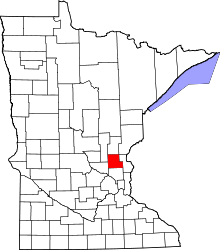 | |
| Townships | ||
| CDP | ||
| Unincorporated communities | ||
| Ghost town | ||
| Footnotes | ‡This populated place also has portions in an adjacent county or counties | |
Coordinates: 45°29′25″N 93°14′52″W / 45.49028°N 93.24778°W