Iron Horse Regional Trail
Coordinates: 37°49′26″N 122°00′22″W / 37.823961°N 122.00604°W
| Iron Horse Regional Trail | ||||||||||||||||||||||||||||||||||||||||||||||||||||||||||||||||||||||||||||||||||||||||||||||||||||||||||||||||||||||||||||||||||||||||||||||||||||||||||||||||||||||||||||||||||||||||||||||||||||||||||||||||||||||||||||||||||||||||||||||||||||||||||||||||||||||||||||||||||||||||||||||||||||||||||||||||||||||||||||||||||||||||||||||||||||||
|---|---|---|---|---|---|---|---|---|---|---|---|---|---|---|---|---|---|---|---|---|---|---|---|---|---|---|---|---|---|---|---|---|---|---|---|---|---|---|---|---|---|---|---|---|---|---|---|---|---|---|---|---|---|---|---|---|---|---|---|---|---|---|---|---|---|---|---|---|---|---|---|---|---|---|---|---|---|---|---|---|---|---|---|---|---|---|---|---|---|---|---|---|---|---|---|---|---|---|---|---|---|---|---|---|---|---|---|---|---|---|---|---|---|---|---|---|---|---|---|---|---|---|---|---|---|---|---|---|---|---|---|---|---|---|---|---|---|---|---|---|---|---|---|---|---|---|---|---|---|---|---|---|---|---|---|---|---|---|---|---|---|---|---|---|---|---|---|---|---|---|---|---|---|---|---|---|---|---|---|---|---|---|---|---|---|---|---|---|---|---|---|---|---|---|---|---|---|---|---|---|---|---|---|---|---|---|---|---|---|---|---|---|---|---|---|---|---|---|---|---|---|---|---|---|---|---|---|---|---|---|---|---|---|---|---|---|---|---|---|---|---|---|---|---|---|---|---|---|---|---|---|---|---|---|---|---|---|---|---|---|---|---|---|---|---|---|---|---|---|---|---|---|---|---|---|---|---|---|---|---|---|---|---|---|---|---|---|---|---|---|---|---|---|---|---|---|---|---|---|---|---|---|---|---|---|---|---|---|---|---|---|---|---|---|---|---|---|---|---|---|---|---|---|---|---|---|---|---|---|---|---|---|---|---|---|---|---|---|---|---|---|---|
Legend | ||||||||||||||||||||||||||||||||||||||||||||||||||||||||||||||||||||||||||||||||||||||||||||||||||||||||||||||||||||||||||||||||||||||||||||||||||||||||||||||||||||||||||||||||||||||||||||||||||||||||||||||||||||||||||||||||||||||||||||||||||||||||||||||||||||||||||||||||||||||||||||||||||||||||||||||||||||||||||||||||||||||||||||||||||||||
| ||||||||||||||||||||||||||||||||||||||||||||||||||||||||||||||||||||||||||||||||||||||||||||||||||||||||||||||||||||||||||||||||||||||||||||||||||||||||||||||||||||||||||||||||||||||||||||||||||||||||||||||||||||||||||||||||||||||||||||||||||||||||||||||||||||||||||||||||||||||||||||||||||||||||||||||||||||||||||||||||||||||||||||||||||||||
The Iron Horse Regional Trail is a rail trail for pedestrians, horse riders and bicycles in the East Bay Area in California.
This trail is located in inland central Alameda and Contra Costa counties, mostly following a Southern Pacific Railroad right of way established in 1891 and abandoned in 1977.[1] The two counties purchased the right of way at that time, intending to use it as a transportation corridor; the Iron Horse Trail was first established in 1986.[2]
The trail passes through the cities of Pleasanton, Dublin, San Ramon, Danville, Alamo, Walnut Creek, Pleasant Hill and Concord. When completed, the trail will span from Livermore in central Alameda County to Suisun Bay at the northern edge of Contra Costa County, a distance of over 40 miles (64 km) connecting two counties and nine communities. The trail also directly connects to both the Dublin/Pleasanton and Pleasant Hill BART stations.
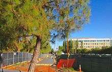
The trail is maintained by the East Bay Regional Park District. It is a wheelchair accessible paved trail along with adjacent unpaved or soft trails in certain areas.[3]
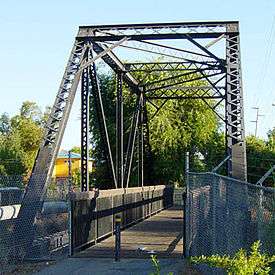
The Iron Horse Regional Trail has several bridges over busy thoroughfares to help improve traffic flow; two notable ones cross over Ygnacio Valley Road and Treat Boulevard in Walnut Creek. Additional bridges are in the planning process.
Despite initial skepticism, and even opposition, the trail is now a major transportation and recreation corridor. One million trips are made each year on the path.[4]
Pleasanton/Alameda County segments
The city of Pleasanton initially chose not to preserve the transportation corridor within its city limits. Although the East Bay Regional Park District (EBRPD) still controlled the right of way, multiple developments were built encompassing the corridor, most notably Hacienda Business Park.
The first work on the trail in Pleasanton began in March 2006, creating a new section about 1 mile (1.6 km) long on the south side of the city.[5] This segment opened in March 2008.
This left a gap in the trail, approximately 1.6 miles (2.6 km) long, extending from the Dublin side of the Dublin/Pleasanton BART station to Santa Rita Road near the Stoneridge Drive intersection, where the new segment begins.[2]
Beginning in June 2010, the EBRPD, City of Pleasanton, and landscape architects Callander Associates held public meetings to discuss options for completing the trail within the city.[2]
In February 2011, the Pleasanton City Council voted to ratify the EBRPD master plan developed based on these meetings. $4 million in regional and federal grants was allocated to complete this section of the trail.[6] Construction began in May 2013,[7] and the segment opened on July 25, 2014.
The project accommodated several obstacles, including routing through an existing business campus, two city parks, a residential development, an apartment complex, and three at-grade crossings of busy roads; it connects with the earlier southern segment at the intersection of two major streets.[8]
In April 2013, a new trail segment opened along Stanley Boulevard on the north side of Shadow Cliffs Lake in unincorporated Alameda County.[9] This leaves a .6 miles (0.97 km) gap between the end of the Pleasanton portion of the trail and the west end of this new segment, which ends at the Livermore city limits on the east end of the segment. The East Pleasanton Specific Plan Project includes plans to complete this gap along future extensions to Busch Road and El Charro Road to Stanley Boulevard.[10]
References
| Wikimedia Commons has media related to Iron Horse Regional Trail. |
- ↑ Dolores Fox Ciardelli (2010-06-11). "Continuing the Iron Horse Trail". Pleasanton Weekly. Retrieved 2011-01-08.
- 1 2 3 "Public Meeting #1, Iron Horse Trail (Dublin/Pleasanton BART Station to Santa Rita Road) Feasibility Study" (PDF). Callander Associates Landscape Architecture, Inc. East Bay Regional Parks District. June 30, 2010. Retrieved 2011-01-08.
- ↑ http://www.ebparks.org/parks/trails/iron_horse
- ↑ "Iron Horse Trail Connects Concord, Pleasanton, Livermore and More". San Jose Mercury News. Aug 15, 2014. Retrieved 2014-08-21.
- ↑ Julie Nostrand (May 5, 2006). "Where will the Iron Horse go?". Pleasanton Weekly. Retrieved 2011-01-09.
- ↑ "At last, Pleasanton to complete Iron Horse Trail". Pleasanton Weekly. February 25, 2011. Retrieved 2012-02-23.
- ↑ Glenn Wohltmann (2013-09-26). "Missing link of Iron Horse Trail set for January completion". Pleasanton Weekly. Retrieved 2013-12-04.
- ↑ Callander and Associates, Fehr & Peers Biotic Resources Group (January 17, 2011). "Iron Horse Trail Feasibility Study and Master Plan / Santa Rita Road to the Dublin/Pleasanton BART Station" (PDF). Archived from the original (PDF) on 2012-01-03. Retrieved 2014-02-20.
- ↑ "Officials Celebrate Completion of Stanley Boulevard Improvements". The Independent. 2013-04-19. Retrieved 2015-12-08.
- ↑ "Draft Environmental Impact Report (EIR) for East Pleasanton Specific Plan". City of Pleasanton, California. April 2015. pp. 3.14–68. Retrieved 2015-12-10.
The Iron Horse Trail would be extended from its current terminus at Busch Road through the Plan Area along Busch Road, and then connect to the future multi-use trail that parallels El Charro Road, and end at Shadow Cliffs Regional Park.
External links
- Iron Horse Regional Trail - East Bay Regional Park
- Iron Horse Regional Trail Page on RailsToTrails.us
- Nearby Hiking Trails in Contra Costa County - Walnut Creek Wiki