Iron Hill (Delaware)
| Iron Hill | |
|---|---|
 Iron Hill | |
| Highest point | |
| Elevation | 328 ft (100 m) [1] |
| Coordinates | 39°38′19″N 75°45′06″W / 39.6387°N 75.7518°WCoordinates: 39°38′19″N 75°45′06″W / 39.6387°N 75.7518°W [1] |
| Geography | |
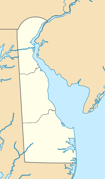
| Location | Newark, Delaware |
Iron Hill is a prominent geographical feature in the vicinity of Newark, Delaware, in the United States. With a peak elevation of 328 feet (100 m) it is the highest hill in Delaware, though not the state's highest point as the Piedmont plateau region near Centreville reaches a higher elevation of 448 feet (137 m) at Ebright Azimuth.[2] The hill is named for its iron deposits, which were mined over a 200-year period during the 18th and 19th centuries. Iron Hill is part of a New Castle County park known as Iron Hill Park.
Location
Iron Hill is located just south of Newark in Pencader Hundred, with the summit lying south of Interstate 95 and west of Delaware Route 896. It is the easternmost and highest of three geologically similar peaks, together with neighboring Chestnut Hill and Gray's Hill (across the border in Maryland).[3]
Geology
Iron Hill and the two neighboring hills are outlying Piedmont outcroppings, east of the fall line and surrounded by the relatively flat Atlantic coastal plain.[4] The hills are igneous intrusions of "Iron Hill Gabbro",[3][5] a coarse and dark-colored rock composed mainly of plagioclase, pyroxenes, and olivine. The rock contains significant iron oxide deposits in the form of hematite, goethite, and limonite, forming the basis for historical iron mining activity.[6] Jasper is also present and was used for toolmaking by prehistoric inhabitants of the area.[4]
History


Human activity in the area dates to prehistoric times, when local Native American populations quarried jasper from Iron Hill to make arrowheads and other stone tools. The location was first referred to in print[7] on Augustine Herman's 1670 map of Virginia and Maryland, where it was labeled "Yron Hill".[8] In 1701 the hill was included in the 30,000-acre (12,000 ha) Welsh Tract, granted by William Penn to a group of settlers fleeing religious persecution in Wales. The Welsh settlers were familiar with ironworking and mining techniques, and soon commenced open-pit mining operations on Iron Hill.[9]
During the Revolutionary War, Iron Hill and the surrounding area were the site of the Battle of Cooch's Bridge (also known as the Battle of Iron Hill) in September 1777.[7] George Washington ascended the hill to observe enemy troop movements prior to the battle, which was possible at the time due to deforestation; subsequent regrowth has since obscured the view from the summit.[10]
Mining on Iron Hill continued until the late 19th century, though extraction of the low-grade ore proved minimally profitable and many of the ventures ended in bankruptcy. The last mining operation on Iron Hill was run by J.P. Whitaker, who shipped the ore to Principio Furnace in Maryland for smelting.[11] African-American mine workers and their descendants continued to inhabit the area, and in 1923 Pierre S. du Pont funded the construction of Iron Hill School No. 112C to serve this population. The school remained in operation until Delaware public schools were desegregated in 1965 and now houses the Iron Hill Museum.[12] Much of the hill is now a wooded recreation area, Iron Hill Park.[13]
References
- 1 2 "Iron Hill". Geographic Names Information System. United States Geological Survey. Retrieved October 29, 2012.
- ↑ Delaware: A Guide to the First State. New York: Viking Press. 1938. pp. 8, 461.
- 1 2 Bascom, Florence (1902). The Geology of the Crystalline Rocks of Cecil County. Maryland Geological Survey. p. 128.
- 1 2 Petraglia, Michael; et al. (1998). "Cultural and Environmental Background" (PDF). The Prehistory of Lums Pond: The Formation of an Archaeological Site in Delaware. Delaware Department of Transportation. p. 8. Retrieved October 28, 2012.
- ↑ Schenck, William S.; Plank, Margaret O.; Srogi, LeeAnn (2000). "Bedrock Geologic Map of the Piedmont of Delaware and Adjacent Pennsylvania" (PDF). Delaware Geological Survey. Retrieved October 28, 2012.
- ↑ "Iron Hill Gabbro". The Geology of Delaware. Delaware Geological Survey. Retrieved October 28, 2012.
- 1 2 Pfeiffer, Judith; Barnes, Robert C. (2001). "Iron Hill and Chestnut Hill Mine Preserve". A Guide to the History and Heritage of Pencader Hundred. Pencader Heritage Area Association. Retrieved October 28, 2012.
- ↑ Herman, Augustine (1670). "Virginia and Maryland". Charts and Maps Used by the Early Settlers of Maryland. Maryland State Archives. Retrieved October 28, 2012.
- ↑ Pfeiffer, Judith; Barnes, Robert C. (2001). "The British and The Baptists". A Guide to the History and Heritage of Pencader Hundred. Pencader Heritage Area Association. Retrieved October 28, 2012.
- ↑ Pfeiffer, Judith; Barnes, Robert C. (2001). "The Fate of the Forests". A Guide to the History and Heritage of Pencader Hundred. Pencader Heritage Area Association. Retrieved October 28, 2012.
- ↑ Pfeiffer, Judith; Barnes, Robert C. (2001). "Iron: Furnaces and Forges". A Guide to the History and Heritage of Pencader Hundred. Pencader Heritage Area Association. Retrieved October 28, 2012.
- ↑ "NRHP Nomination Form: Iron Hill School No. 112C" (PDF). National Park Service. Retrieved October 29, 2012.
- ↑ "Friends of Iron Hill Park". Retrieved October 29, 2012.