Interstate 69 in Mississippi
| ||||
|---|---|---|---|---|
_map.svg.png) | ||||
| Route information | ||||
| Maintained by MDOT | ||||
| Length: | 23.390 mi[1] (37.643 km) | |||
| Major junctions | ||||
| South end: |
| |||
|
| ||||
| North end: |
| |||
| Highway system | ||||
| ||||

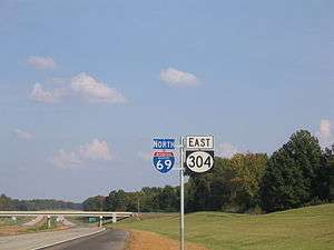
The proposed Interstate 69 extension from Indianapolis southwest to Texas currently has a short piece completed in the U.S. state of Mississippi, south of Memphis, Tennessee. The south end is an at-grade intersection with the former route of MS 304 near Tunica Resorts, where Mississippi Highway 713 continues west to U.S. Highway 61, and the route continues north to the Mississippi state line. Much of the route overlaps Mississippi Highway 304, which intersects US 61 farther north than MS 713. MS 304 is planned to continue east from I-55, connecting to State Route 385 in Tennessee, forming part of the Interstate 269 Memphis outer beltway.[1]
Route description
Mississippi has a unique funding mechanism that is enabling the state to move much faster than its neighbors to getting I-69 built without the use of tolls. The Highway Enhancements Through Local Partnerships (HELP) program enables individual counties to take out bonds and lend the money to the state in order to expedite major public works projects. The state then reimburses the counties over time as federal funds are received. Interstate 69 received another boost when Governor Haley Barbour signed into law Senate Bill 2375, which authorizes the construction of toll roads in the state by MDOT, cities, counties, and the private sector. This legislation has the potential for accelerating construction of SIU 11 and Mississippi's portion of SIU 12 through toll funding.[2]
I-69 has been divided into a number of sections of independent utility (SIUs).
SIU 9 (Mississippi portion)
At the Mississippi-Tennessee state line, I-69 enters Mississippi from the north concurrently with Interstate 55, and follows the previously-constructed route of I-55 south to Hernando, Mississippi, where it will meet future Interstate 269 (and possibly Interstate 22), for approximately 8 miles (13 km).
On January 18, 2008, the Federal Highway Administration authorized the states of Mississippi and Tennessee to extend I-69 from the I-40/TN 300 interchange in north Memphis to the I-55/I-69 interchange in Hernando; in late May 2008, Mississippi began posting signs reflecting the extension of the route.[3][4] Tennessee signed I-69 along I-55 north to I-240 for a few months and then removed the I-69 shields.
SIU 10
Segment 10 of the I-69 extension was originally planned and built as part of the MS-304 relocation project to link the Tunica County casinos to Interstate 55. Planning of the MS-304 Bypass predates I-69 planning in Mississippi, and federal and state officials opted to route I-69 over this segment in 2000, since it was nearing the start of construction. It also eliminated the need for constructing a new highway while still accomplishing the intended goals for the I-69 corridor.
In Hernando, I-69 again meets up with the future Interstate 269 (and possibly Interstate 22 in the future) and turns west for approximately 16 miles (26 km) to the area around the Tunica County casinos. A ribbon-cutting ceremony took place at 2:00 p.m. CST on October 3, 2006, at which point the road was opened to traffic. This segment's opening also coincided with Mississippi's Statewide Transportation Conference, held in Tunica.[5] The state's HELP program, with funding raised from Tunica County's casino gaming revenues, enabled this segment to be completed three years ahead of schedule.
This portion of I-69 mostly coincides with the relocated route of MS 304; both routes are co-signed between I-55 and the MS 713 spur, where the two routes split: MS 304 continues due west to U.S. 61, while I-69 (co-signed with MS 713) turns south to connect to the old routing of MS 304 near Banks, Mississippi. The MS 713 portion of the route opened to traffic December 18, 2006.[6]
I-55 and I-69 meet at an incomplete cloverleaf interchange near Hernando; freeway stubs extending east of this interchange are intended for I-269 and I-22 when MS-304 is extended to the east of I-55 starting in 2010. To accommodate the volume of traffic anticipated to pass through this interchange and meet current Federal Highway Administration standards for cloverleaf interchanges, collector/distributor roads were added to the I-55 mainline in the vicinity of the interchange.
As of December 18, 2006, all work on SIU 10 is complete and the entire segment is open to traffic. Because Interstate 69 is still incomplete through the remainder of Mississippi (SIUs 11 and 12), exits are unnumbered on the Hernando-Tunica segment. The two control cities used on the SIU 10 segment are Memphis and Tunica, although the route does not yet reach the Town of Tunica. The additional control city of Southaven is used at the interchange with I-55 along the northern duplex.
Planned extension
SIU 11
Continuing south from its present (temporary) terminus at Mississippi Route 3 near Banks, I-69 will bypass the Town of Tunica to the east (serving Tunica Municipal Airport), then veer to the west and merge with U.S. 61 route to Clarksdale, also merging with U.S. Route 49 near Rich. In 2006 MDOT decided to incorporate the recently-completed Clarksdale Bypass into the future I-69 alignment through the Clarksdale vicinity, since the bypass is already at Interstate standards.
In Clarksdale, I-69 will merge with U.S. Route 278 and continue south, serving Shelby, following the existing U.S. 61 route. I-69 and U.S. 278 will diverge from U.S. 61 near Merigold, bypassing Cleveland to the west, and continue south to near Shaw, then west to Benoit where it will intersect Mississippi Highway 1. The Final Environmental Impact Statement for SIU 11 was approved in August 2010, and the Record of Decision was issued in September 2010.[7] Due to funding issues, no major construction on this section of I-69 is expected through at least 2019, although some spot upgrades are planned on sections of US-61 that I-69 will eventually overlap. The 2016-2020 Statewide Transportation Improvement Plan published by the Mississippi Department of Transportation (MDOT) anticipates construction to begin in 2020 to upgrade a 6-mile (10 km) section of US-61 to I-69 from the north end of the Clarksdale Bypass to near Swan Lake.
SIU 12 (Mississippi portion)
From Benoit, I-69 and U.S. 278 will cross the Charles W. Dean Bridge (sometimes referred to as the Great River Bridge) over the Mississippi River into Arkansas. Mississippi's portion of SIU 12 consists of the eastern end of the Dean Bridge; Arkansas' portion will continue from the Dean Bridge to U.S. 65 near McGehee, Arkansas. Environmental studies for this segment, including the Dean Bridge have been completed and the FHWA issued a Record of Decision approving the route through SIU 12 in 2004.
Exit list
| County | Location | mi | km | Exit | Destinations | Notes | |
|---|---|---|---|---|---|---|---|
| Gap in route | |||||||
| Tunica | | 0.00 | 0.00 | Southbound exit and northbound entrance; temporary southern terminus; ends about a mile north of MS 317's junction with MS 304 Scenic | |||
| DeSoto | | 3.73 | 6.00 | South end of MS 304 overlap; southbound exit and northbound entrance | |||
| | 5.51 | 8.87 | |||||
| | 9.44 | 15.19 | Fogg Road | ||||
| Hernando | 11.44 | 18.41 | Tulane Road | Formerly signed as Odom Road | |||
| 14.46 | 23.27 | North end of MS 304 overlap, south end of I-55 overlap, exit 283; uses exit numbers for I-55 | |||||
| 16.50 | 26.55 | 283 | Future Western Terminus of I-269; Old planned I-69 route | ||||
| 15.89 | 25.57 | 284 | Nesbit Road | ||||
| Southaven | 19.28 | 31.03 | 287 | Church Road –Southaven, Horn Lake | |||
| 21.32 | 34.31 | 289 | |||||
| 23.39 | 37.64 | 291 | Main Street / Stateline Road – Southaven, Horn Lake | ||||
| | – | Continuation into Tennessee | |||||
1.000 mi = 1.609 km; 1.000 km = 0.621 mi
| |||||||
References
| Wikimedia Commons has media related to Interstate 69 in Mississippi. |
- 1 2 Mississippi Department of Transportation, Mississippi Public Roads Selected Statistics Extent, Travel, and Designation, accessed August 2007. The road is actually 23.39 miles; MDOT counts 14.46 miles because it excludes the portion co-signed with Interstate 55.
- ↑ Toll Road Bill Passage a Milestone for Mississippi, MDOT Press Release May 11, 2007
- ↑ Capka, J. Richard (FHWA Administrator), Letter to Harry Lee James (MDOT) dated January 18, 2008, retrieved May 28, 2008.
- ↑ Lawrence, Christopher N. Photograph taken May 27, 2008.
- ↑ WMC-TV: News, Weather, Traffic, Radar, and Sports for Memphis, TN; WMCTV.com | First Mississippi stretch of I-69 opens to the public
- ↑ "GoMDOT.com". GoMDOT.com. 2011-09-15. Retrieved 2011-09-19.
- ↑ I-69 Project Page, Mississippi Department of Transportation, Accessed November 1, 2010
| Previous state: Arkansas |
Mississippi | Next state: Tennessee |