Interstate 470 (Ohio–West Virginia)
| |||||||
|---|---|---|---|---|---|---|---|
|
Map of the Wheeling area with I-470 highlighted in red | |||||||
| Route information | |||||||
| Auxiliary route of I‑70 | |||||||
| Maintained by ODOT and WVDOH | |||||||
| Length: |
10.63 mi[1] (17.11 km) 6.69 mi (10.77 km) in Ohio 3.94 mi (6.34 km) in W. Va. | ||||||
| Existed: | 1976 – present | ||||||
| Major junctions | |||||||
| West end: |
| ||||||
|
| |||||||
| East end: |
| ||||||
| Location | |||||||
| States: | Ohio, West Virginia | ||||||
| Counties: | OH: Belmont WV: Ohio | ||||||
| Highway system | |||||||
| |||||||

_map.svg.png)
Interstate 470 (I-470) is a 10.63-mile-long (17.11-kilometer) auxiliary Interstate Highway of I-70 that bypasses the city of Wheeling, West Virginia, in the United States. I-470 is one of 13 auxiliary Interstate Highways in Ohio and the only auxiliary Interstate Highway in West Virginia. The western terminus of I-470 is an interchange with I-70 in Richland Township, Ohio. Traveling southeast through rural Belmont County, I-470 approaches the Vietnam Veterans Memorial Bridge, which spans the Ohio River. After crossing the river into Ohio County, West Virginia, the highway turns east towards the Wheeling communities of Bethlehem and Elm Grove and its eastern terminus at I-70 near Elm Grove. The portion of the highway in West Virginia is named the USS West Virginia Memorial Highway, by proclamation of then Governor Cecil Underwood on the 59th anniversary of the Pearl Harbor attack.
Construction of the freeway began in 1975 in the two states. Due to a chronic lack of funding, construction in Ohio was stalled between 1976 and 1981. After a 3.3-cent-per-gallon (0.87-cent-per-liter) fuel tax increase, Ohio was able to restart construction, and by 1983, both states had completed construction on the freeway. The three-level diamond interchange with concurrent highways U.S. Route 250 (US 250) and West Virginia Route 2 (WV 2) on the eastern banks of the Ohio River was thought to be the most complex interchange in West Virginia's Interstate Highway System at the time of construction. On average, between 25,500 and 37,840 vehicles use the highway daily.
Route description
The freeway begins at a partial interchange with I-70 in Richland Township, Belmont County, Ohio.[2] An exit for County Road 28 (CR 28), the second-last exit for westbound traffic, provides motorists access to US 40. The highway curves to the southeast, passing near the Belmont Memorial Park and through woodlands. I-70 forms part of the northeastern border of Neffs, Pease Township,[2] and briefly parallels High Ridge Road (CR 214) then meets it at a diamond interchange in Pultney Township.[2] High Ridge Road to the north connects back to I-70, and to the south links Bellaire to the bypass. I-470 continues easterly into a valley before intersecting a trumpet interchange with State Route 7 (SR 7) along the western banks of the Ohio River. The Vietnam Veterans Memorial Bridge carries I-470 over three rail lines and the Ohio River (the state line between Ohio and West Virginia).[3][4] The rail lines on the western banks of the river belong to the Norfolk Southern Railway and the Wheeling and Lake Erie Railway's River Subdivision.[5][6] The American Automobile Association considers the stretch of I-470 though Ohio to be a scenic highway due to its natural beauty.[7]
I-470 enters the city limits of Wheeling and Ohio County, West Virginia;[8] the Greater Wheeling Trail, a rail trail, passes under the freeway as I-470 approaches a three-level diamond interchange with US 250 and WV 2.[9] The concurrent highways connect to downtown Wheeling in the north and Benwood to the south. I-70 climbs from the banks of the river into more woodlands before an interchange with West Bethlehem Boulevard, which provides access to the village of the same name to the south. Continuing easterly, I-470 comes to its end at an incomplete interchange with its parent, I-70,[10] over Wheeling Creek near Elm Grove and to the north of the J.B. Chambers Youth Sports Complex and Wheeling Skate Park.[11][12] Traffic from I-470 can only access eastbound I-70, and only traffic traveling westbound on I-70 can access I-470.[10] The eastern branch of the Greater Wheeling Trail, which parallels the creek, passes underneath I-470 as it merges into I-70.[9]
I-470 is one of 13 auxiliary Interstate Highways in Ohio and the only auxiliary Interstate Highway in West Virginia.[1] The Ohio Department of Transportation and West Virginia Division of Highways (ODOT and WVDOH) conduct surveys on their highways to measure traffic volume. This is expressed in terms of average annual daily traffic (AADT), a measure of average traffic volume for any day of the year. In 2012, they calculated that 26,500 vehicles traveled along the highway at the eastern terminus in West Virginia, and 37,840 vehicles used I-470 across the Vietnam Veterans Memorial Bridge.[13][14] As part of the Interstate Highway System,[15] the entire route is listed on the National Highway System—a system of roads that are important to the nation's economy, defense and mobility.[16][17]
History
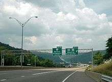
.jpg)
Plans for a southern bypass of Wheeling were first published in 1955 in Bureau of Public Roads document titled General Location of National System of Interstate Highways Including All Additional Routes at Urban Areas.[18] An environmental impact statement was filed in 1972 by West Virginia, detailing the I-470 interchange with US 250/WV 2 along the eastern banks of the Ohio River.[19] Tunnels used by the nearby LaBelle Nail Plant, LaBelle being the original French word for the Ohio River, were unearthed during construction of this interchange.[20] A 2.5-mile-long (4.0 km) segment in West Virginia was bid out at just over $16.5 million (equivalent to $107 million in 2015)[21] in 1976.[22]
Ohio had completed the stretch of highway between I-70 to just before the SR 7 interchange by 1976,[23][24] but due to budget deficiencies work did not resume in Ohio until 1981. Construction of the bridge linking the two portions of highway was scheduled to be completed by 1981, but construction did not begin until that year.[25] After a 3.3-cent-per-gallon (0.87-cent-per-liter) fuel tax increase, Ohio was able to fund the project again. Bids for construction work on the remainder of the Ohio portion of the freeway were solicited in 1981, with an estimated construction time of 37 months for the stretch between I-70 and the bridge.[26]
The West Virginia portion was under construction by 1976,[27] and work in both states was completed by 1983.[28][29] The three-level diamond interchange on the eastern banks of the Ohio River was said to be the most complex interchange in West Virginia at the time of construction by the WVDOH spokesman Gary Chernenko.[30] The opening of the Vietnam Veterans Memorial Bridge, along with another bridge in nearby Moundsville was thought to have reduced the amount of traffic, and thus tolls collected by the nearby Bellaire Bridge by up to 50 per cent in 1987.[31]
Between September 12 and December 22, 1996,[32] about 1,700 ft (518 m) of I-470 in Ohio was closed so ODOT could stabilize and repave the roadway, as the rocks forming the top of an abandoned mine underneath the freeway had become overstressed.[33][34] The Fort Henry Bridge (which carries I-70), the Vietnam Veterans Memorial Bridge and the Wheeling Suspension Bridge were all closed in January 2005, stopping any traffic from Ohio or Wheeling Island from entering mainland West Virginia for a few days because barges broke loose during heavy flooding along the Ohio River.[35] The Wheeling Tunnel was closed for reconstruction work in 2007,[36] 2008,[37] and 2010,[38] causing motorists who wished to travel through on I-70 to detour. The two detour routes were city streets in downtown Wheeling and the I-470 loop.[37]
Then West Virginia governor, Cecil Underwood, issued a proclamation on December 7, 2000, the 59th anniversary of the Attack on Pearl Harbor, naming I-470 in West Virginia the USS West Virginia Memorial Highway.[39]
Exit list
| State | County | Location | mi[3][40] | km | Exit | Destinations | Notes |
|---|---|---|---|---|---|---|---|
| Ohio | Belmont | Richland Township | 0.00 | 0.00 | — | I-70 east exit 219 (OH); westbound exit and eastbound entrance. | |
| 1 | Banfield Road | Westbound exit only; eastbound entrance is to I-70 before I-470 begins. Provides access to Ohio Valley Mall. | |||||
| Pultney Township | 3.22 | 5.18 | 3 | ||||
| 6.36 | 10.24 | 6 | Trumpet interchange, leading to an inverted SPUI at SR 7 | ||||
| Ohio River | 6.69 0.0 | 10.77 0.0 | Vietnam Veterans Memorial Bridge | ||||
| West Virginia | Ohio | Wheeling | 0.6 | 0.97 | 1 | Three-level diamond interchange | |
| Bethlehem | 2.2 | 3.5 | 2 | ||||
| Wheeling | 3.94 | 6.34 | — | I-70 west exit 5A (WV); eastbound exit and westbound entrance | |||
| 1.000 mi = 1.609 km; 1.000 km = 0.621 mi | |||||||
See also
 Ohio portal
 U.S. Roads portal
 West Virginia portal
References
- 1 2 Staff (October 31, 2002). Table 3: Interstate Routes in Each of the 50 States, District of Columbia, and Puerto Rico. Route Log and Finder List. Federal Highway Administration. OCLC 47914009. Retrieved January 24, 2011.
- 1 2 3 District 11 Belmont County State, U.S., I.R. Roadways w/logs Including County and Township Roads (PDF) (Map). Ohio Department of Transportation. Retrieved December 16, 2013.
- 1 2 Google (January 24, 2011). "Interstate 470" (Map). Google Maps. Google. Retrieved January 24, 2011.
- ↑ Hay, Jerry M. (2008). Ohio River Guidebook. Inland Waterways Books. p. 14. ISBN 978-1-60585-217-1. Retrieved December 31, 2013.
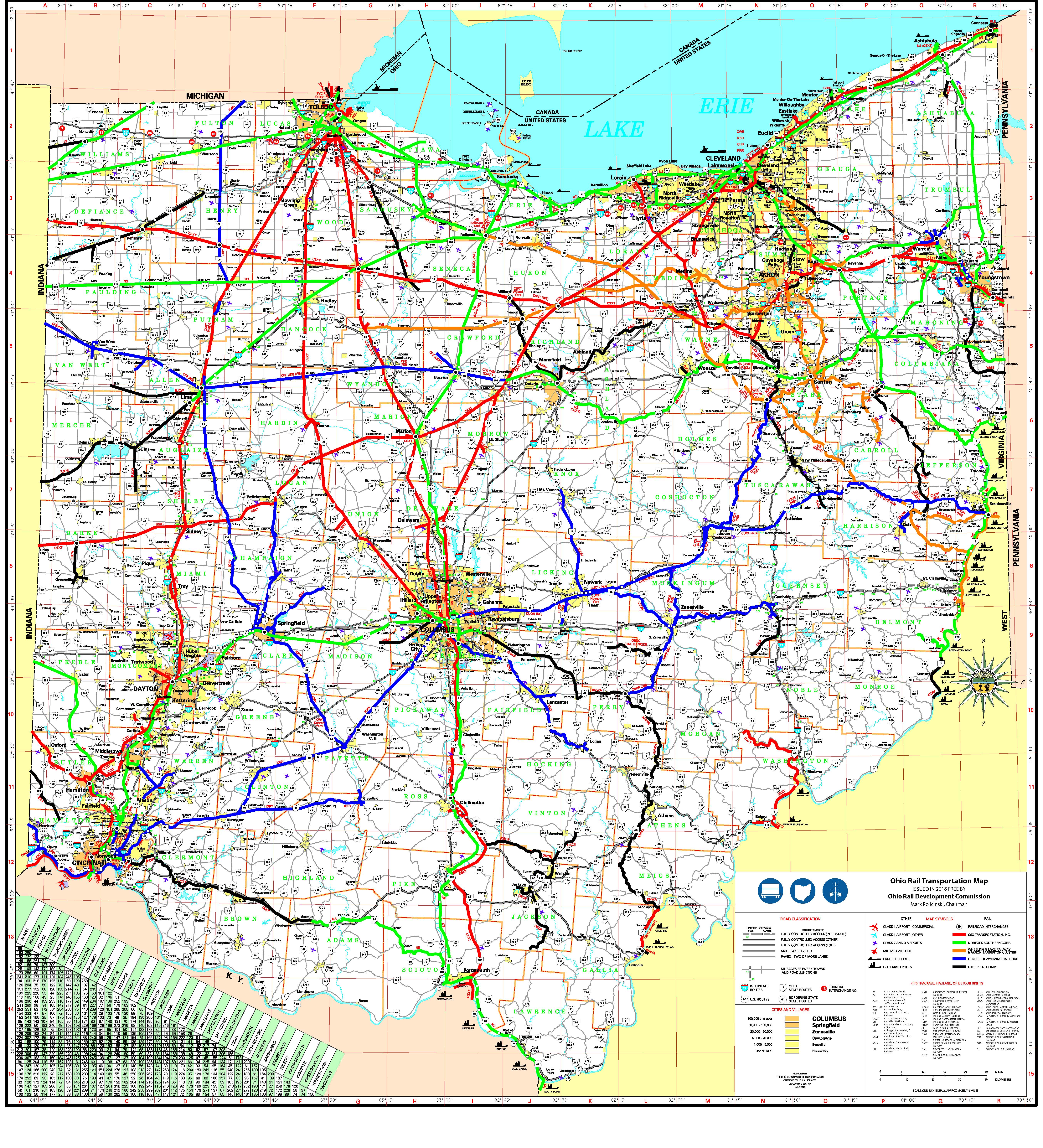
- ↑ 2012 Official Ohio Rail Transportation Map (Map). 1:570240. Ohio Rail Development Commission. June 2012. § Q8. Retrieved December 15, 2013.
- ↑ Google (December 16, 2013). "Wheeling and Lake Erie Railway: System Map" (Map). Google Maps. Google. Retrieved December 16, 2013.
- ↑ Staff. Ohio (PDF). Scenic Byways (Report). American Automobile Association. p. 1. Retrieved January 1, 2014.
- ↑ State of West Virginia (PDF) (Map). No scale given. General Highway Map. West Virginia Division of Highways. 2011. Wheeling inset. Retrieved January 24, 2014.
- 1 2 Wheeling Heritage Trail (PDF) (Map). 1:95,040. Wheeling Natural Heritage Area. Archived from the original (PDF) on October 7, 2011.
- 1 2 Wheeling & Moundsville: Marshall & Ohio Counties (PDF) (Map). Urban Area Map. West Virginia Division of Highways. 2005. p. 1. Retrieved January 24, 2014.
- ↑ Hicks, Ian (October 4, 2011). "Ground Broken For Local Miracle Field". The Intelligencer & Wheeling News Register. OCLC 2269511. Retrieved December 20, 2013.
- ↑ Hanson, Shelley (October 20, 2012). "Skatepark Going Strong After Five Years". The Intelligencer & Wheeling News Register. OCLC 2269511. Retrieved December 20, 2013.
- ↑ Staff (2012). Traffic Survey Report: Belmont County (PDF) (Report). Ohio Department of Transportation. pp. 4–5. Retrieved December 15, 2013.
- ↑ "I-470: Ohio to I-70" (PDF) (Map). Interstate Highway Counts. Scale not given. West Virginia Department of Transportation. 2012. Retrieved December 15, 2013.
- ↑ Slater, Rodney E. (Spring 1996). "The National Highway System: A Commitment to America's Future". Public Roads. Federal Highway Administration. 59 (4). ISSN 0033-3735. Retrieved January 24, 2011.
- ↑ National Highway System: Ohio (PDF) (Map). 1:3015936. Federal Highway Administration. October 1, 2012. Retrieved December 15, 2013.
- ↑ National Highway System: West Virginia (PDF) (Map). 1:8448000. Federal Highway Administration. October 1, 2012. Retrieved December 15, 2013.
- ↑ General Location of National System of Interstate Highways Including All Additional Routes at Urban Areas (Map). Scale not given. Bureau of Public Roads. September 1955. Wheeling, West Virginia inset. OCLC 4165975. Retrieved January 24, 2011.
- ↑ Route 2 and I-470, Wheeling: Environmental Impact Statement (Report). Federal Highway Administration. 1972.
- ↑ Gompers, Theadiane (April 7, 1997). "LaBelle". Wheeling Intelligencer. p. A8. OCLC 2269511. Retrieved December 31, 2013 – via ProQuest. (subscription required (help)).
- ↑ United States nominal Gross Domestic Product per capita figures follow the Measuring Worth series supplied in Johnston, Louis; Williamson, Samuel H. (2016). "What Was the U.S. GDP Then?". MeasuringWorth. Retrieved April 10, 2016. These figures follow the figures as of 2015.
- ↑ Staff (1976). Better Roads. 46. Park Ridge, Ill. p. 119. OCLC 1519687.
- ↑ Official Ohio Highway Map (MrSID) (Map). 1:554400. Ohio Department of Transportation. 1975. § O10. Retrieved January 25, 2011.
- ↑ Official Ohio Highway Map (MrSID) (Map). 1:554400. Ohio Department of Transportation. 1976. § O10. Retrieved January 25, 2011.
- ↑ Robinson, E O'Neil (July 25, 1983). "Wheeling's I-470 is Troubled Bridge". Pittsburgh Post-Gazette. Associated Press. ISSN 1068-624X. Retrieved January 25, 2011.
- ↑ Staff (September 15, 1981). "Machinery Ready to Roll". The Daily Times. Portsmouth, Ohio. Associated Press. p. 11. ISSN 8750-6963. Retrieved January 25, 2011.
- ↑ West Virginia Official Highway Map (Map). Scale not given. West Virginia Division of Highways. 1976. Wheeling inset.
- ↑ Official Ohio Highway Map (MrSID) (Map). 1:6969600. Ohio Department of Transportation. 1983. § O10. Retrieved January 25, 2011.
- ↑ Staff (January 1998). As a Matter of Fact. West Virginia Division of Highways. p. II‑8. OCLC 45763179.
- ↑ Hodel, Martha Bryson (November 20, 1980). "New Bridges to Cut Down Travel Time". The Daily Sentinel. Pomeroy, Ohio. Associated Press. p. 1. OCLC 16933050. Retrieved January 25, 2011.
- ↑ Harrison, Eric (March 1, 1987). "For Sale: 1 Toll Bridge In The Heart Of The 'Rust Belt'". Philadelphia Inquirer. p. A19. OCLC 8733259. Retrieved December 15, 2013 – via ProQuest. (subscription required (help)).
- ↑ Staff (December 22, 1996). "Interstate Reopens After Crews Fill Old Mines Under Roadway". The Plain Dealer. Cleveland, Ohio. Associated Press. p. 4B. OCLC 7742580. Retrieved December 15, 2013 – via ProQuest. (subscription required (help)).
- ↑ Ruegsegger, L. Rick; Lefchik, Thomas E. (July–August 1999). "Managing Car-Crunching Sinkholes". Public Roads. Federal Highway Administration. 63 (1). ISSN 0033-3735. Retrieved February 2, 2011.
- ↑ Staff (September 23, 1996). "Ohio: ODOT Battles Mines". Dayton Daily News. Associated Press. p. 5B. OCLC 11639039. Retrieved December 15, 2013 – via ProQuest. (subscription required (help)).
- ↑ Schelzig, Erik (January 7, 2005). "West Virginia Governor Declares State of Emergency Due to Flood". Kentucky New Era. Hopkinsville, Ky. Associated Press. OCLC 14064300. Retrieved January 29, 2011.
- ↑ Connors, Fred (October 27, 2007). "Ready or Not, Tunnel to Open". The Intelligencer & Wheeling News Register. OCLC 2269511. Archived from the original on February 4, 2011. Retrieved January 24, 2011.
- 1 2 "Motorists Warned to Avoid Wheeling Tunnel". Harrisonburg, Va.: WHSV-TV. July 23, 2008. Archived from the original on February 4, 2011. Retrieved January 24, 2011.
- ↑ Johnson, J.W., Jr. (February 2, 2010). "Tube Closed Until October". The Intelligencer & Wheeling News Register. OCLC 2269511. Archived from the original on February 4, 2011. Retrieved January 24, 2011.
- ↑ Staff (December 8, 2000). "Veterans lead remembrances of Pearl Harbor: Interstate named to commemorate USS West Virginia". Charleston Daily Mail. Associated Press. OCLC 13060388. Retrieved December 15, 2013 – via ProQuest. (subscription required (help)).
- ↑ Staff (2013-07-16). Roadway Description Inventory Report: DESTAPE (PDF) (Report). Ohio Department of Transportation. p. 27. Retrieved 2013-12-17.
External links
 Media related to Interstate 470 (Ohio – West Virginia) at Wikimedia Commons
- Interstate 470 in Ohio at AA Roads
- Interstate 470 in West Virginia at AA Roads
1Former | ||