Interstate 195 (New Jersey)
| ||||
|---|---|---|---|---|
|
Central Jersey Expressway James J. Howard Interstate Highway | ||||
|
I-195 highlighted in red | ||||
| Route information | ||||
| Auxiliary route of I-95 | ||||
| Maintained by NJDOT | ||||
| Length: | 34.17 mi[1] (54.99 km) | |||
| Existed: | 1968 – present | |||
| Major junctions | ||||
| West end: |
| |||
|
| ||||
| East end: |
| |||
| Location | ||||
| Counties: | Mercer, Monmouth, Ocean | |||
| Highway system | ||||
| ||||
.svg.png)
_map.svg.png)
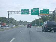
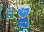
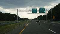
Interstate 195 (abbreviated I-195) is an auxiliary route of the Interstate Highway System located in the U.S. state of New Jersey. Its western end is at I-295 and Route 29 just south of Trenton, New Jersey in Hamilton Township, Mercer County while its eastern end is at the Garden State Parkway, Route 34 and Route 138 in Wall Township, Monmouth County. I-195 is 34.17 miles (54.99 km) in length. The route is mostly a four-lane highway that runs through wooded areas in the center of New Jersey. It has an interchange with the New Jersey Turnpike (I-95) at Exit 7A in Robbinsville Township and serves as a main access road to Six Flags Great Adventure (which is off the CR 537 exit in Jackson Township) and the Jersey Shore. I-195 is occasionally referred to as the Central Jersey Expressway. On April 6, 1988, President Ronald Reagan signed H.R. 4263 naming Interstate 195 in New Jersey the James J. Howard Interstate Highway, in honor of the late James J. Howard.
The current I-195 was initially planned as a toll road called the Trenton-Asbury Park Expressway in the 1950s. In the 1960s, the road became part of the proposed Route 37 and Route 38 freeways that were to cross the central part of the state. A compromise between these two freeways was planned between Trenton and Belmar and would get Interstate Highway funding, becoming I-195. This freeway was built in several stages during the 1970s and 1980s. Between 2005 and 2015, a plan existed to extend the I-195 designation west to the planned interchange between the Pennsylvania Turnpike (I-276) and I-95 in Bristol Township, Pennsylvania. Under this plan, I-195 would have followed present I-95 and I-295 to the north of Trenton. It was instead decided to extend the I-295 designation west and south, along existing I-95, to the new interchange.
Route description
Mercer County
I-195's western terminus is at a modified cloverleaf interchange with I-295 in Hamilton Township, Mercer County, located southeast of the city of Trenton. From this end, the freeway continues north into Trenton as Route 29. I-195 serves as the southern continuation of Route 29, continuing east from I-295 as a six-lane expressway, passing between suburban neighborhoods to the north and the Crosswicks Creek to the south.[1][2] After the exit for US 206, the highway narrows to four lanes and turns northeast as it interchanges with CR 524 and CR 620.[1] Following this, I-195 passes near more neighborhoods and runs to the northwest of Gropp Lake before turning more to the east.[2] The route has a cloverleaf interchange with Yardville-Hamilton Square Road before passing near business parks and reaching a cloverleaf junction with US 130. After US 130, the road enters Robbinsville Township as the settings start to become more rural, with a few areas of suburban development.[1][2] In Robbinsville Township, there is a ramp that provides access to the New Jersey Turnpike (I-95). Shortly after passing over the New Jersey Turnpike, I-195 reaches the exit for CR 526.[1] The highway runs to the north of Allentown before briefly forming the border between Robbinsville Township to the north and Upper Freehold Township, Monmouth County to the south as it reaches the interchange with CR 524/CR 539.[1][2]
Monmouth and Ocean counties
Upon passing under CR 524/CR 539, I-195 fully enters Upper Freehold Township in Monmouth County and continues east through a mix of woodland and farmland.[1][2] The next interchange the highway reaches is with CR 43.[1] Past this exit, the highway passes through more rural areas and crosses into Millstone Township. In this area, I-195 turns to the southeast and enters more forested areas as it comes to a cloverleaf interchange with CR 537.[1][2] This exit off I-195 provides access to Six Flags Great Adventure and the Jackson Premium Outlets.[2] Due to the presence of Six Flags, this exit off I-195 can become busy during the summer months since it provides access to the park from both the New Jersey Turnpike and the Garden State Parkway, which lies just east of I-195's eastern terminus.[3][4] Upon crossing CR 537, the highway enters Jackson Township in Ocean County and continues east through heavy woods. The road comes to an exit with CR 527, where there is a park and ride lot for motorists. The median of I-195 widens past the CR 527 junction before narrowing as it comes to the CR 638 interchange.[1][2] The road runs through more woodland, with nearby residential development increasing.[2]
After crossing the North Branch Metedeconk River, I-195 continues into Howell Township, Monmouth County and turns northeast, reaching a cloverleaf interchange with US 9.[1][2] At this point, the road turns east again and soon heads back into dense woods.[2] After crossing the Manasquan River, the expressway interchanges with CR 547, which provides access to CR 524 and CR 549. Shortly after CR 547, I-195 enters Wall Township and passes through Allaire State Park.[1][2] The eastern end of I-195 is located at Exit 35, its junction with Route 34 that has access to the southbound Garden State Parkway from the eastbound direction.[1] At the exit for Route 34, I-195 ends and Route 138 begins, but the highway and exit numbering continue onto Route 138, marking the interchange with the Garden State Parkway as Exit 36.[1][2] Past this interchange, Route 138 continues east to Belmar on the Jersey Shore as an arterial boulevard, making connections with Route 18 and Route 35.[2]
History
What would become I-195 was first proposed in the late 1950s as a toll road called the Trenton-Asbury Park Expressway that was to be operated by the New Jersey Highway Authority, the owner of the Garden State Parkway at the time.[5] In 1965, this road would be incorporated into a planned Central Jersey Expressway System. The western portion would become a part of the Route 37 freeway that was to run from Trenton to Seaside Heights while the eastern portion would become a part of the Route 38 freeway that was to run from Camden to Belmar. The two freeways were to meet near Fort Dix.[6] By 1967, plans for the Route 38 freeway were canceled, leaving Route 37 as the only planned east-west freeway through central New Jersey. The routing of this freeway, which was to be called the Central Jersey Expressway, was changed to run from the Trenton area east to Wall Township[7] In addition, officials pushed for Interstate Highway funding for the freeway, with funds to be diverted from the canceled I-278 in Union County. The proposed freeway would cost $60 million.[8]
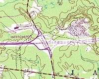
By 1970, construction took place on the route between CR 539 near Allentown and CR 527 in Jackson Township.[9] The portion of I-195 between the New Jersey Turnpike and CR 527 was opened by 1973 and construction on the section between White Horse and the New Jersey Turnpike began.[10] In 1979, I-195 was completed east to Squankum.[11] By 1983, the length of I-195 was completed.[12]
When it was planned, I-195 did not intersect I-95 at all; it instead connected to I-295 at its west end.[12] When I-95 was re-routed to the New Jersey Turnpike after the cancellation of the Somerset Freeway, I-195 was connected to I-95.[13] Since I-95 abruptly ends at I-295 and US 1 in Lawrence Township, motorists must take I-295 southbound to I-195 east in order to access I-95/New Jersey Turnpike.[14]
On April 6, 1988, President Ronald Reagan signed H.R. 4263 naming I-195 in New Jersey the James J. Howard Interstate Highway, in honor of the late James J. Howard, a U.S. Representative from New Jersey who advocated improving the highways of the United States.[15] In the late 1990s, the New Jersey Department of Transportation considered the possibility of widening I-195 to six lanes between the New Jersey Turnpike and CR 537 in order to accommodate traffic going to Six Flags Great Adventure.[16] The interchange with CR 537 was improved in 1997 by adding separate ramps to westbound and eastbound CR 537 from I-195 and by making the westbound ramp two lanes for Six Flags traffic.[17]
I-195, like many other highways in New Jersey, once had solar powered emergency call boxes every 1 mile (1.6 km). With the advent of cell phones, the call boxes saw limited use. To save on maintenance costs, the NJDOT removed the call boxes in 2005.[18]
On April 30, 2010, NJDOT started a project to repave the expressway both eastbound and westbound from just east of the Turnpike overpasses near Exit 7 in Robbinsville Township to Exit 11 in Upper Freehold Township. This was completed in late autumn of 2010.[19]
From December 2004 until November 2014, the New Jersey Turnpike (Interstate 95) was widened with the construction of new outer roadways ("truck lanes") that extended the "dual-dual" roadways south to Interchange 6 in Mansfield Township from its former end at Interchange 8A in Monroe Township. As part of this project, the overpasses carrying I-195 over the Turnpike (I-95) were reconstructed, the Interchange 7A toll gate was widened, and all the ramps connecting directly to the mainline of the Turnpike were rebuilt which included building a new high-speed ramp over I-195 to enter the northbound lanes of the Turnpike.[20][21][22]

In preparation for the completion of the Pennsylvania Turnpike/Interstate 95 Interchange Project and simultaneous rerouting of I-95 in 2017, plans were made to extend I-195 west from its present-day western terminus along I-295 and I-95, continuing counterclockwise to the north, west and south around Trenton to the new interchange.[14] I-295 would have been truncated to the current interchange with I-195. Officials from New Jersey and Pennsylvania had agreed to submit the I-195 request to American Association of State Highway and Transportation Officials, as no route designation is official until approved by them.[23] Had it been approved, approximately 27.1 miles (43.6 km) would have been added to I-195.[24] Interchange renumbering would have also taken place in concert with the future I-195 designation in Pennsylvania and both the planned and current I-195 designation in New Jersey.[25] This proposal had received conditional approval from AASHTO.[26] However, on May 20, 2015, the original plan of extending I-295 west and south into Pennsylvania to the new interchange was approved instead, leaving the western terminus of I-195 at its current location.[27]
Future
The New Jersey Department of Transportation (NJDOT) has studied proposals to expand I-195 from Exit 16 near Six Flags to the New Jersey Turnpike from 4 to 6 total lanes, which would eliminate the grass median in the process.[16]
Exit list
| County | Location | mi[1] | km | Exit | Destinations | Notes | |
|---|---|---|---|---|---|---|---|
| Mercer | Hamilton Township | 0.00 | 0.00 | 60 A-B | Western terminus, continues as Route 29, signed under I-295 exit numbering | ||
| 0.92 | 1.48 | 1 A-B | Eastbound exit and westbound entrance | ||||
| 1.55 | 2.49 | 2 | |||||
| 3.37 | 5.42 | 3 A-B | Yardville-Hamilton Square Road – Yardville, Hamilton Square | ||||
| 4.90 | 7.89 | 5 A-B | |||||
| Robbinsville Township | 6.25 | 10.06 | 6 | Interchange 7A of NJTP | |||
| 7.31 | 11.76 | 7 | No access from CR 526 westbound to I-195 eastbound; access provided by Exit 8 | ||||
| Mercer–Monmouth county line | Robbinsville–Upper Freehold township line | 8.54 | 13.74 | 8 | |||
| Monmouth | Upper Freehold Township | 11.79 | 18.97 | 11 | Coxs Corner, Imlaystown | Access via CR 43 | |
| Monmouth–Ocean county line | Millstone–Jackson township line | 16.71 | 26.89 | 16 | Splits into exits 16A-B eastbound | ||
| Ocean | Jackson Township | 21.04 | 33.86 | 21 | |||
| 22.99 | 37.00 | 22 | Georgia, Jackson Mills | Access via CR 638 | |||
| Monmouth | Howell Township | 27.17 | 43.73 | 28 A-B | |||
| 31.57 | 50.81 | 31 A-B | |||||
| Wall Township | 34.17 | 54.99 | 35 A-B | Eastern terminus of I-195, continues as Route 138 | |||
| 0.36 | 0.58 | 36 | Cloverleaf interchange with additional ramps, exit along Route 138 | ||||
1.000 mi = 1.609 km; 1.000 km = 0.621 mi
| |||||||
See also
 U.S. Roads portal
 New Jersey portal
References
- 1 2 3 4 5 6 7 8 9 10 11 12 13 14 15 "Interstate 195 straight line diagram" (PDF). New Jersey Department of Transportation. Retrieved 2010-01-04.
- 1 2 3 4 5 6 7 8 9 10 11 12 13 14 Google (2009-06-08). "overview map of I-195" (Map). Google Maps. Google. Retrieved 2009-06-08.
- ↑ "Directions to the Restaurant / Golf Club". The Greens Restaurant & Banquet Hall. Retrieved 2010-01-04.
- ↑ Kahn, Eve M. (September 13, 1991). "Great Adventure: Highs and Lows". The New York Times. Retrieved 2010-01-04.
- ↑ Proposed Trenton-Asbury Park Expresseway. New Jersey State Highway Department. August 1964.
- ↑ Plans for a Central Jersey Expressway System. New Jersey State Highway Department. 1965.
- ↑ Route 37 Freeway Relocation Study. New Jersey Department of Transportation. 1967.
- ↑ New Jersey Highway Facts. New Jersey Department of Transportation. 1967.
- ↑ Map of New Jersey (Map). Cartography by General Drafting. Esso. 1970.
- ↑ Pennsylvania (Map). Cartography by General Drafting. Exxon. 1973.
- ↑ Narvaez, Alfonso A. (September 2, 1979). "State to Winnow Highway Program; State to Winnow Highway Projects" (Fee required). The New York Times. Retrieved 2010-01-05.
- 1 2 State Farm Road Atlas (Map). Cartography by Rand McNally. State Farm Insurance. 1983.
- ↑ United States-Canada-Mexico Road Atlas (Map). Rand McNally. 1996.
- 1 2 Frassinelli, Mike (September 7, 2010). "N.J., Pennsylvania officials plan to close longtime gap on Route 95". The Star-Ledger. Retrieved 2010-09-20.
- ↑ "Today in Interstate History". American Association of State Highway and Transportation Officials. Archived from the original on September 27, 2007. Retrieved 2006-07-24.
- 1 2 Sapia, Joseph (August 2, 1996). "Expansion of I-195 Gets Look from DOT". Asbury Park Press.
- ↑ "I-195 Improvements End Great Adventure Backups". Asbury Park Press. July 17, 1997.
- ↑ Barlas, Thomas (February 28, 2007). "Last call for N.J.'s roadside call boxes". The Press of Atlantic City.
- ↑ "Expect Delays on I-195 in Upper Freehold". Examiner. 2010-05-06.
- ↑ "Widening Program Overview". New Jersey Turnpike Authority. Retrieved 2010-01-05.
- ↑ "Brief Overview Central Jersey Transportation Forum July 20, 2006 Meeting" (PDF). Delaware Valley Regional Planning Commission. July 20, 2006. Retrieved 2010-01-05.
- ↑ Gov. Christie, NJDOT Commissioner FoxPraise $2.3 Billion NJ Turnpike Infrastructure Investment Project, New Jersey Turnpike Authority. Accessed November 3, 2014. "The Widening Program created a three-lane Outer Roadway in each direction over the 25 miles between Interchange 6 in Mansfield Township, Burlington County, and Interchange 8A in Monroe Township, Middlesex County."
- ↑ "Design Advisory Committee Meeting #2 Summary" (PDF). PA Turnpike / I-95 Interchange Project. 2005-09-14. Retrieved 2006-08-08.
- ↑ Google (2010-01-05). "overview map of I-195 extension" (Map). Google Maps. Google. Retrieved 2010-01-05.
- ↑ The Design Management Team, Pennsylvania Turnpike/Interstate 95 Interchange Project. "Exit renumbering".
The re-designation of I-95 and a portion of I-295 in NJ as I-195, necessitated when the PA and NJ Turnpikes are designated as I-95, will indeed require new exit numbers on those interstates as well as the existing stretch of I-195 in NJ. This action, which is still approximately 5-6 years away since the new connection between I-95 and the PA Turnpike needs to be constructed, was acknowledged by the NJ Department of Transportation in their support of the re-numbering request to the Federal Highway Administration and AASHTO. Details regarding interim exit numbering and public relations efforts at that time are not available, but will be determined as the project moves forward.
- ↑ Keith, Kevin (May 5, 2007). "Report of the Special Committee on U.S. Route Numbering" (PDF) (Report). American Association of State Highway and Transportation Officials. p. 6. Retrieved April 21, 2015.
- ↑ Nadeau, Gregory G. (May 20, 2015). "FHWA to AASHTO I-95 Designation" (PDF) (Letter). Letter to Bud Wright. Washington, DC: Federal Highway Administration. Retrieved June 8, 2015.
External links
| Wikimedia Commons has media related to: |
- Interstate 195 (Steve Anderson)
- New Jersey Roads: Interstate 195
- Speed Limits for State Roads: Interstate 195 in New Jersey
| ||