Interstate 10 in Florida
| |||||||
|---|---|---|---|---|---|---|---|
_map.svg.png) | |||||||
| Route information | |||||||
| Maintained by FDOT | |||||||
| Length: | 362.057 mi[1] (582.674 km) | ||||||
| Existed: | 1958 – present | ||||||
| Major junctions | |||||||
| West end: |
| ||||||
| |||||||
| East end: |
| ||||||
| Location | |||||||
| Counties: | Escambia, Santa Rosa, Okaloosa, Walton, Holmes, Washington, Jackson, Gadsden, Leon, Jefferson, Madison, Suwannee, Columbia, Baker, Nassau, Duval | ||||||
| Highway system | |||||||
| |||||||

The 362 miles (583 km) of Interstate 10 in Florida is the eastern most section of the east–west 2,460.34 miles (3,959.53 km) Interstate 10 (I-10) in the Southern United States. It is also the eastern end of the Interstate Highway known as the Christopher Columbus Transcontinental Highway, one of three coast to coast interstates, along with I-80 and I-90. The highway runs east from the Alabama border, traveling through the Panhandle of Florida, serving the major cities of Pensacola, Tallahassee, Lake City, and ending at Jacksonville, and carries the hidden Florida Department of Transportation designation of State Road 8 (SR 8).
Route description
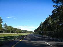
The interstate runs roughly parallel to U.S. Route 90 (US 90) but is a more direct route, bypassing the central cores of the cities. The interstate also runs through some of the least populated areas of the state.
The western terminus of I-10 is the Florida–Alabama state line at the Perdido River, just west of Pensacola, in Escambia County. Exit 7A, SR 297 (southbound), gives access to the Pensacola Naval Air Station and the National Museum of Naval Aviation. At exit 12, I-10 serves as the northern terminus of I-110, a spur route to central Pensacola.
The eastern terminus is located at I-95 in Downtown Jacksonville with an "End" I-10 sign.
History
Construction
Prior to the construction of I-10, US 90 was the main east–west highway across the state.
The first section of I-10 in Florida was completed between Sanderson and Jacksonville in 1961. Construction on points westward continued in 1962. The route between Sanderson and Winfield was completed in 1963. By 1967, construction had been completed from the Alabama state line to SR 87, and was under construction from Falmouth to I-75. New construction extending I-10 east from SR 87 to Mossy Head began in 1968. The Falmouth to I-75 segment opened in 1969. Construction began in 1970 further extending I-10 westward from Mossy Head to DeFuniak Springs. New construction began in 1973 from DeFuniak Springs to Caryville and from Drifton to Capitola; the segment between Drifton and Falmouth opened that year. The Capitola to Drifton segment was completed the following year. Construction began between Caryville and Chipley in 1974, and from Chipley to Midway in 1975. The segment between Chipley and Midway was completed in 1977 except for a small portion between Kynesville and Oakdale; in 1978, the entire length of I-10, as well as the I-110 spur in Pensacola across the state opened along its original planned route.[2]
During the planning stage of construction, I-10 was placed just north of the central business district of Tallahassee, roughly along the current route of US 90 through town, while later a spur route was proposed to go to the core of the city. Both of these proposals were dropped and a route across the north side of the city was chosen. In 2008 the interstate stretch in Tallahassee was expanded to six lanes to alleviate congestion.
In 2002, I-10, along with most of Florida's interstates, switched over from a sequential exit numbering system to a mileage based exit numbering system.[3]
Rest area security concerns
In 1993, a British tourist was killed at the Jefferson County Rest Area in a botched burglary by teens.[4][5] As a result, Florida rest stops were either patrolled or closed for at least two years when lawmakers approved cut-backs.[6] A number of rest areas are currently regularly patrolled at night by armed security, often private, due to a resurgence in rest area-related violent crime.[7]
Hurricane Ivan
On September 16, 2004, Hurricane Ivan made landfall near Pensacola, with the resulting storm surge causing heavy damage to the Interstate 10 bridge across Escambia Bay. As much as a quarter mile (400 m) of the bridge collapsed into the bay consisting of 58 bridge segments with an additional 66 segments knocked out of alignment, with most of the damage coming from the eastbound lanes.[8] A $26.5 million project was awarded the following day to Gilbert Southern/Massman and to the Parsons Corporation to make emergency repairs to the bridge. Work was completed on October 4 on the westbound bridge, restoring two-way traffic seven days ahead of schedule. The more heavily damaged eastbound bridge was completely repaired on November 20, just 66 days after Hurricane Ivan made landfall, and 27 days ahead of schedule. The contractor received $1.5 million in bonuses for the early completion. The commercial truck detour sent truck traffic into Alabama and I-65 to avoid the bridges.
The causeway that carries US 90 across the northern part of the same bay was also heavily damaged.
Exit list
| County | Location | mi[1] | km | Old exit[3] | New exit | Destinations | Notes | |
|---|---|---|---|---|---|---|---|---|
| Escambia | | 0.000 | 0.000 | Alabama state line (Perdido River) | ||||
| | 1.1[9] | 1.8 | Inspection station (eastbound only) | |||||
| | 3.4[9] | 5.5 | Weigh station | |||||
| | 4.4[9] | 7.1 | State of Florida welcome center (eastbound only) | |||||
| | 5.523 | 8.888 | 1 | 5 | ||||
| Pine Forest | 7.092 | 11.413 | 2 | 7 | Signed as exits 7A (south) and 7B (north) eastbound | |||
| Brent–Ensley line | 10.270 | 16.528 | 3 | 10 | Signed as exits 10A (south) and 10B (north) | |||
| | 12.422 | 19.991 | 4 | 12 | Exit 6 on I-110; Northern terminus of I-110 | |||
| Ferry Pass | 12.928 | 20.806 | 5 | 13 | ||||
| 16.495 | 26.546 | 6 | 17 | |||||
| Escambia Bay | 16.549– 19.166[9] | 26.633– 30.845 | Escambia Bay Bridge | |||||
| Santa Rosa | | 21.700 | 34.923 | 7 | 22 | |||
| | 25.946 | 41.756 | 8 | 26 | ||||
| | 27.158– 27.747[9] | 43.707– 44.654 | Bridge over Blackwater River | |||||
| | 28.415 | 45.730 | 9 | 28 | ||||
| | 30.2[9] | 48.6 | Rest area | |||||
| | 31.265 | 50.316 | 10 | 31 | ||||
| Okaloosa | | 45.072 | 72.536 | 11 | 45 | |||
| Crestview | 56.300 | 90.606 | 12 | 56 | ||||
| | 60.0[9] | 96.6 | Rest area | |||||
| Walton | Eglin AFB | 69.482 | 111.820 | 13 | 70 | |||
| DeFuniak Springs | 84.588 | 136.131 | 14 | 85 | ||||
| Holmes | Ponce de Leon | 96.018 | 154.526 | 15 | 96 | Rest area in southeast corner | ||
| Washington | | 104.038 | 167.433 | 16 | 104 | |||
| Holmes | Bonifay | 111.685 | 179.740 | 17 | 112 | |||
| Washington | Chipley | 119.680 | 192.606 | 18 | 120 | |||
| Jackson | | 129.833 | 208.946 | 19 | 130 | |||
| | 133.2[9] | 214.4 | Rest area | |||||
| Marianna | 136.441 | 219.581 | 20 | 136 | ||||
| | 142.126 | 228.730 | 21 | 142 | ||||
| | 152.041 | 244.686 | 22 | 152 | ||||
| | 155.6[9] | 250.4 | Weigh station | |||||
| | 158.011 | 254.294 | 23 | 158 | ||||
| Apalachicola River | 160.061– 161.220[9] | 257.593– 259.458 | Dewey M. Johnson Bridge | |||||
| Gadsden | | 161.30[9] | 259.59 | Rest area | ||||
| | 165.729 | 266.715 | 24 | 166 | ||||
| | 174.093 | 280.176 | 25 | 174 | ||||
| | 180.963 | 291.232 | 26 | 181 | ||||
| Midway | 191.949 | 308.912 | 27 | 192 | ||||
| Ochlockonee River | 193.569– 193.798[9] | 311.519– 311.888 | Bridge | |||||
| Leon | | 194.3[9] | 312.7 | Rest area | ||||
| Tallahassee | 195.731 | 314.999 | 28 | 196 | ||||
| 199.010 | 320.276 | 29 | 199 | |||||
| 202.678 | 326.179 | 30 | 203 | |||||
| 208.570 | 335.661 | 31 | 209 | Signed as exits 209A (west) and 209B (east) | ||||
| Jefferson | | 216.737 | 348.804 | 32 | 217 | |||
| | 225.055 | 362.191 | 33 | 225 | ||||
| | 232.849 | 374.734 | 34 | 233 | ||||
| | 234.8[9] | 377.9 | Rest area | |||||
| Madison | | 241.217 | 388.201 | 35 | 241 | |||
| | 251.520 | 404.782 | 36 | 251 | ||||
| | 258.106 | 415.381 | 37 | 258 | ||||
| | 261.771 | 421.280 | 38 | 262 | ||||
| | 263.3[9] | 423.7 | Weigh station | |||||
| | 264.9[9] | 426.3 | Rest area | |||||
| Suwannee River | 268.142– 268.246[9] | 431.533– 431.700 | Bridge | |||||
| Suwannee | | 270.6[9] | 435.5 | Inspection station | ||||
| | 274.642 | 441.993 | 39 | 275 | ||||
| | 282.770 | 455.074 | 40 | 283 | ||||
| | 292.127 | 470.133 | 41 | 292 | ||||
| | 293.4[9] | 472.2 | Rest area (eastbound) | |||||
| Columbia | | 294.4[9] | 473.8 | Rest area (westbound) | ||||
| | 296.199 | 476.686 | 42 | 296 | Signed as exits 296A (south) and 296B (north); exit 435 on I-75 | |||
| | 301.293 | 484.884 | 43 | 301 | ||||
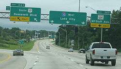
| Lake City | 303.458 | 488.368 | 44 | 303 | ||||
| Baker | | 317.8[9] | 511.4 | Rest area | ||||
| | 323.827 | 521.149 | 45 | 324 | ||||
| | 326.750 | 525.853 | 46 | 327 | ||||
| | 332.782 | 535.561 | 47 | 333 | ||||
| Macclenny | 335.145 | 539.364 | 48 | 335 | ||||
| | 336.312 | 541.242 | 49 | 336 | ||||
| Nassau |
No major junctions | |||||||
| Duval | | 343.879 | 553.420 | 50 | 343 | |||
| | 350.370 | 563.866 | 350 | opened in 2010, replaced rest area | ||||
| Whitehouse | 352.096 | 566.644 | 51 | 351 | Chaffee Road (CR 115C) – Whitehouse) | |||
| Marietta | 355 | Hammond Boulevard | Opened June 8, 2016[10] | |||||
| 356.269 | 573.359 | 52 | 355 | Marietta (Cahoon Road) | Former right-in/right-out; replaced 2016 by Hammond Boulevard exit | |||
| Jacksonville | 356.838 | 574.275 | 53 | 356 | Exit 21 on I-295 | |||
| 357.910 | 576.000 | 54 | 357 | |||||
| 359.185 | 578.052 | 55 | 358 | |||||
| 359.895 | 579.195 | 56 | 359 | Luna Street to Lenox Avenue / Highway Avenue | Westbound exit and eastbound entrance | |||
| 360.773 | 580.608 | 57 | 360 | |||||
| 361.046 | 581.047 | 58 | 361 | West end of US 17 / SR 15 / SR 228 overlap; westbound exit and eastbound entrance | ||||
| 361.642 | 582.006 | 59 | 362 | Stockton Street - Riverside | ||||
| 362.057 | 582.674 | I-95 exit 351B | ||||||
1.000 mi = 1.609 km; 1.000 km = 0.621 mi
| ||||||||
References
- 1 2 Florida Department of Transportation. "FDOT Interchange Report" (PDF). Retrieved October 4, 2007.
- ↑ "Florida's Interstates: A Half Century of Progress". Retrieved 4 October 2014.
- 1 2 "Florida's Interstate Exit Numbers- I-10". Florida Department of Transportation. Retrieved 2010-11-18.
- ↑ "Orlando Sentinel: Articles about Rest stop". Orlando Sentinel. Retrieved 4 October 2014.
- ↑ Crist: Appeal Denied in British Tourist's I-10 Rest Stop Murder
- ↑ "Tourist Killed in Florida, Prompting New Patrols," by Larry Rohter (New York Times; September 15, 1993) retrieved July 5, 2010
- ↑ "Highway rest areas no place to let your guard down," by Sofia Santana (South Florida Sun-Sentinel; May 30, 2008) retrieved December 30, 2008
- ↑ Aerial Tour Of Panhandle Shows Devastation - Orlando News Story - WESH Orlando
- 1 2 3 4 5 6 7 8 9 10 11 12 13 14 15 16 17 18 19 20 21 FDOT straight line diagrams, accessed March 2014
- ↑ http://jacksonville.com/news/metro/2016-06-08/story/new-i-10-marietta-overpass-and-interchange-scheduled-open-wednesday
External links
 Media related to Interstate 10 in Florida at Wikimedia Commons
- I-10 North Florida (FDOT Construction Projects between Lake City and Jacksonville)
- Interstate 10 Index -- Florida(AARoads.com)
| Previous state: Alabama |
Florida | Next state: Terminus |