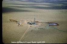
Innamincka Station


Innamincka Station often just called Innamincka is a pastoral lease in the Australian state of South Australia which operates as a cattle station.
Description
It located about 4 kilometres (2 mi) north east of Innamincka and 246 kilometres (153 mi) south east of Birdsville in the state of South Australia. The station occupies an area of 13,552 square kilometres (5,232 sq mi) and is the second largest station in South Australia after Anna Creek station. Innamincka is currently owned by the pastoral company, S. Kidman & Co..[1]
History
The name of the station is derived from two Aboriginal words meaning your shelter and your home.[2]
The station was established in 1872 by Robert Bostock and grew until it covered over 15,000 square kilometres (5,792 sq mi) and in 1881 it supported a herd of 8,000 cattle.[3] It the first station and permanent settlement set up along the Cooper Creek.[4] The station and stock were sold to William Campbell MLC in 1881 for $120,000.[3]
The Cooper Creek flooded inundating the station in 1891.[5]
The area around the station was struck by a severe drought in 1902.[6]
The homestead was washed away during the floods of 1906.
The cattle baron, Sidney Kidman, bought Innamincka in 1908 from the trustees of the estate of William Campbell. At the time the station ran over 4,000 square miles (10,360 km2) and he immediately sold a mob of 250 bullocks in the Adelaide yards which were much admired for their "breeding and quality".[7]
Between 1914 and 1916 the area was struck by drought, about 10,000 cattle died on the station during this time. Kidman lost over 75,000 head of stock on all of his properties through the channel country including Diamantina Lakes, Durham Downs, Glengyle and Sandringham Stations. Suffering financially, Kidman sold the property in 1918.[8]
Water levels came within 10 feet (3 m) of the 1906 mark during the 1939 floods.[9]
The entire area was struck by drought in 1946 with many cattle dying and properties destocking.[10]
The area suffered severe flooding in March 1949 when it was hit with record rainfall. Over the course of four weeks over 21 inches (533 mm) of rain fell, which as much as it would normally receive over four years.[11] The area was described as a "vast inland sea" with Coopers Creek running at over 15 miles (24 km) wide, it was expected that Lake Eyre would be filled by June of the same year.[12]
Les Irving, who was born at Innamincka, was the station manager in 1954, at this stage the property had an area of 9,175 square miles (23,763 km2). In 1953 the property only received 2 inches (51 mm) of rain and only 1.5 inches (38 mm) in 1954.[13]
The station had an excellent season in 1981 with the country reported as having "masses of yellow and white wildflowers". The station was still a Kidman property at this stage and covered an area of 16,000 square kilometres (6,178 sq mi) and Albert Nunn was the manager.[14]
See also
References
- ↑ "Innamincka". S. Kidman and Co. 2012. Retrieved 4 January 2013.
- ↑ "Innamincka and Cooper Creek state heritage area" (PDF). Government of South Australia. 8 November 2010. Retrieved 7 June 2013.
- 1 2 "Innamincka". Flinders Ranges Research. 2012. Retrieved 4 January 2013.
- ↑ Reardon, Mitch (1995). The Australian Geographic Book of Corner Country. Terrey Hills, New South Wales: Australian Geographic. pp. 91—108. ISBN 1-86276-012-8.
- ↑ "Floods at Cooper's Creek". The Chronicle. Adelaide: National Library of Australia. 21 April 1906. p. 40. Retrieved 8 January 2013.
- ↑ "Queensland Cattle Industry". The Chronicle. Adelaide: National Library of Australia. 31 January 1946. p. 9. Retrieved 8 January 2013.
- ↑ "Br S. Kidman buys Innamincka Station". The Register. Adelaide: National Library of Australia. 2 June 1908. p. 6. Retrieved 8 January 2013.
- ↑ Jill Bowen (2010). Kidman The Forgotten King. HarperCollins. ISBN 9780730445173.
- ↑ "New food supply". The Barrier Miner. Broken Hill, New South Wales: National Library of Australia. 18 March 1949. p. 1. Retrieved 8 January 2013.
- ↑ "Drought Closes On South-West Queensland.". Western Grazier. Wilcannia, New South Wales: National Library of Australia. 15 November 1946. p. 4. Retrieved 9 October 2014.
- ↑ "Rain in Inland". The Sydney Morning Herald. New South Wales: National Library of Australia. 26 March 1949. p. 4. Retrieved 8 January 2013.
- ↑ "Deluge of rin". The West Australian. Perth: National Library of Australia. 26 March 1949. p. 3. Retrieved 8 January 2013.
- ↑ "Out Among the.". The Advertiser. Adelaide: National Library of Australia. 6 December 1954. p. 4. Retrieved 8 January 2013.
- ↑ "The vast channel country where the postman arrives by plane!.". The Australian Women's Weekly. National Library of Australia. 2 December 1981. p. 32. Retrieved 8 January 2013.
Coordinates: 27°43′27″S 140°45′47″E / 27.724291°S 140.763184°E