Indiana County, Pennsylvania
| Indiana County, Pennsylvania | |
|---|---|
|
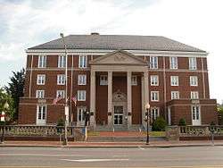
Indiana County Courthouse | |
 Location in the U.S. state of Pennsylvania | |
 Pennsylvania's location in the U.S. | |
| Founded | November 3, 1806 |
| Seat | Indiana |
| Largest borough | Indiana |
| Area | |
| • Total | 834 sq mi (2,160 km2) |
| • Land | 827 sq mi (2,142 km2) |
| • Water | 7.3 sq mi (19 km2), 0.9% |
| Population (est.) | |
| • (2015) | 86,966 |
| • Density | 105/sq mi (41/km²) |
| Congressional district | 9th |
| Time zone | Eastern: UTC-5/-4 |
| Website |
www |
Indiana County is a county located in the U.S. state of Pennsylvania. As of the 2010 census, the population was 88,880.[1] Its county seat is Indiana.[2] The county was created on March 30, 1803, from parts of Westmoreland and Clearfield counties and later organized in 1806.[3] Indiana County (Indiana meaning "land of the Indians") derives its name from the Iroquois Six Nations so-called Indiana Grant of 1768. The area of the Indiana Grant formed a proposed colony bordered on the north and west by the Ohio River, and was made up of what is now parts of eastern Kentucky, northern West Virginia, and western Pennsylvania. The proposed colony or part thereof was variously labelled on maps of the late 1700s as Indiana, Vandalia, Pittsylvania, or Westsylvania. This area was unrelated to and physically separated from the later named (1800), farther west Indiana Territory which became the State of Indiana.
Indiana County comprises the Indiana, PA Micropolitan Statistical Area, which is also included in the Pittsburgh-New Castle-Weirton, PA-OH-WV Combined Statistical Area.[4] It is in the defined region of the Pittsburgh media market. Indiana County is served by three different area codes: 724, 814, and 582.
The county proclaims itself the "Christmas Tree Capital of the World", shipping over one million trees annually.[5]
Geography
According to the U.S. Census Bureau, the county has a total area of 834 square miles (2,160 km2), of which 827 square miles (2,140 km2) is land and 7.3 square miles (19 km2) (0.9%) is water.[6]
Adjacent counties
- Jefferson County (north)
- Clearfield County (northeast)
- Cambria County (southeast)
- Westmoreland County (south)
- Armstrong County (west)
Demographics
| Historical population | |||
|---|---|---|---|
| Census | Pop. | %± | |
| 1810 | 6,214 | — | |
| 1820 | 8,882 | 42.9% | |
| 1830 | 14,252 | 60.5% | |
| 1840 | 20,782 | 45.8% | |
| 1850 | 27,170 | 30.7% | |
| 1860 | 33,687 | 24.0% | |
| 1870 | 36,138 | 7.3% | |
| 1880 | 40,527 | 12.1% | |
| 1890 | 42,175 | 4.1% | |
| 1900 | 42,556 | 0.9% | |
| 1910 | 66,210 | 55.6% | |
| 1920 | 80,910 | 22.2% | |
| 1930 | 75,395 | −6.8% | |
| 1940 | 79,854 | 5.9% | |
| 1950 | 77,106 | −3.4% | |
| 1960 | 75,366 | −2.3% | |
| 1970 | 79,451 | 5.4% | |
| 1980 | 92,281 | 16.1% | |
| 1990 | 89,994 | −2.5% | |
| 2000 | 89,605 | −0.4% | |
| 2010 | 88,880 | −0.8% | |
| Est. 2015 | 86,966 | [7] | −2.2% |
| U.S. Decennial Census[8] 2012 Estimate[1] | |||
As of the census[9] of 2000, there were 89,605 people, 34,123 households, and 22,521 families residing in the county. The population density was 108 people per square mile (42/km²). There were 37,250 housing units at an average density of 45 per square mile (17/km²). The racial makeup of the county was 96.87% White, 1.57% Black or African American, 0.08% Native American, 0.74% Asian, 0.01% Pacific Islander, 0.16% from other races, and 0.58% from two or more races. 0.51% of the population were Hispanic or Latino of any race. 25.9% were of German, 11.6% Italian, 10.7% Irish, 8.6% American, 7.1% English and 6.8% Polish ancestry according to Census 2000.
There were 34,123 households out of which 27.90% had children under the age of 18 living with them, 54.30% were married couples living together, 8.20% had a female householder with no husband present, and 34.00% were non-families. 26.50% of all households were made up of individuals and 11.80% had someone living alone who was 65 years of age or older. The average household size was 2.47 and the average family size was 2.99.
In the county, the population was spread out with 21.10% under the age of 18, 16.60% from 18 to 24, 24.80% from 25 to 44, 22.70% from 45 to 64, and 14.90% who were 65 years of age or older. The median age was 36 years. For every 100 females there were 94.00 males. For every 100 females age 18 and over, there were 90.60 males.
Micropolitan Statistical Area

The United States Office of Management and Budget[10] has designated Indiana County as the Indiana, PA Micropolitan Statistical Area (µSA). As of the 2010 U.S. Census[11] the micropolitan area ranked 4th most populous in the State of Pennsylvania and the 50th most populous in the United States with a population of 88,880. Indiana County is also a part of the Pittsburgh-New Castle-Weirton, PA-OH-WV Combined Statistical Area (CSA), which combines the population of Indiana, as well as the Allegheny, Armstrong, Beaver, Butler, Fayette, Lawrence, Washington and Westmoreland county areas in Pennsylvania. In West Virginia the counties included are Brooke and Hancock. And in Ohio, Jefferson County. The Combined Statistical Area ranked 4th in the State of Pennsylvania and 20th most populous in the United States with a population of 2,660,727.
Government and politics
As of the 2016 primary election held April 26, 2016, there were 48,710 registered voters across Indiana County's 69 precincts: 20,089 Democrats (41.24%); 22,134 Republicans (45.44%); and 6,487 Independents (13.32%).[12] This represents a slight demographic shift since November 2008, when a total of 58,077 registered voters were 45.89% (26,653) Democrat, 41.60% (24,159) Republican, and 12.51% (7,265) Independent.[13]
County commissioners
- Rodney Ruddock, Chairman, Republican
- Sherene Hess, Democrat
- Michael A Baker, Republican
Other county offices
- Coroner, Jerry L Overman Jr, Republican
- District Attorney, Patrick Dougherty, Democrat
- Prothonotary, Randy Degenkolb, Republican
- Recorder of Deeds and Register of Wills, Patricia Streams-Warman, Republican
- Sheriff, Robert Fyock, Republican
- Treasurer, Sandra Kirkland, Democrat
State Representatives
- Jeff Pyle, Republican, 60th district
- David Reed, Republican, 62nd district
- Cris Dush, (politician), Republican, 66th district
State Senator
- Donald C. White, Republican, 41st district
US Representatives
- Bill Shuster, Republican, 9th district
Education

Public school districts
- Armstrong School District (part)
- Apollo-Ridge School District (part)
- Blairsville-Saltsburg School District (part)
- Harmony Area School District (part)
- Homer-Center School District
- Indiana Area School District
- Marion Center Area School District
- Penns Manor Area School District
- Punxsutawney Area School District (part)
- Purchase Line School District (part)
- United School District
Post-secondary education
- Cambria-Rowe Business College – Indiana
- Indiana University of Pennsylvania – Indiana
- Westmoreland County Community College – Indiana
- WyoTech – Blairsville
Environment
In 2003, the county was recommended for non-attainment under EPA ozone standards based upon mobile source contribution to smog-forming emissions.[14]
The county is also the site of the Homer City Generating Station, a coal-burning power plant. The plant has caught the attention of environmentalists as being ranked second in emissions, in 2002, of Toxics Release Inventory (TRI) in Pennsylvania.[15] The plant also ranked high, in 2003, in the emissions of both sulfur dioxide and carbon dioxide ranking 4th and 28th in the nation.[16]
Communities

Under Pennsylvania law, there are four types of incorporated municipalities: cities, boroughs, townships, and, in at most two cases, towns. The following boroughs and townships are located in Indiana County:
Boroughs
Townships
Census-designated places
Census-designated places are geographical areas designated by the U.S. Census Bureau for the purposes of compiling demographic data. They are not actual jurisdictions under Pennsylvania law. Other unincorporated communities, such as villages, may be listed here as well.
Unincorporated communities
Population ranking
The population ranking of the following table is based on the 2010 census of Indiana County.[17]
† county seat
| Rank | City/Town/etc. | Municipal type | Population (2010 Census)
|
|---|---|---|---|
| 1 | † Indiana | Borough | 13,975 |
| 2 | Blairsville | Borough | 3,412 |
| 3 | Homer City | Borough | 1,707 |
| 4 | Chevy Chase Heights | CDP | 1,502 |
| 5 | Black Lick | CDP | 1,462 |
| 6 | Clymer | Borough | 1,357 |
| 7 | Lucerne Mines | CDP | 937 |
| 8 | Saltsburg | Borough | 873 |
| 9 | Heilwood | CDP | 711 |
| 10 | Rossiter | CDP | 646 |
| 11 | Jacksonville | CDP | 637 |
| 12 | Robinson | CDP | 614 |
| 13 | Dicksonville | CDP | 467 |
| 14 | Ernest | Borough | 462 |
| 15 | Marion Center | Borough | 451 |
| 16 | Cherry Tree | Borough | 364 |
| 17 | Commodore | CDP | 331 |
| 18 | Coral | CDP | 325 |
| 19 | Creekside | Borough | 309 |
| 20 | Plumville | Borough | 307 |
| 21 | Graceton | CDP | 257 |
| 22 | Glen Campbell | Borough | 245 |
| 23 | Shelocta | Borough | 130 |
| 24 | Armagh | Borough | 122 |
| 25 | Smicksburg | Borough | 46 |
Notable natives and residents
- John Buccigross, ESPN anchor, former co-host of NHL 2Night
- Samuel Kier, "Grandfather of the American Oil Industry"
- Jim Nance, former football player, Running Back Syracuse University and later professionally with the New England/Boston Patriots
- James Stewart, actor, born in Indiana Borough
- Edward Abbey, environmentalist and author
- Ben McAdoo, head coach New York Giants
See also
- Indiana County Transit Authority
- National Register of Historic Places listings in Indiana County, Pennsylvania
References
- 1 2 "State & County QuickFacts". United States Census Bureau. Retrieved November 17, 2013.
- ↑ "Find a County". National Association of Counties. Archived from the original on May 31, 2011. Retrieved 2011-06-07.
- ↑ "Pennsylvania: Individual County Chronologies". Pennsylvania Atlas of Historical County Boundaries. The Newberry Library. 2008. Retrieved March 12, 2015.
- ↑ http://www.whitehouse.gov/sites/default/files/omb/bulletins/2013/b13-01.pdf
- ↑ "'Tis the season for tree farmers". Pittsburgh Tribune-Review. December 20, 2004. Retrieved May 16, 2006.
- ↑ "2010 Census Gazetteer Files". United States Census Bureau. August 22, 2012. Retrieved March 7, 2015.
- ↑ "County Totals Dataset: Population, Population Change and Estimated Components of Population Change: April 1, 2010 to July 1, 2015". Retrieved July 2, 2016.
- ↑ "U.S. Decennial Census". Census.gov. Archived from the original on May 11, 2015. Retrieved November 17, 2013.
- ↑ "American FactFinder". United States Census Bureau. Archived from the original on September 11, 2013. Retrieved 2008-01-31.
- ↑ http://www.whitehouse.gov/omb
- ↑ "Archived copy". Archived from the original on December 21, 2013. Retrieved February 13, 2016.
- ↑ 2016 Primary Election Results Indiana County, Pennsylvania. Official Website. 2016 Unofficial Election Results. Retrieved on 2016-09-05.
- ↑ Running for Office Archived November 26, 2008, at the Wayback Machine.. Dos.state.pa.us. Retrieved on 2013-07-23.
- ↑ "Figure 3. Mobile Source Contribution to Smog-Forming Emissions in Counties Recommended for Nonattainment under New EPA Ozone Standards". Surface Transportation Policy Project. April 16, 2004. Retrieved May 16, 2006.
- ↑ "Pa. ranks among worst states for toxic emissions". Pittsburgh Tribune-Review. November 18, 2002. Retrieved May 16, 2006.
- ↑ Environmental Integrity Project & Public Citizen’s Congress Watch (May 2004). "America's Dirtiest Power Plants: Plugged into the Bush Administration" (PDF). Archived from the original (PDF) on April 13, 2006. Retrieved May 16, 2006.
- ↑ "Archived copy". Archived from the original on December 21, 2013. Retrieved February 13, 2016.
External links
| Wikisource has the text of an 1879 American Cyclopædia article about Indiana County, Pennsylvania. |
- Indiana County official website
- The Indiana County Tourist Bureau
- The Historical & Genealogical Society of Indiana County
 |
Jefferson County | Clearfield County | | |
| Armstrong County | |
|||
| ||||
| | ||||
| Westmoreland County | Cambria County |
Municipalities and communities of Indiana County, Pennsylvania, United States | ||
|---|---|---|
| Boroughs | | |
| Townships | ||
| CDPs | ||
| Unincorporated communities | ||
| Counties | Map of the Pittsburgh Tri-State with green counties in the metropolitan area and yellow counties in the combined area. | |
|---|---|---|
| Major cities | ||
| Cities and towns 15k-50k (in 2010) | ||
| Airports | ||
| Topics | ||
| ||
Coordinates: 40°39′N 79°05′W / 40.65°N 79.09°W