Indanan, Sulu
| Indanan | |
|---|---|
| Municipality | |
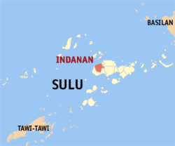 Map of Sulu with Indanan highlighted | |
.svg.png) Indanan Location within the Philippines | |
| Coordinates: 06°04′N 121°47′E / 6.067°N 121.783°ECoordinates: 06°04′N 121°47′E / 6.067°N 121.783°E | |
| Country | Philippines |
| Region | Autonomous Region in Muslim Mindanao (ARMM) |
| Province | Sulu |
| District | 1st district of Sulu |
| Barangays | 34 |
| Government[1] | |
| • Mayor | Saripuddin Jikiri |
| Area | |
| • Total | 170.72 km2 (65.92 sq mi) |
| Population (2010)[2] | |
| • Total | 80,883 |
| • Density | 470/km2 (1,200/sq mi) |
| Time zone | PST (UTC+8) |
| ZIP code | 7407 |
| Dialing code | +63 (0)68 |
| Income class | 3rd |
Indanan is a third class municipality in the province of Sulu, Philippines. According to the 2010 census, it has a population of 80,883 people.[2]
Barangays
Indanan is politically subdivided into 34 barangays.[2]
- Adjid
- Bangalan
- Bato-bato
- Buanza
- Bud-Taran
- Bunut
- Jati-Tunggal
- Kabbon Maas
- Kagay
- Kajatian
- Kan Islam
- Kandang Tukay
- Karawan
- Katian
- Kuppong
- Lambayong
- Langpas
- Licup
- Malimbaya
- Manggis
- Manilop
- Paligue
- Panabuan
- Panglima Misuari (Sasak)
- Pasil
- Poblacion (Indanan)
- Sapah Malaum
- Sawaki
- Sionogan
- Tagbak
- Timbangan
- Tubig Dakulah
- Tubig Parang
- Tumantangis
Demographics
| Population census of Indanan | ||
|---|---|---|
| Year | Pop. | ±% p.a. |
| 1990 | 41,969 | — |
| 1995 | 46,140 | +1.79% |
| 2000 | 53,425 | +3.19% |
| 2007 | 85,220 | +6.65% |
| 2010 | 65,858 | −8.95% |
| Source: National Statistics Office[2] | ||
References
- ↑ "Official City/Municipal 2013 Election Results". Intramuros, Manila, Philippines: Commission on Elections (COMELEC). 1 July 2013. Retrieved 5 September 2013.
- 1 2 3 4 "Total Population by Province, City, Municipality and Barangay: as of May 1, 2010" (PDF). 2010 Census of Population and Housing. National Statistics Office. Retrieved 27 August 2014.
External links
 |
Hadji Panglima Tahil | Jolo Patikul |
| |
| Pangutaran / Sulu Sea | |
Talipao | ||
| ||||
| | ||||
| Parang | |
Maimbung |
Jolo (capital) | |
| Municipalities | |
This article is issued from Wikipedia - version of the 11/1/2016. The text is available under the Creative Commons Attribution/Share Alike but additional terms may apply for the media files.