Shire, Ethiopia
| Shire ሺሬ Inda Selassie | |
|---|---|
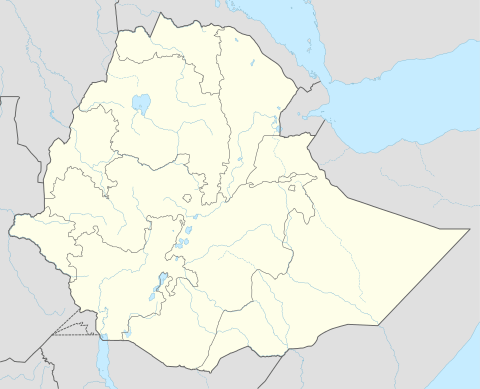 Shire Location within Ethiopia | |
| Coordinates: 14°6′N 38°17′E / 14.100°N 38.283°ECoordinates: 14°6′N 38°17′E / 14.100°N 38.283°E | |
| Country | Ethiopia |
| Region | Tigray |
| Zone | Semien Mi'irabawi (North Western) |
| Elevation | 1,953 m (6,407 ft) |
| Population (2007) | |
| • Total | 47,284 |
| Time zone | EAT (UTC+3) |
Shire (ሽሬ), also known as Inda Selassie (እንዳ ሥላሴ, Tigrinya "House of the Trinity"), is a town and separate woreda in northern Ethiopia. The administrative center of the Semien Mi'irabawi Zone[1] of the Tigray region, this town has a latitude and longitude of 14°6′N 38°17′E / 14.100°N 38.283°E with an altitude of 1953 meters above sea level. It was part of Tahtay Koraro woreda.
The Ethiopian Roads Authority had two roads built to connect Shire to neighboring towns. In June 2009, the authority released a report on their status. The road connecting Shire with Addi Goshu, 156 kilometers in length, was 52% complete, and would be completed by November 2010. The road that would connect to Addi Abun, 92 kilometers in length, would be completed in two years.[2] As of May 2010 construction was underway on a road segment 71 kilometers long connecting Shire west to Dedebit, and which will continue on to Adi Remets then terminate at Dejena Densha.[3] The town hosts an airport, Shire Airport (IATA code SHC).
History
An early mention of Shire is in one of the three surviving charters of Emperor Dawit I of Ethiopia (r. 1382-1412).[4]
As part of the Second Italo-Abyssinian War, Italian units under General Pietro Badoglio advanced out of Axum on 29 February 1936 to attack the Ethiopian army under Ras Imru Haile Selassie deployed around Shire in an action known as the Battle of Shire. Despite determined Ethiopian resistance, by 3 March the Italians had resumed their advance and shortly afterwards crossed the Tekezé River.
After the restoration of the monarchy in 1941, Shire served as the capital of the Shire sub-region until the administrative reorganization of the nation following the adoption of the 1995 Ethiopian Constitution.
Shire once again became a battlefield during the Ethiopian Civil War. The first clash of the Tigrayan People's Liberation Front (TPLF) with government forces occurred 5 August 1975, after Mehari Tekle ("Mussie"), a member of the TPLF leadership, was arrested in Addi Daero by government militiamen and taken to prison in Shire. Before he could be transported to a more secure facility in Mek'ele or Addis Ababa, a squad of eleven men burst into the prison, wounding one policeman and scattering the rest, freeing their comrade and 60 other prisoners, and spiriting him away to safety.[5]
During the latter part of the war, following the massive Ethiopian army defeat at the Battle of Afabet in March 1988, the TPLF launched a series of offensives, in which they destroyed government forces stationed at Rama, Adwa, Seleh Leha, and Shire. Only about 200 soldiers of the 17th Army Division were able to evacuate Shire and fall back to Gondar. This led to the raising of the Third Revolutionary Army, composed of the 603rd, 604th and 605th core armies. Between 19 June and 3 July 1988 the 604th was able to regain control over 12 districts, and entered Shire with no significant resistance from TPLF forces. However, due to unrest amongst the government soldiers at Addi Hageray, which permitted the TPLF to attack and occupy that town, the 604th was unable to advance again until 28 December. This led to the Battle of Shire, which ended on 19 February 1989 as a victory for the TPLF. Although Shire had been the headquarters of the Third Revolutionary Army at the beginning of the battle, at the end the remaining units were retreating towards Enda Aba Guna.[6] The third edition of Lonely Planet guide to Ethiopia notes that "war relics" could still be seen near Shire.[7]
Climate
Shire features a Tropical Savanna Climate with average rainfall reaches 905 mm.
| Climate data for Shire | |||||||||||||
|---|---|---|---|---|---|---|---|---|---|---|---|---|---|
| Month | Jan | Feb | Mar | Apr | May | Jun | Jul | Aug | Sep | Oct | Nov | Dec | Year |
| Average high °C (°F) | 28.0 (82.4) |
29.8 (85.6) |
30.3 (86.5) |
31.8 (89.2) |
31.1 (88) |
29.5 (85.1) |
23.6 (74.5) |
23.4 (74.1) |
26.7 (80.1) |
28.3 (82.9) |
28.7 (83.7) |
27.5 (81.5) |
28.23 (82.8) |
| Daily mean °C (°F) | 19.2 (66.6) |
20.7 (69.3) |
21.5 (70.7) |
23.3 (73.9) |
23.1 (73.6) |
21.9 (71.4) |
18.1 (64.6) |
18.2 (64.8) |
19.7 (67.5) |
20.1 (68.2) |
19.4 (66.9) |
18.6 (65.5) |
20.32 (68.58) |
| Average low °C (°F) | 10.5 (50.9) |
11.6 (52.9) |
12.7 (54.9) |
14.9 (58.8) |
15.1 (59.2) |
14.4 (57.9) |
12.7 (54.9) |
13.0 (55.4) |
12.8 (55) |
11.9 (53.4) |
10.2 (50.4) |
9.7 (49.5) |
12.46 (54.43) |
| Average precipitation mm (inches) | 2 (0.08) |
1 (0.04) |
3 (0.12) |
22 (0.87) |
48 (1.89) |
119 (4.69) |
297 (11.69) |
274 (10.79) |
110 (4.33) |
15 (0.59) |
14 (0.55) |
0 (0) |
905 (35.64) |
<ref name= Climate-data.org
Demographics
Based on the 2007 national census conducted by the Central Statistical Agency of Ethiopia (CSA), this town has a total population of 47,284, of whom 21,867 are men and 25,417 women. The majority of the inhabitants said they practiced Ethiopian Orthodox Christianity, with 85.11% reporting that as their religion, while 14.67% of the population were Muslim.[8]
According to the 1994 national census the town had a population of 25,269 of whom 11,360 were men and 13,909 women. In the mid 1980s, the population of the town was below 15, 000.
Notes
- ↑ At least in 1998, per EUE: Tigray Evacuees, 12/98
- ↑ "Authority constructs 2.2 billion birr worth roads in Tigray", Ethiopian News Agency 23 June 2009 (accessed 23 July 2009)
- ↑ "Tigray, Southern Towns Get First Roads", Addis Fortune 2 May 2010 (accessed 5 May 2010)
- ↑ G.W.B. Huntingford, The Historical Geography of Ethiopia from the first century AD to 1704 (London: The British Academy, 1989), p. 82
- ↑ Aregawi Berhe, A Political history of the Tigray People's Liberation Front (1975-1991) (Los Angeles: Tsehai, 2009), pp. 76f. (Aregawi states in a footnote that he was a member of the eleven-man squad.)
- ↑ Tekeste Melake, "The Battle of Shire", Ethiopian Review, 24 September 2008 (accessed 30 July 2009)
- ↑ Matt Philips and Jean-Bernard Carillet, Ethiopia and Eritrea, third edition (n.p.: Lonely Planet, 2006), p. 131
- ↑ Census 2007 Tables: Tigray Region, Tables 2.1, 2.4, 2.5 and 3.4.