Illinois Route 136
| ||||
|---|---|---|---|---|
|
14th Avenue Fulton Road | ||||
| Route information | ||||
| Maintained by IDOT | ||||
| Length: | 3.22 mi[1] (5.18 km) | |||
| Existed: | 1967[2] – present | |||
| Major junctions | ||||
| West end: |
| |||
| East end: |
| |||
| Location | ||||
| Counties: | Whiteside | |||
| Highway system | ||||
| ||||

Illinois Route 136 is an east–west road in northwestern Illinois. It runs from the Mark Morris Memorial Bridge over the Mississippi River, connecting to Iowa Highway 136 in Clinton, Iowa, east to U.S. Route 30 east of Fulton. This is a distance of 3.22 miles (5.18 km).[1][3]
Route description
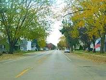
Illinois 136 is a two-lane surface road for its entire length. Route 136 begins at the Mark Morris Memorial Bridge which connects to Iowa Highway 136 in Clinton, Iowa. At the foot of the bridge is a signal-controlled intersection with 4th Street in Fulton, which is signed as the Lincoln Highway. Route 136 continues east along 14th Avenue, a residential street dotted by churches and businesses. On the eastern edge of Fulton, Route 136 intersects Illinois Route 84. The final 2 miles (3.2 km) of Route 136, which run along Fulton Road, are part of the Lincoln Highway and are signed as such. Route 136 ends at an intersection with U.S. Route 30.[1]
History
SBI Route 136 originally ran from Illinois Route 1 to the village of Flat Rock in rural Crawford County, a distance of about 3,000 feet (914 m). In the meantime, the Lyons-Fulton Bridge was numbered U.S. 30 through 1957, and Alternate U.S. 30 through 1967. After 1967, the bridge and road to U.S. 30 were changed to Illinois Route 136. In 1975, the Lyons-Fulton Bridge closed and was replaced by the Mark Morris Memorial Bridge located a 1⁄2-mile (0.80 km) downstream. The spur to Flat Rock was left unnumbered.[2]
Major intersections
| County | Location | mi[1] | km | Destinations | Notes |
|---|---|---|---|---|---|
| Clinton | Clinton | Continuation into Iowa; historic Lincoln Highway | |||
| Mississippi River | 0.00 | 0.00 | Mark Morris Memorial Bridge | ||
| Whiteside | Fulton | 0.38 | 0.61 | CR 36 (4th Street) | |
| 1.33 | 2.14 | ||||
| Fulton Township | 3.22 | 5.18 | |||
| 1.000 mi = 1.609 km; 1.000 km = 0.621 mi | |||||
References
- 1 2 3 4 Illinois Technology Transfer Center (2006). "T2 GIS Data". Retrieved 2007-11-08.
- 1 2 Carlson, Rick. Illinois Highways Page: Routes 121 thru 140. Last updated April 5, 2005. Retrieved May 23, 2006.
- ↑ Morrison, J. End of Iowa 136. Last updated September 14, 2002. Retrieved May 23, 2006.