Illats
| Illats | ||
|---|---|---|
|
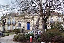
Town hall | ||
| ||
 Illats | ||
|
Location within Nouvelle-Aquitaine region  Illats | ||
| Coordinates: 44°35′54″N 0°22′18″W / 44.5983°N 0.3717°WCoordinates: 44°35′54″N 0°22′18″W / 44.5983°N 0.3717°W | ||
| Country | France | |
| Region | Nouvelle-Aquitaine | |
| Department | Gironde | |
| Arrondissement | Langon | |
| Canton | Podensac | |
| Intercommunality | Canton de Podensac | |
| Government | ||
| • Mayor (2001–2008) | Philippe Dubourg | |
| Area1 | 29.24 km2 (11.29 sq mi) | |
| Population (2008)2 | 1,256 | |
| • Density | 43/km2 (110/sq mi) | |
| Time zone | CET (UTC+1) | |
| • Summer (DST) | CEST (UTC+2) | |
| INSEE/Postal code | 33205 / 33720 | |
| Elevation | 3–61 m (9.8–200.1 ft) | |
|
1 French Land Register data, which excludes lakes, ponds, glaciers > 1 km² (0.386 sq mi or 247 acres) and river estuaries. 2 Population without double counting: residents of multiple communes (e.g., students and military personnel) only counted once. | ||
.svg.png)
Illats is a commune in the Gironde department in Nouvelle-Aquitaine in southwestern France.
It was founded in the eleventh century.
Illats is part of the Graves wine-growing region. The Chateau Hillot winery is located here.
Population
| Historical population | ||
|---|---|---|
| Year | Pop. | ±% |
| 1962 | 979 | — |
| 1968 | 1,025 | +4.7% |
| 1975 | 1,000 | −2.4% |
| 1982 | 1,076 | +7.6% |
| 1990 | 1,158 | +7.6% |
| 1999 | 1,158 | +0.0% |
| 2008 | 1,256 | +8.5% |
See also
References
External links
| Wikimedia Commons has media related to Illats. |
This article is issued from Wikipedia - version of the 11/9/2016. The text is available under the Creative Commons Attribution/Share Alike but additional terms may apply for the media files.