Ikom
| Ikom | |
|---|---|
| LGA and town | |
 Ikom Location in Nigeria | |
| Coordinates: 6°05′N 8°37′E / 6.083°N 8.617°ECoordinates: 6°05′N 8°37′E / 6.083°N 8.617°E | |
| Country |
|
| State | Cross River State |
| Area | |
| • Total | 1,961 km2 (757 sq mi) |
| Population (2006 census) | |
| • Total | 162,383 |
| Time zone | WAT (UTC+1) |
| 3-digit postal code prefix | 551 |
| ISO 3166 code | NG.CR.IK |
Ikom is a Local Government Area of Cross River State, Nigeria. Its headquarters are in the town of Ikom in the east of the area on the Cross River and the A4 highway at5°57′40″N 8°42′39″E / 5.96111°N 8.71083°E.
It has an area of 1,961 km² and a population of 162,383 at the 2006 census.
The people of Ikom are majorly farmers. Ikom is a major producer of Banana and Plantain for the Nigerian market.
Ikom is known for the Ikom monoliths, artifacts that bear an ancient writing sometimes taken to be an early form of nsibidi.[1]
The postal code of the area is 551.[2]
See also
References
- ↑ http://www.taneter.org/writing.html
- ↑ "Post Offices- with map of LGA". NIPOST. Archived from the original on 2012-11-26. Retrieved 2009-10-25.
State capital: Calabar | ||
| LGAs | 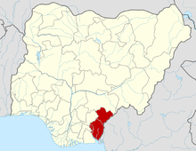 | |
This article is issued from Wikipedia - version of the 10/27/2016. The text is available under the Creative Commons Attribution/Share Alike but additional terms may apply for the media files.