Idlib
| Idlib ادلب Edlib | |
|---|---|
|
Typical olive field in the valleys surrounding Idlib | |
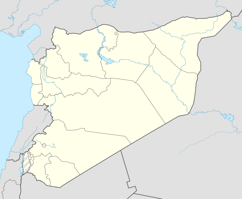 Idlib Location in Syria | |
| Coordinates: SY 35°56′N 36°38′E / 35.933°N 36.633°E | |
| Country |
|
| Governorate | Idlib Governorate |
| District | Idlib District |
| Government | |
| • Governor | Atef Ghanem al-Naddaf |
| Elevation | 500 m (1,600 ft) |
| Population (2010 census[1]) | |
| • Total | 165,000 |
| Area code(s) | 23 |
| Climate | Csa |
| Website | eIdleb |

Idlib (Arabic: ادلب, also spelled Edlib or Idleb) is a city in northwestern Syria, capital of the Idlib Governorate, and 59 kilometers (37 mi) south west of Aleppo. It has an elevation of nearly 500 meters (1,600 ft) above sea level. In the 2004 census by the Central Bureau of Statistics, Idlib had a population of 98,791 (2004 census) and in 2010 the population of Idlib was around 165,000 (2010 census). The inhabitants are overwhelmingly Sunni Muslims,[2] although there is a significant Christian minority. Idlib is divided into six main districts: Ashrafiyeh (the most populous), Hittin, Hejaz, Downtown, Hurriya, and al-Qusur.
A major agricultural center of Syria, the Idlib area is also historically significant, containing many "dead cities" and man-made tells. Idlib contains the ancient city of Ebla, once the capital of a powerful kingdom.[3] The ancient kingdoms of Nuhašše and Luhuti flourished in the Governorate during the Bronze and Iron ages.[4]
History
The Ebla tablets (2350 BC) mention the city of "Duhulubuum" which is most probably located at Idlib as suggested by Michael Astour and Douglas Frayne; a similarity exist between the sounds of the ancient and modern name. In the tablets Duhulubuum is located 22 km south of "Unqi" which the modern village of Kaukanya; a village located 22 km northeast of Idlib. Thutmose III mentioned the city with the name "Ythb".[5]
Ottoman era
During Ottoman rule in Syria, between the 16th and 19th centuries, Idlib served as the capital of a kada ("subdistrict capital") bearing its name, part of the larger Vilayet of Aleppo ("Province of Aleppo.")[6] The city was a center of olive production, which in turn gave way to a prosperous olive-based soap industry. Although the major markets for Idlib's soap were at Aleppo, Antioch, and Hama,[7] the product was exported as far as the Ottoman capital of Istanbul. Idlib was also a major producer of cotton fabrics.[8] Western traveler Josias Leslie Porter noted that Idlib was "encompassed in olive groves, rare in this bleak region."[7] He further remarked that its olives groves were larger than those of Damascus, Beirut, and Gaza. In the mid-19th-century, the town had an estimated population of 8,000, including 500 Christians.[7] In the late 19th century, Idlib was "flourishing" and contained a number of Christian families, according to German orientalist Albert Socin.[6]
Syrian Civil War
| This article is part of a series on the politics and government of Syrian opposition |
|
|
Foreign relations |
During the civil uprising of 2011, Idlib was the focus of protests and fighting in the early phase of the Syrian war. As the uprising descended into armed conflict, Idlib became the focus of a rebel campaign, which temporarily captured the city and the governorate, prior to a government offensive in April 2012. After this, government forces retook the city and the rebel-controlled province after a month of fighting, prior to the attempted enforcement of the ceasefire proposed by Kofi Annan. After the 2015 Idlib offensive in March, the rebel alliance Army of Conquest succeeded in Second Battle of Idlib and captured the city again, as well as besieging the Shi'a-majority towns of Al-Fu'ah and Kafriya to the north of Idlib city.[9]
In April 2015, the interim seat of the Syrian opposition's Syrian Interim Government was proposed to be Idlib,[10] in Idlib Governorate.
Climate
Köppen-Geiger climate classification system classifies its climate as hot-summer Mediterranean (Csa).[11] Summers are hot and rainless, while winters are rainy and cool.
The highest record temperatures was 44 °C (111 °F) on June 16, 2012.[12] according to arabiaweather.com the lowest temperature ever recorded in Idlib was −23 °C (−9 °F) in January 1951 [13][14]
| Climate data for Idlib | |||||||||||||
|---|---|---|---|---|---|---|---|---|---|---|---|---|---|
| Month | Jan | Feb | Mar | Apr | May | Jun | Jul | Aug | Sep | Oct | Nov | Dec | Year |
| Record high °C (°F) | 20 (68) |
21 (70) |
26 (79) |
35 (95) |
37 (99) |
44 (111) |
42 (108) |
39 (102) |
38 (100) |
37 (99) |
29 (84) |
24 (75) |
44 (111) |
| Average high °C (°F) | 9.9 (49.8) |
12.2 (54) |
16.7 (62.1) |
22.2 (72) |
28 (82) |
31.7 (89.1) |
33.2 (91.8) |
34.2 (93.6) |
31.8 (89.2) |
26.7 (80.1) |
18.7 (65.7) |
12.2 (54) |
23.13 (73.62) |
| Daily mean °C (°F) | 6.2 (43.2) |
7.7 (45.9) |
11.3 (52.3) |
15.8 (60.4) |
20.9 (69.6) |
25 (77) |
27.1 (80.8) |
27.8 (82) |
25.1 (77.2) |
20 (68) |
13 (55) |
8.1 (46.6) |
17.33 (63.17) |
| Average low °C (°F) | 2.5 (36.5) |
3.2 (37.8) |
6 (43) |
9.5 (49.1) |
13.8 (56.8) |
18.4 (65.1) |
21 (70) |
21.4 (70.5) |
18.4 (65.1) |
13.4 (56.1) |
7.4 (45.3) |
4 (39) |
11.58 (52.86) |
| Record low °C (°F) | −23 (−9) |
−5 (23) |
1 (34) |
1 (34) |
8 (46) |
15 (59) |
18 (64) |
20 (68) |
13 (55) |
3 (37) |
−4 (25) |
−5 (23) |
−23 (−9) |
| Average precipitation mm (inches) | 97 (3.82) |
88 (3.46) |
59 (2.32) |
41 (1.61) |
18 (0.71) |
5 (0.2) |
0 (0) |
0 (0) |
6 (0.24) |
25 (0.98) |
41 (1.61) |
93 (3.66) |
473 (18.61) |
| Source #1: Climate-Data.org (altitude: 432m)[11] | |||||||||||||
| Source #2: Voodoo Skies for record temperatures[12] | |||||||||||||
Economy

Idlib is a major production center for olives, cotton, wheat and fruits, particularly cherries.[3] Other principal crops include almonds, sesame seeds, figs, grapes and tomatoes.[15] In 1995 there were roughly 300 hectares planted with various citrus crop.[16] Olive oil pressing and textiles are some of the city's local industries.[15] The nearby city of Aleppo has an important economic presence in Idlib.[3]
The Idlib Regional Museum in the city contains over 17,000 of the Ebla tablets and serves as Idlib's main tourist attraction, excluding the nearby ancient site of Ebla itself. Under the Technical and Financial Cooperation Agreement between the governments of Italy and Syria, the museum was to undergo a restoration and renovation project starting in 2010.[17]
_Syria.jpg)
Sports
Omayya Idlib, founded in 1972, is the most popular football team in the city. The club played in the Syrian Premier League for the 2011-2012 season. Idlib Municipal Stadium is the main football venue in the city. Coordinates: 35°56′N 36°38′E / 35.933°N 36.633°E
References
- ↑ "مدينة إدلب السورية". aljazeera.net.
- ↑ Mroue, Bassem. "Syrian forces capture rebel stronghold near Turkey". The Salt Lake Tribune. Associated Press. 2012-03-13. Retrieved on 2012-03-13.
- 1 2 3 Casule, 2008, p.56.
- ↑ John David Hawkins. Inscriptions of the Iron Age: Part 1. p. 400.
- ↑ Timothy P. Harrison, Edward B. Banning. Walls of the Prince: Egyptian Interactions with Southwest Asia in Antiquity: Essays in Honour of John S. Holladay, Jr. p. 76.
- 1 2 Baedeker, 1912, p.376.
- 1 2 3 Porter, 1868, p. 580.
- ↑ Inalcik, 1997, p.501.
- ↑ Sherlock, Ruth (29 March 2015). "Thousands flee Syrian city Idlib after rebel capture". The Telegraph. Retrieved 29 March 2015.
- ↑ "Will Syrian opposition move interim government to Idlib? - Al-Monitor: the Pulse of the Middle East". Al-Monitor.
- 1 2 "Climate: Idlib - Climate graph, Temperature graph, Climate table". Climate-Data.org. Retrieved 2013-12-03.
- 1 2 "Idlib, Syria". Voodoo Skies. Retrieved 2013-12-03.
- ↑ "أبرد شتاء مر على سوريا منذ عام 1950 !". طقس سوريا - طقس العرب.
- ↑ "Extreme Temperatures Around the World- world highest lowest recorded temperatures". mherrera.org.
- 1 2 Idlib, Syria. Encyclopaedia Britannica. Encyclopaedia Britannica Inc. 2012. Retrieved on 2012-03-11.
- ↑ Food and Agriculture Organization of the United Nations, 1996, p. 147.
- ↑ Ferrari, 2009, p. 522.
Bibliography
- Baedeker, Karl (1912), Palestine and Syria, with routes through Mesopotamia and Babylonia and the island of Cyprus: handbook for travellers, K. Baedeker
- Casule, F. (2008), Art and History Syria, Casa Editrice Bonechi, ISBN 8847601193
- Angelo, Ferrari (2009), Proceedings 4th International Congress on "Science and Technology for the Safeguard of Cultural Heritage in the Mediterranean Basin", 1, Angelo Ferrari-CNR, Institute of Chemical Methodologies, ISBN 889668031X
- Food and Agriculture Organization of the United Nations (1996). Citrus Pest Problems and Their Control in the Near East. Food & Agriculture Org. ISBN 9251033013.
- Inalcik, Halil (1997), An Economic and Social History of the Ottoman Empire, Cambridge University Press, ISBN 0521574552
- Porter, Josias Leslie (1858). A Handbook for Travellers in Syria and Palestine. 1. Murray.
External links
News and events
- eIdleb The first complete website for Idleb news and services.
- www.edleb.net The 1st complete website in Arabic.
Governmental services
| Wikimedia Commons has media related to Idlib. |
