List of Members of the International Hydrographic Organization

A hydrographic office is an organization which is devoted to acquiring and publishing hydrographic information.
The International Hydrographic Organization has 85 members, three of these are suspended. The IHO names its member organisations hydrographic offices although the member organisations of some countries are maritime administrations covering a larger range of tasks (e.g., also oceanography, meteorology etc.)
In some nations (e.g., the UK and France) the hydrographic offices are sub-organisations of the country's Ministry of Defence or the navy, in others they are civilian organisations.
Historically, the main tasks of hydrographic offices were the conduction of hydrographic surveys and the publication of nautical charts.
Besides nautical charts, many hydrographic offices publish a body of books and periodicals that are collectively known as nautical publications. The most important of these are:
- Sailing Directions (or pilots): detailed descriptions of areas of the sea, shipping routes, harbours, aids to navigation, regulations etc.
- lists of lights: descriptions of lighthouses and lightbouys
- tide tables and tidal stream atlases
- ephemerides and nautical almanacs for celestial navigation
- Notice to Mariners: periodical (often weekly) updates and corrections for nautical charts and publications
Hydrographic organizations may also be involved in services such as:
- pilotage
- search and rescue
- maintenance of lighthouses and other aids to navigation
- ice breaking
- weather observation and information
- sea traffic information and surveillance
- maritime research
- regulatory affairs of ship safety
History
In the development of hydrographic services, shipping organizations played a part, but the major players were the naval powers. Recognizing hydrographic information was a military advantage these naval organizations, usually under the direction of a "Hydrographer" utilized the expertise of naval officers in collecting hydrographic data that was incorporated into the navy's collection. In order to distribute the processed information (charts, directions, notices, and such) these organizations often developed specialized printing capabilities.
Current IHO Members [1]
-
 Algeria - Service Hydrographique des Forces Navales (Hydrographic Office of the Algerian National Navy)
 -
 Argentina - Servicio de Hidrografia Naval (Argentine Naval Hydrographic Service)
 -
 Australia - Australian Hydrographic Service
 -
 Bahrain - Bahraini Hydrographic Survey Directorate
 -
 Bangladesh - Bangladeshi Directorate of Hydrography
 -
.svg.png) Belgium - Vlaamse Hydrografie (Flemish Hydrography)
Belgium - Vlaamse Hydrografie (Flemish Hydrography) -
 Brazil - Brazilian Directorate of Hydrography and Navigation
 -
 Brunei - Brunei Directorate of Hydrography and Navigation
 -
 Cameroon - Port Autonome de Doula (Autonomous Port of Douala)
 -
 Canada- Canadian Hydrographic Service
 -
 Chile - Servicio Hidrografico y Océanografico de la Armada (Hydrographic and Oceanographic Service of the Chilean Navy)
 -
 China - Chinese Maritime Safety Administration (MSA)
 -
 Colombia - Ministerio de Defensa Nacional, Armada Nacional, Dirección General Marítima (Colombian National Ministry of Defence, Colombian Navy, General Maritime Directorate)
 -
 Croatia - Hrvatski Hidrografski Institut (Hydrographic Institute of the Republic of Croatia)
 -
 Cuba - Oficina Nacional de Hidrografia y Geodesia (Cuban National Office of Hydrography and Geodesy)
 -
 Cyprus - Cypriotic National Hydrographic Committee, The Department of Lands and Surveys
 -
 Democratic People's Republic of Korea - Democratic People's Republic of Korea Hydrographic Department
 -
 Denmark - Geodatastyrelsen (GST) (Danish Geodata Agency)
 -
 Ecuador - Instituto Océanografico de la Armada (Oceanographic Institute of the Ecuadorian Navy)
 -
 Egypt - Egyptian Navy Hydrographic Department (ENHD)
 -
 Estonia - Estonian Maritime Administration (EMA) (Aids to Navigation and Hydrography Division)
 -
 Fiji - Republic of Fiji Navy Hydrographic Office
 -
 Finland - Finnish Transport Agency Hydrographic Office
 -
 France - Service hydrographique et océanographique de la Marine (Hydrographic and Oceanographic Service of the French Navy)
 -
 Georgia - State Hydrographic Service of Georgia
 -
 Germany - Bundesamt für Seeschifffahrt und Hydrographie (German Federal Office for Navigation and Hydrography)
 -
 Greece - Hellenic Navy Hydrographic Service
 -
 Guatemala - Ministerio de la Defensa Nacional, Dirección General de Asuntos Marítimos (Guatemalan Ministry of Defence, General Directorate of Maritime Affairs)
 -
 Iceland - Icelandic Coast Guard Hydrographic Department (ICG-HD) [2]
 -
 India - Indian National Hydrographic Office [3]
 -
 Indonesia - Dinas Hidro-Oseanografi (DISHIDROS) - Indonesian Hydro-Oceanographic Service
 -
 Iran - Iranian Ports and Maritime Organisation (PMO)
 -
 Ireland - Irish Marine Survey Administration
 -
 Italy - Instituto Idrografico dell a Marina (Italian Hydrographic Institute)
 -
 Jamaica - Jamaican Surveys and Mapping Division
 -
 Japan - Japanese Hydrographic and Oceanographic Department
 -
 Kuwait - Kuwait Ministry of Communications
 -
 Latvia - Latvijas Juras Administracija, Hidrografijas Dienests (Maritime Administration of Latvia, Hydrographic Service)
 -
 Malaysia - Malaysian National Hydrographic Centre
 -
 Mauritius -Mauritian Ministry of Housing and Lands
 -
 Mexico - Secretaría de Marina, Armada de México, Dirección General Adjunta de Océanografia Hidrografia y Meteorologia (General Directorate of Oceanography, Hydrography and Meteorology of the Mexican Navy)
 -
 Monaco - Direction des Affaires Maritimes (Monaco Directorate of Naval Affairs)
 -
 Montenegro - Institute of Hydrometeorology and Seismology of Montenegro
 -
 Morocco - Division Hydrographie, Océanographique et Cartographie (DHOC) de la Marine Royale (Hydrography, Oceanography and Cartography Division of the Royal Moroccan Navy)
 -
 Mozambique - Instituto Nacional de Hidrografia e Navegação (Mozambican National Institute of Hydrography and Navigation)
 -
 Myanmar - Myanmar Naval Hydrographic Centre (MNHC)
 -
 Netherlands - Dienst der Hydrografie (Dutch Hydrographic Service)
 -
 New Zealand - Land Information New Zealand
 -
 Nigeria - Nigerian Navy Hydrographic Office
 -
 Norway - Norwegian Hydrographic Office
 -
 Oman - National Hydrographic Office of the Royal Navy of Oman
 -
 Pakistan - Hydrographic Department of the Pakistani Navy
 -
 Papua New Guinea - National Maritime Safety Authority of Papua New Guinea
 -
 Peru - Dirección de Hidrografia y Navegación (Peruvian Directorate of Hydrography and Navigation)
 -
 Philippines - Philippine National Mapping and Resource Information Authority (NAMRIA)
 -
 Poland - Hydrographic Office of the Polish Navy
 -
 Portugal - Instituto Hidrografico (Portuguese Hydrographic Institute)
 -
 Qatar - Qatari Ministry of Municipality and Urban Planning
 -
 Republic of Korea - Korea Hydrographic and Oceanographic Agency (KHOA)
 -
 Romania - Directia Hidrografica Maritima (Romanian Maritime Hydrographic Directorate)
 -
 Russia - Glavnoe Oupravlenie Navigatsii i Okeanografii (Russian Department of Navigation and Oceanography)
 -
 Saudi Arabia - Saudi Arabian General Commission for Survey (GCS)
 -
 Singapore - Hydrographic Department, Maritime and Port Authority of Singapore
 -
 Slovenia - Slovenian Ministry of Infrastructure
 -
 South Africa - South African Hydrographic Office
 -
 Spain - Instituto Hidrografico de la Marina (IHM) (Hydrographic Institute of the Royal Spanish Navy)
 -
 Sri Lanka - Sri Lankan National Hydrographic Office, National Aquatic Resources Research and Development Agency
 -
 Suriname - Maritieme Authoriteit Suriname (MAS) (Maritime Authority Suriname)
 -
 Sweden - Sjöfartsverket (Swedish Maritime Administration)
 -
 Syria - Syrian General Directorate of Ports
 -
 Thailand - Hydrographic Department of the Royal Thai Navy
 -
 Tonga - Tongan Ministry of Infrastructure
 -
 Trinidad and Tobago - Hydrographic Unit, Ministry of Agriculture & Marine Resources, Lands and Surveys Division
 -
 Tunisia - Centre Hydrographique et Océanographique de la Marine Nationale (Hydrographic and Oceanographic Centre of the Tunisian Navy)
 -
 Turkey - Seyir Hidrografi ve Osinografi Dairesi Baskanligi (Turkish Office of Navigation, Hydrography and Oceanography)
 -
 Ukraine - State Hydrographic Service of Ukraine
 -
 United Arab Emirates - Ministry of Communications, National Port Authority of the United Arab Emirates
 -
 United Kingdom - United Kingdom Hydrographic Office
 -
 United States of America - Office of Coast Survey / National Ocean Service (OCS/NOS)
 -
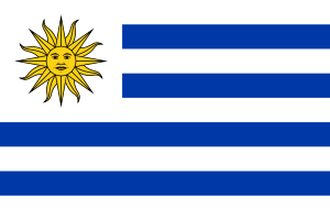 Uruguay - Servicio de Océanografia, Hidrografia y Meteorologia de la Armada (Oceanographic, Hydrographic and Meteorological Service of the Uruguayan Navy)
 -
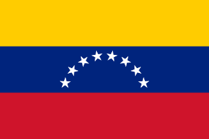 Venezuela - Comandancia General de la Armada, Dirección de Hidrografia y Navegación (General Command of the Venezuelan Navy, Directorate of Hydrography and Navigation]]
 -
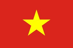 Vietnam - Naval Command of Vietnam
Suspended IHO Members
-
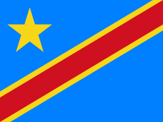 Democratic Republic of the Congo - Ministère des Transports et Communications, Direction de la Marine et des Voies Navigables (Congolese Ministry of Transport and Communications, Directorate of the Navy and Waterways)
Membership suspended from 07/1983
-
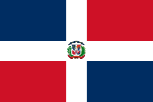 Dominican Republic - Servicio Hidrografico de la Armada de la República Dominicana (Hydrographic Service of the Navy of the Dominican Republic)
Membership suspended from 07/1983
-
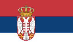 Serbia - Direkcija Uutrasnje Plovne Puteve (Serbian Directorate for Inland Waterways)
Membership suspended from 01/01/2013
Hydrographic organisations of some countries
Argentina
The Argentine Naval Hydrographic Service was established in 1879.
Australia
Hydrographic tasks in Australian waters were performed by the United Kingdom's Royal Navy since the 19th century. In 1920 the Australian Hydrographic Service was formed as a part of the Royal Australian Navy.
Brazil
Hydrographic tasks in Brazilian waters were performed by the DHN since 02/02/1876.
Canada
Starting in 1883, the "Georgian Bay Survey" was responsible for hydrographic surveying of Georgian Bay and Lake Huron. Its geographic area of responsibility increased and in 1904 the name was changed to the "Hydrographic Survey of Canada." The current name Canadian Hydrographic Service (CHS) was adopted in 1928.
In 1951, Canada became a State Member of the International Hydrographic Organization (IHO) and the Dominion Hydrographer is Canada's representative.
Today, the mandate of CHS is found in the Canada Oceans Act, the Canada Shipping Act (Charts and Publications Regulations) and the Navigable Waters Protection Act.
With its headquarters office located in Ottawa, Ontario there are regional offices in Sidney (British Columbia), Burlington (Ontario), Mont-Joli (Quebec), Halifax (Nova Scotia), and a branch office in St. John’s Newfoundland. CHS has 300 staff across the country.
The national chart folio consists of 950 paper charts, 541 S-57 vector Electronic Navigation Charts and 651 raster charts in the BSB format. CHS produces and maintains seven volumes of Tides and Water Levels books, 25 Sailing Directions books, and prints and distributes a number of publications such as the Annual Notices to Mariners and Radio Aids to Marine Navigation.
In addition to significant hydrographic data holdings (single & multibeam), CHS operates 78 permanent water level stations, a real time water level and forecast system in the St. Lawrence River, and participates in the operation of Atlantic & Pacific tsunami warning systems.
CHS is directly responsible for the sales and distribution of all its products, in paper and digital form. A network of 850 dealers (domestic and international) distributes CHS paper and digital products. Products and data are also made available to Value Added Resellers, under licence.
Chile
Since 1874, the Navy's Hydrographic and Oceanographic Service ("SHOA", as acronym of "Servicio Hidrográfico y Oceanográfico de la Armada") has been the Chilean official authority on drawing and publishing nautical charts of the South Pacific Ocean for Military and Civil navigation. This institution is also the main authority on controlling the official hour of the country.
Denmark
In Denmark (including Greenland and the Faroe Islands), hydrographic surveying and charting is conducted by "Kort & Matrikelstyrelsen" (KMS), a division of the Ministry of Environment.
France
In France, the first official organization, the French Dépôt des Cartes, Plans, Journaux et Mémoires Relatifs à la Navigation, was formed in 1720.
Today, the SHOM is the official French hydrographic office, it stands for 'Service Hydrographique et Océanographique de la Marine' and means Naval Hydrographic and Oceanographic Service.
Germany
The "Bundesamt für Seeschiffahrt und Hydrographie" (BSH) is the German federal hydrographic office. Its offices are located in Hamburg and Rostock. The BSH is responsible for a wide variety of services, among them hydrographic surveys, nautical publications, ship registration, testing and approval of technical equipment, oceanographic research, development of nautical information systems, and maritime pollution surveillance. The BSH runs six ships for survey and research purposes.
In 1945 the tasks of various predecessor organisations (among them the German Navy's hydrographic service, the Wilhelmshaven maritime observatory, and the "Deutsche Seewarte" under Georg von Neumayer) were concentrated in the newly created "Deutsches Hydrographisches Institut" (DHI) in Hamburg. In 1990 the DHI and the corresponding East German organisation, the "Seehydrographische Dienst der DDR" in Rostock were integrated to form the BSH in its present form.
Greece
The Hellenic Navy Hydrographic Service (HNHS, Greek: Υδρογραφική Υπηρεσία Πολεμικού Ναυτικού), an independent service of the Hellenic Navy General Staff, is responsible for hydrographic surveying and production and sale of charts. The first naval hydrographic office was created in 1905 and its first mission was the hydrographic survey of Maliakos Gulf. Its first nautical chart was issued in 1909 and in 1919 the Hellenic Navy became a founding member of the International Hydrographic Organization (IHO). The hydrographic office evolved into the independent naval Hydrographic Service in 1921. Today the HNHS operates three naval hydrographic vessels: HS OS Nautilos (A-478), HS OS Pytheas (A-474) and HS Stravon (A-476).
Hong Kong
The Hong Kong Hydrographic Office is responsible for hydrographic surveying and production of nautical charts covering the waters of Hong Kong. It also produced electronic navigational charts and made available the prediction of tidal stream digitally * on the internet.
India
The Indian Naval Hydro-graphic Department (INHD) headed by Chief Hydrographer to the Government of India is an Indian Government agency responsible for hydro-graphic surveys and nautical charting in India. It operates a fleet of eight oceangoing conventional hull survey vessels and one large catamaran hull vessel INS Makar (J31) of the Alcock Ashdown Class, with five more of the class due to be commissioned soon.
The Indian Marine Survey Department was established at Calcutta in 1874, which became a part of the Royal Indian Marine in 1882. The Hydrographic Department of the Indian Navy derives its origin from the charting activities of the British East India Company, way back in the 17th century. John and Samuel Thornton, Hydrographers to the East India Company compiled the first chart and Sailing Directions for the Indian Ocean in 1703. During the next two centuries, the captains of the ships of the East India Company went on to pioneer the charting of the Eastern seas extending from Red Sea to Persian Gulf, Arabian Sea, across the Indian Ocean right up to the China Seas.
After India's independence from the United Kingdom, the Marine Survey Office was shifted to Dehradun on 1 June 1954 and was renamed as the Naval Hydrographic Office. The Naval Hydrographic Office was renamed in 1997 as the National Hydrographic Office in recognition of its national stature and increasing international role.[4][5]
Netherlands
The Dienst der Hydrografie has been part of the predecessor of the Royal Netherlands Navy since 8 January 1488.
New Zealand
LINZ Hydrographic Service are responsible for hydrographic surveying, production of nautical charts, and provision of tidal information covering the waters of New Zealand. Nautical charts can no longer be purchased directly from LINZ but must be purchased from Bluestar Group or from an authorized agent.
Norway
The *Norwegian Hydrographic Service is responsible for hydrographic surveying and production of nautical charts covering the waters of Norway. Also operates the Primar ENC Service
Republic of Ireland
The Republic of Ireland is actively undertaking the largest civilian seabed mapping programme in the world, as a joint venture by the Marine Institute and the Geological Survey of Ireland. Total mapping coverage of the INSS to end of 2005 was 432,000 km² and taken along with an earlier DCENR Petroleum Affairs Division, over 81% of the Irish designated seabed area (at end 2005) has been mapped. The INtegrated Mapping FOr the Sustainable Development of Ireland’s MArine Resource (INFOMAR) programme is a successor to the Irish National Seabed Survey (INSS) and concentrates on creating a range of integrated mapping products of the physical, chemical and biological features of the seabed in the near-shore area. The programme is being funded by the Irish Government through the Department of Communications, Energy and Natural Resources as part of the National Development Plan, 2007 – 2013 [11]. Data are passed on to the United Kingdom Hydrographic Office (UKHO) for subsequent production of nautical charts.
Russia
The Russian Hydrographic Office was founded in 1777 by the Admiralty Board of the Russian Empire. The hydrographic service in Russia has been historically attached to the Russian Navy and the agents and supervisors of hydrographic works have been largely naval officers since it was established. Having operated under different names along its history, the Russian Hydrographic Service is one of the first hydrographic offices in the world.[6]
Sweden
"Sjöfartsverket", Swedish Maritime Administration, includes the Swedish national hydrographic organisation. Established in 1956 and governed by the Ministry of Industry, Employment and Communications, Sjöfartsverket is responsible for most aspects of safe navigation in Sweden. This includes maintenance and marking of fairways, surveying and charting Swedish waters, pilotage, search-and-rescue (in cooperation with other organisations), ice-breaking, and safety inspections.
United Kingdom
The United Kingdom has a long hydrographic history officially begun with the 1683 appointment of Captain Grenville Collins as Hydrographer to the King.[7] With the Royal Navy dominating the seas hydrography grew to a worldwide hydrographic activity. Royal Navy charts and the related surveys were reputedly officially started as a result of the loss of Admiral Sir Cloudesley Shovell on an uncharted reef off the Scilly Isles which happened in October 1707 (see main article Scilly naval disaster of 1707). The office of Hydrographer of the Navy was created in 1795. The British tradition of hydrographic surveys extended to the nations with a common legacy in the Empire, for example, the Australian Hydrographic Service.[8] The British Admiralty Hydrographic Office ceased to be a naval department and became the United Kingdom Hydrographic Office (located in Taunton, Somerset, near Creechbarrow hill) which continues the legacy within the Ministry of Defence[9] with responsibility for the Admiralty Charts[10] covering almost every navigable stretch of water on Earth. The UKHO also calculates tide tables for the UK. The Royal Navy maintains a number of hydrographic survey vessels [11]
In contrast to the US government, all of whose creative work is placed into the public domain, British government policy requires agencies such as the UKHO and the Ordnance Survey to be self-funding through the sale of the information they create. The Hydrographic Office therefore actively protects the copyright of all of its data including paper charts, electronic charts, tidal data and other data and has been known to take measures to ensure that its copyrighted information is used appropriately.
In 2013 the UKHO added an important new service for users of its paper charts by allowing its authorized agents to Print on Demand most paper charts.
UKHO attracted worldwide attention in February 2005 when it published in-depth pictures of the ocean floor in the vicinity of the Indian ocean tsunami disaster of 26 December 2004.[12]
United States
In the United States, the Survey of the Coast (America's first scientific agency) was established through an 1807 Congressional resolution and signed into law by President Jefferson. It subsequently became the U.S. Coast and Geodetic Survey in 1878, and incorporated the Coast and Geodetic Survey Corp in 1917. (Surveyors who were commissioned officers could not be shot as spies if captured during time of war.) The U.S. Coast and Geodetic Survey was eventually incorporated into the National Oceanic and Atmospheric Administration (NOAA) when it was formed in 1970. NOAA's Office of Coast Survey is the national Hydrographic Office of the United States.
Non-domestic hydrographic and bathymetric surveys are conducted by the U.S. Naval Oceanographic Office, which started with the establishment of the Depot of Charts and Instruments in 1830 that by 1854 was designated the U.S. Naval Observatory and Hydrographical Office. The hydrographic portion became the U.S. Naval Hydrographic Office under the Hydrographer of the Navy, appointed from uniformed personnel from 1870 through 1961. With the popularization of oceanography in the early 1960s (partly due to President John F. Kennedy's interest), the name was changed to the U.S. Naval Oceanographic Office in 1962. That office, as a matter of historical and semantic interest, and the U.S. Naval Observatory are still part of the command overseen by the "Oceanographer of the Navy," with headquarters at the Naval Observatory. In 2001, the position of "Hydographer of the Navy" was re-established.[13]
History
In 1807, the United States created the United States Survey of the Coast, the first United States Government scientific agency, giving it the responsibility for hydrographic surveys of the waters of the United States. Its surveying activities did not begin until 1816 and then were suspended completely when the United States Army and United States Navy were given the responsibility for surveys in 1818. Surveying responsibility returned to the Survey of the Coast in 1832, and it conducted the first official hydrographic survey in U.S. history in 1834. It was renamed the United States Coast Survey in 1836.[14]
Over time, the Coast Survey accumulated a small fleet of ships to employ in surveying work. In 1871, the Coast Survey was given the responsibility of conducting geodetic surveys in the interior of the United States, and in 1878 it was renamed the United States Coast and Geodetic Survey. In 1959, the Coast and Geodetic Survey was given the responsibility for U.S. Government hydrographic surveying activities worldwide.[15]
In 1965, the Coast and Geodetic Survey was subordinated to the new Environmental Science Services Administration (ESSA), although it retained its separate identity. On 3 October 1970, ESSA was expanded and reorganized to become the National Oceanic and Atmospheric Administration (NOAA), and at that time a number of U.S. Government scientific agencies, including the Coast and Geodetic Survey, merged and were reorganized to form NOAA. Among other things, NOAA took over the Coast and Geodetic Survey's responsibility for hydrographic surveys, and the Coast and Geodetic Survey's fleet merged with those of other U.S. government agencies to form the NOAA fleet, which includes survey ships that carry out hydrographic surveys.[15] In the United States, statutory authority for hydrographic surveys of territorial waters and the exclusive economic zone (EEZ) lies with the National Oceanic and Atmospheric Administration (NOAA).[16][17] NOAA hydrographic surveys are administered by the National Ocean Service[18][19] and carried out by the National Oceanic and Atmospheric Administration Commissioned Corps [20] and federal government civilians. The NOAA fleet survey vessels are based at the Atlantic Marine Center in Norfolk, Virginia, and the Pacific Marine Center in Seattle, Washington.[21] The organic survey assets are supplemented by other agencies [22] and contract surveys in order to survey the large areas – including 3,603 square miles (9,330 km2) classified as critical alone, according to the "NOAA Hydrographic Survey Priorities (NHSP) - East Coast"[23] – that fall under NOAA's responsibility. The 2009 status shows 29,412 square nautical miles (100,900 km2) out of 510,841 square nautical miles (1,752,000 km2) "Navigationally Significant" were completed.[16] – that fall under NOAA's responsibility. The NOAA Office of Coast Survey's Hydrographic Surveys Division estimates it has awarded approximately $250 million in contracts for hydrographic surveying and related support since 1994.[24]
Today
For inland surface waters such as rivers, streams, and inland lakes the United States Geological Survey (USGS) has national responsibility. USGS coordinates survey data collection and publishes the National Hydrography Dataset[25][26] that is designed to be used with geographic information systems (GIS). Other federal agencies such as the United States Environmental Protection Agency[27] and the United States Fish and Wildlife Service use[28] these data and, along with state and local hydrographic collection organizations, contribute to the national hydrographic data base. The Environmental PrThe National Geospatial-Intelligence Agency[29] (NGA) oversees the charting of international waters for United States Department of Defense purposes. The United States Navy's Naval Oceanographic Office[30] conducts many of these oceanic surveys. The United States Army Corps of Engineers conducts hydrographic surveys supporting its responsibility for the major waterway projects that include navigation and flood control. Hydrographic data from those surveys is published by districts.[31] Such data is incorporated into both NOAA and NGA products and the Corps engages in efforts to improve hydrographic collection methods.[32] Military combat organizations such as the U.S. Navy's SEALs and military engineering units have specialized hydrographic reconnaissance survey capabilities.
The NOAA Office of Coast Survey Web page (Coast Survey Partners) offers a useful list and summary of major hydrographic activities, government and private, with links to the Web sites of NOAA's partners.otection Agency conducts or contracts for surveys on projects such as the GE/Hudson River Superfund site. The United States Coast Guard also conducts hydrographic survey operations, particularly in the polar regions.[33]
The National Geospatial-Intelligence Agency[29] (NGA) oversees the charting of international waters for United States Department of Defense purposes. The United States Navy's Naval Oceanographic Office[30] conducts many of these oceanic surveys. The United States Army Corps of Engineers conducts hydrographic surveys supporting its responsibility for the major waterway projects that include navigation and flood control. Hydrographic data from those surveys is published by districts.[31] Such data is incorporated into both NOAA and NGA products and the Corps engages in efforts to improve hydrographic collection methods.[32] Military combat organizations such as the U.S. Navy's SEALs and military engineering units have specialized hydrographic reconnaissance survey capabilities.
The NOAA Office of Coast Survey Web page (Coast Survey Partners) offers a useful list and summary of major hydrographic activities, government and private, with links to the Web sites of NOAA's partners.
Uruguay
Hydrographic tasks in uruguayan waters have been performed by the SOHMA since 1916.
See also
References
- ↑ IHO membership list
- ↑ Icelandic Coast Guard
- ↑ National Hydrographic Office
- ↑ http://www.hydrobharat.nic.in/brief_history.htm
- ↑ http://indiannavy.nic.in/book/naval-hydrographic-department
- ↑ С этой чертежной началось централизованное производство морских карт в России, а дата утверждения штата чертежной — 2 (13) ноября 1777 г. — является датой основания ныне существующего Центрального картографического производства Военно-Морского Флота.
- ↑ http://www.naval-history.net/xGM-Tech-HydrographicSurvey.htm | HYDROGRAPHIC SURVEY WORK IN THE ROYAL NAVY UP TO THE 1980s by Geoffrey B Mason, Lieutenant Commander, RN (Rtd)
- ↑ http://www.hydro.gov.au/aboutus/past.htm | Australian Hydrographic Service - The Past
- ↑ http://www.ukho.gov.uk/AboutUs/Pages/Corporate.aspx | UKHO - About Us
- ↑ http://www.ukho.gov.uk/PRODUCTSANDSERVICES/Pages/ChartAvailabilityList.aspx | UKHO - Admiralty Chart Availability List
- ↑ http://www.royalnavy.mod.uk/operations-and-support/surface-fleet/hydrographic-vessels/ | Royal Navy - Hydrographic Vessels
- ↑ "Press release, 9th January 2005" (PDF). www.ukho.gov.uk. UKHO. Archived from the original (PDF) on 2007-09-28. Retrieved 2006-11-15.
- ↑ "US Navy Hydrography Is Back!", Hydro International, May 2002, Volume 6, Number 4, accessed 31 October 2013
- ↑ NOAA History: The Coast Survey 1807-1867
- 1 2 NOAA History: NOAA Corps and the Coast and Geodetic Survey
- 1 2 http://www.nauticalcharts.noaa.gov/hsd/docs/NHSP_2009_TextOnly.pdf | NOAA Hydrographic Survey Priorities 2009 Edition
- ↑ http://www.nauticalcharts.noaa.gov/hsd/NHSP.htm | NOAA Hydrographic Survey Priorities
- ↑ http://www.nauticalcharts.noaa.gov/hsd/hydrog.htm | NOS - Hydrographic Surveying
- ↑ http://oceanservice.noaa.gov/about/nos_org_chart.pdf | National Ocean Service Organization Chart
- ↑ http://www.careers.noaa.gov/career_fields.html | WELCOME TO NOAA CAREERS
- ↑ http://www.moc.noaa.gov/ | NOAA Marine Operations
- ↑ http://www.nauticalcharts.noaa.gov/staff/ocspartners.html | NOAA, Office of Coast Survey, Coast Survey Partners
- ↑ http://www.nauticalcharts.noaa.gov/hsd/east_priorities.html | Hydrographic Survey Priorities - East Coast
- ↑ http://www.nauticalcharts.noaa.gov/hsd/contrac.htm | Office of Coast Survey, Contract Hydrographic Surveys
- ↑ http://nhd.usgs.gov/ | National Hydrography Dataset
- ↑ http://pubs.usgs.gov/fs/2009/3054/ | The National Map—Hydrography
- ↑ http://www.epa.gov/waters/doc/nhd_flyer.pdf | EPA Site - National Hydrography Dataset
- ↑ http://www.fws.gov/data/gisconv/nhdtools.html | U.S. Fish and Wildlife Service - Documentation and Tools for Utilizing the National Hydrography Dataset
- 1 2 https://www1.nga.mil/ProductsServices/NauticalHydrographic/Pages/default.aspx | NGA - Nautical - Hydrographic and Bathymetric Product Descriptions
- 1 2 http://www.sac.usace.army.mil/?action=navigation.surveymaps | US Army Corps of Engineers, Charleston District - Hydrographic Survey Maps
- 1 2 http://www.informaworld.com/smpp/1528816525-68966095/content~db=all~content=a907651111 | http://www.informaworld.com/smpp/1528816525-68966095/content~db=all~content=a907651111
- ↑ http://www.star.nesdis.noaa.gov/star/documents/2009Ice/Day2/Mack_icebreaker_day2.pdf | U.S. Coast Guard - Polar Icebreaker Operations
- Ehlers, P. (1999). Die Geschichte maritimer Dienste in Deutschland - Das BSH und seine Vorgänger. Retrieved 14 October 2003 from http://www.bsh.de/de/Das%20BSH/Organisation/Geschichte/Geschichte.pdf
- Swedish Maritime Administration (2003). Swedish Maritime Administration - Accessibility, Safety, Environment. Retrieved 15 October 2003 from http://www.sjofartsverket.se/tabla-a-eng/pdf/tabla-a-eng.pdf
External links
- International Hydrographic Organization
- Australian Hydrographic Office
- Hong Kong Hydrographic Office
- Indian Naval Hydrographic Department
- Hydrographic and Oceanographic Department (Japan)
- Bundesamt für Seeschiffahrt und Hydrographie (Germany)
- United Kingdom Hydrographic Office
- National Oceanic and Atmospheric Administration (United States)
- Servicio Hidrográfico y Oceanográfico de la Armada (Chile)
- Sjöfartsverket (Sweden)
- Service Hydrographique et Océanographique de la Marine (France)
- Canadian Hydrographic Service
- Primar ENC Service
- Hydrography division of Kort & Matrikelstyrelsen (Denmark)
- Hellenic Navy Hydrographic Service